Bear Boxes in Silliman Crest (SC)
Generated on 2 Aug 2022 - see revision history - please send updates to the webmaster
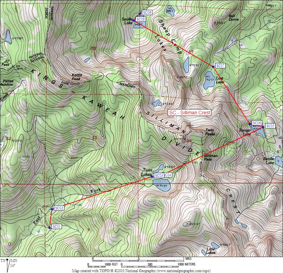
| 9 Bear Boxes in Silliman Crest - GPS route SILLIMAN CREST | |||
|---|---|---|---|
| click on name for details and directions | elevation | waypoint | food locker type |
| Clover Creek South | 8400 | SC01 | a standard box |
| Clover Creek North | 8400 | SC02 | a standard box |
| Twin Lakes West | 9400 | SC03 | a standard box |
| Twin Lakes East | 9500 | SC04 | a standard box |
| Ranger Lake East | 9200 | SC05 | a standard box |
| Ranger Lake NorthWest | 9300 | SC06 | a standard box |
| Lost Lake | 9100 | SC07 | a standard box |
| Seville Lake West | 8400 | SC08 | a standard box |
| Seville Lake North | 8400 | SC09 | a standard box |
Useful Links: