Bear Box at Seville Lake North (SC09)
Generated on 2 Aug 2022 - see revision history - please send updates to the webmaster
Detail Map of waypoint SC09
in Silliman Crest:
(scroll down for directions, waypoints, and area map)
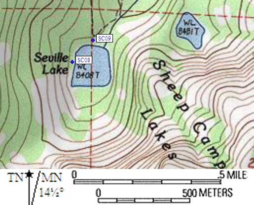
- SC09 is a standard box, at about 8400 feet,
in the GPS route SILLIMAN CREST.
- Note: After the trail crests a small rise at 8400', it drops very slightly
to the lake. There is a sign/map at the top of the rise, showing where
you can camp, and where the two bear boxes are.
- Directions from Steve Eckert, with GPS waypoint, June 2002:
One box just to the left (east) of the trail as it approaches
Seville Lake from the north. The northern box is about 20' from the sign,
behind a triple-forked large tree. This camping area may be drier
and less buggy than the other one due to its location and soil.
The trail and the box are west of the lake outlet.
- Directions from Hal Murray, Sep 1999:
One box is just south of the trail where
it gets to Seville Lake. There is a sign and map right on the trail.
- Directions from Mineral King ranger info sheet, dated 1991:
One box at the main camp area on the north side of Seville Lake.
- SC09 coordinates: (see GPX waypoint download links above)
  (lat,lon) = (36.6842800, -118.7191500) in decimal degrees, NAD83.
  (zone,east,north) = (11S, 346478.0, 4061030.0) in decimal meters, NAD27.
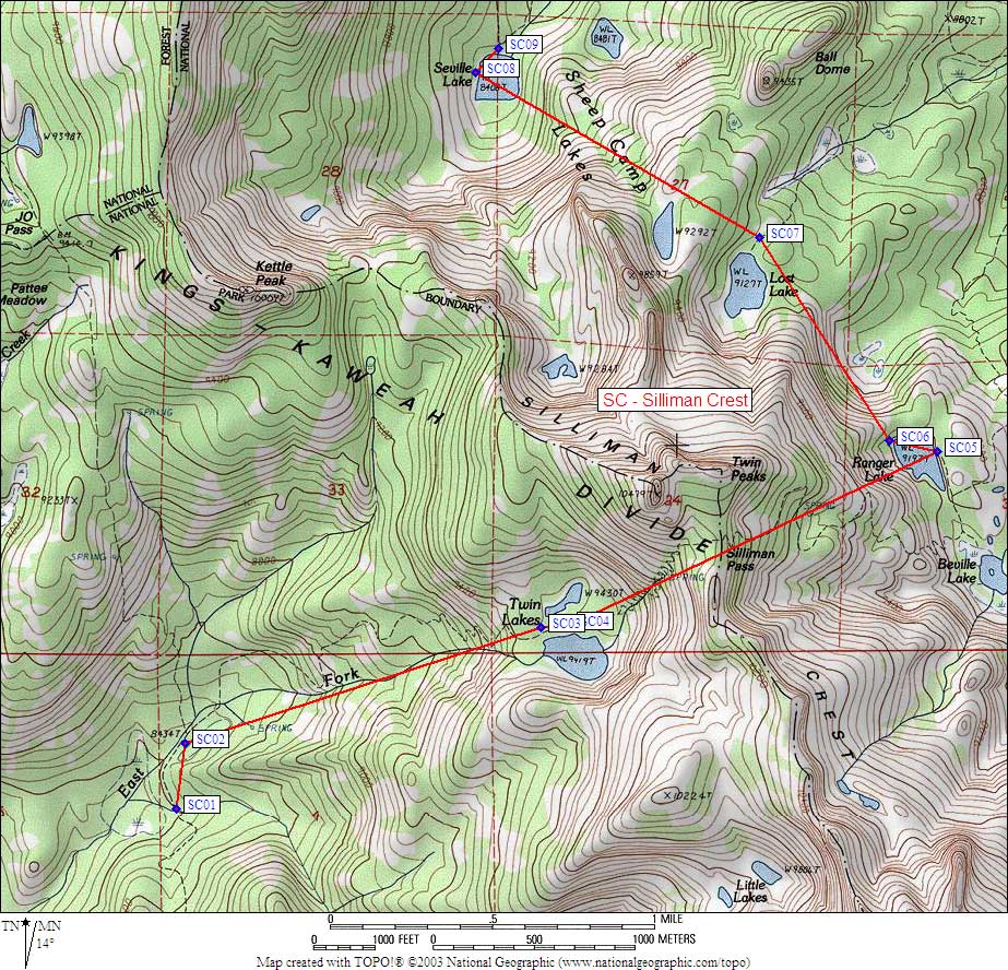
- Scroll down for a regional map of the entire Silliman Crest region.
Map exported from TOPO! software, used with permission.
Useful Links: