Bear Box at Ranger Lake NorthWest (SC06)
Generated on 2 Aug 2022 - see revision history - please send updates to the webmaster
Detail Map of waypoint SC06
in Silliman Crest:
(scroll down for directions, waypoints, and area map)
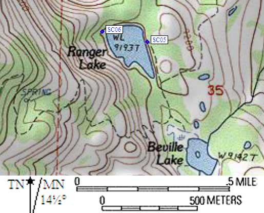
- SC06 is a standard box, at about 9300 feet,
in the GPS route SILLIMAN CREST.
- Note: The main trail does not go to Ranger Lake, nor can you see Ranger Lake
from the junction. There is a side trail which takes you (0.1 mile)
up a slight rise (50' elevation) from the main trail to a sign with
a somewhat inaccurate map showing the location of the two Ranger Lake
bear boxes. The sign is to the right (east) of the lake outlet. The
drawing on the sign is rotated slightly, making the northwest corner
of the lake appear to be the north end, and the box on the 'east'
shore (which is really northeast) is shown too far south. Don't be fooled!
- Directions from Steve Eckert, with GPS waypoint, June 2002:
One box 20 yards from the northwest corner of the lake, due west
of a small island, in a stand of tall trees. The ground is bare
forest duff by the box, but between the box and the lake is a
tangle of brush. This stand of trees is just north of a bare spot
where boulders and perhaps avalanches come right down to lake level
(unique because most of the lake is surrounded by trees), but the
small island is the best landmark. Very few people get this far,
because the use trail around the lake disappears before you get here.
- Directions from Hal Murray, Sep 1999:
There is a sign and map showing how
to find them, either at the main trail where the spur to Ranger Lake
takes off or closer to the lake. The ranger description is good.
(I won't promise the distance is right-on but they are close enough.)
We had no problems finding the boxes but we did arrive in daylight.
- Directions from Mineral King ranger info sheet, dated 1991:
One box at the north end of Ranger Lake, about 80 yards from shoreline.
- SC06 coordinates: (see GPX waypoint download links above)
  (lat,lon) = (36.6667500, -118.6973700) in decimal degrees, NAD83.
  (zone,east,north) = (11S, 348389.0, 4059051.0) in decimal meters, NAD27.
- Scroll down for a regional map of the entire Silliman Crest region.
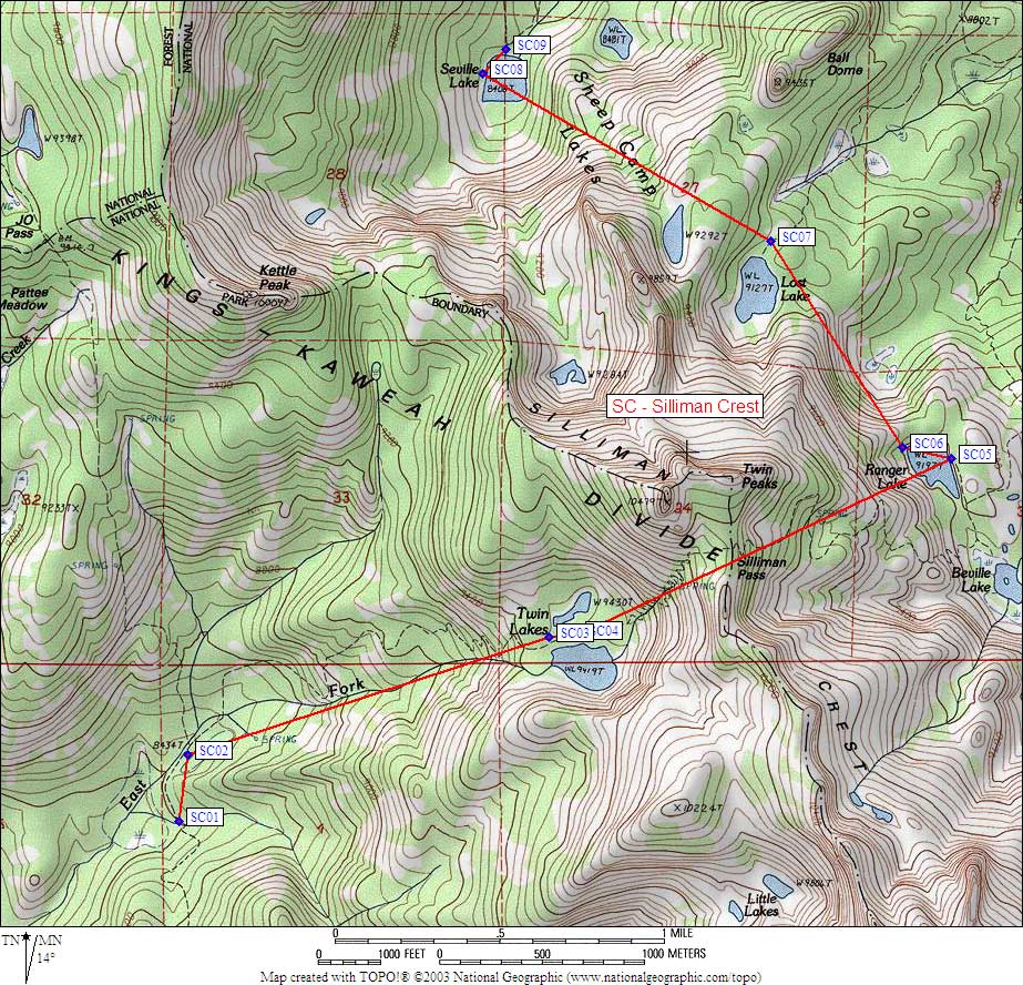
Map exported from TOPO! software, used with permission.
Useful Links: