Bear Box at Twin Lakes East (SC04)
Generated on 20 Oct 2025 - see revision history - please send updates to the webmaster
Detail Map of waypoint SC04
in Silliman Crest:
(scroll down for directions, waypoints, and area map)
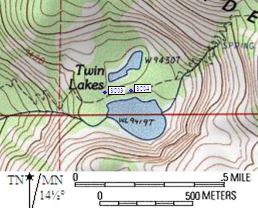
- SC04 is a standard box, at about 9500 feet,
in the GPS route SILLIMAN CREST.
- Note: These are NOT the Twin Lakes between Maggie and Sheep Mtns,
these are the Twin Lakes by Mt Silliman!
As you approach Twin Lakes from Silliman Pass or Lodgepole / JO Pass,
there are signs with small and incorrect maps of where the two
bear boxes are. Unless the sign maps improve, don't trust them!
The old text descriptions from the rangers is also useless.
Both boxes are right beside the trail, both boxes are BETWEEN
the two lakes, and the two boxes are only about 0.1 miles apart.
- Directions from Steve Eckert, with GPS waypoint, June 2002:
The eastern box is between the two lakes at about the midpoint of
both lakes, where the trail comes closest to the larger/lower/southern
lake. It is in a bare dirt-and-boulder area obviously used heavily
for camping, about 10' north of the trail. Just south of the trail
there is an open slope directly down to the larger lake. There is
a 'toilet' sign near this box pointing along the trail down canyon,
and the other box is near a second 'toilet' sign which points away
from the trail.
- Directions from Mineral King ranger info sheet, dated 1991:
Two boxes at Twin Lakes (no description of where).
- SC04 coordinates: (see GPX waypoint download links above)
  (lat,lon) = (36.6584900, -118.7152100) in decimal degrees, NAD83.
  (zone,east,north) = (11S, 346779.0, 4058163.0) in decimal meters, NAD27.
- Scroll down for a regional map of the entire Silliman Crest region.
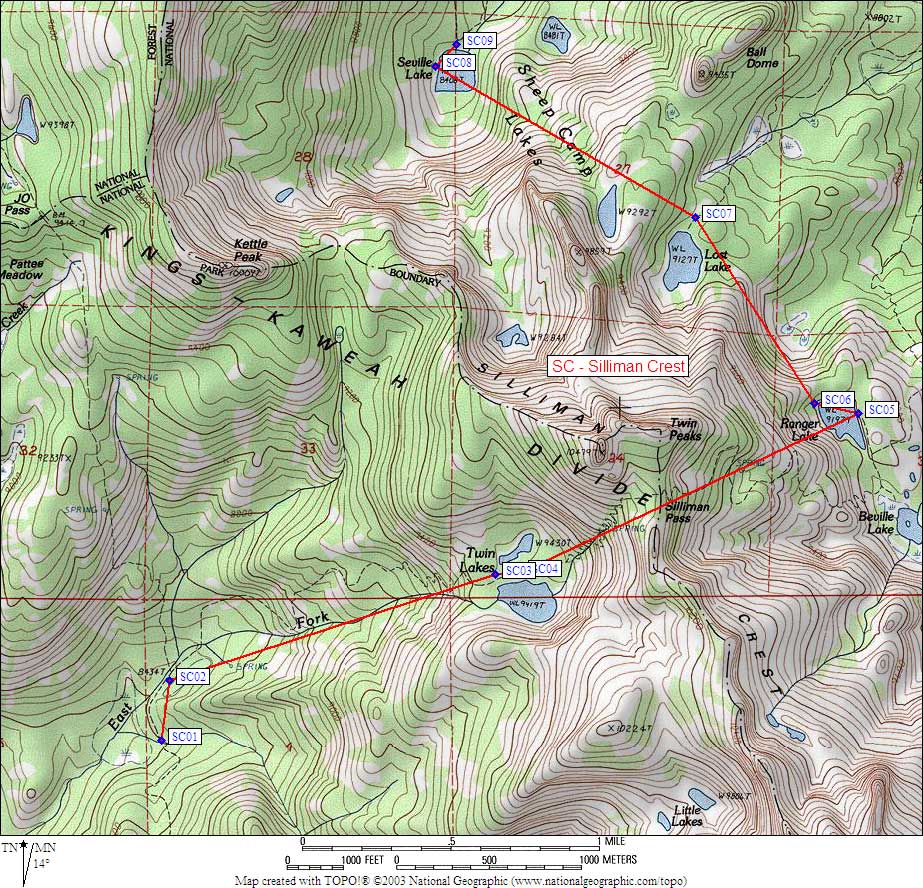
Map exported from TOPO! software, used with permission.
Useful Links: