Bear Boxes in Mineral King Area (MK)
Generated on 20 Oct 2025 - see revision history - please send updates to the webmaster
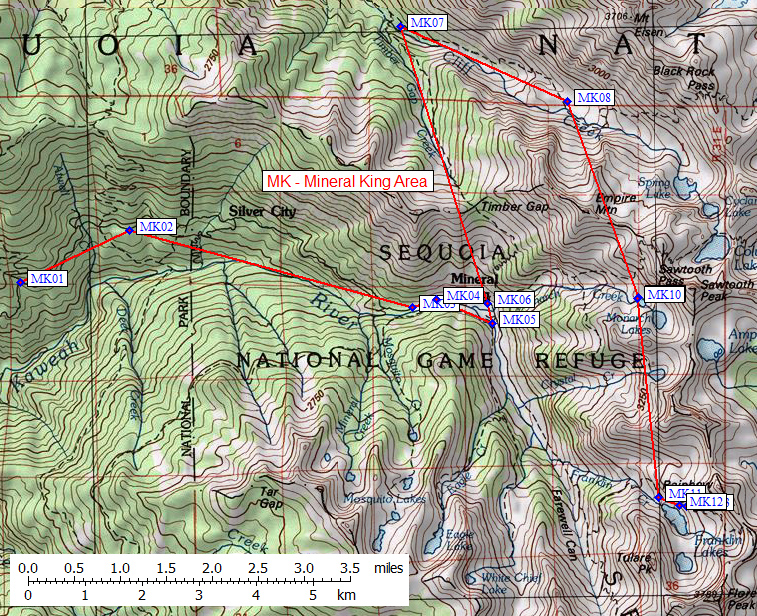
| 13 Bear Boxes in Mineral King Area - GPS route MINERAL KING | |||
|---|---|---|---|
| click on name for details and directions | elevation | waypoint | food locker type |
| Winter Gate | 6300 | MK01 | a standard box |
| Hocket Meadow Trailhead | 6600 | MK02 | a standard box |
| Mineral King Ranger Station | 7500 | MK03 | 3 large boxes |
| Cabin Access Road | 7700 | MK04 | 2 large boxes |
| White Chief Trailhead | 7900 | MK05 | 1 large box |
| Sawtooth Pass Trailhead | 7800 | MK06 | 2 new boxes and 1 standard box |
| Timber Gap Junction | 7100 | MK07 | a standard box |
| Pinto Lake | 8700 | MK08 | a large box |
| Monarch Lake #1 | 10400 | MK09 | a standard box |
| Monarch Lake #2 | 10400 | MK10 | a standard box |
| Franklin Creek | 10300 | MK11 | a standard box |
| Franklin Lake Lower | 10400 | MK12 | a standard box |
| Franklin Lake Upper | 10500 | MK13 | a standard box |
Useful Links: