Climber.Org logo

Sierra Nevada Bear Boxes
Details for MK05

Updated 21 Jun 2008, see revision history for details.
CORRECTIONS WOULD BE APPRECIATED! contact Steve Eckert.
Search and Navigate  |   Trip Reports  |   Trip Announcements  |   Roster
Driving Directions  |   Reference Data  |   Gear  |   Common Sense Rules!
For bear box data, including maps and location instructions, you can jump to:
  • the main Bear Box Page or a clickable Bear Boxes Map
  • click on a sorted list of 141 bear boxes or short list of 25 box regions

    Bear box 'MK05'
    (Timber Gap Junction)

    Detail Map: (scroll down for directions, waypoints, and area map)
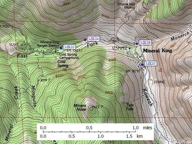
    1. MK05 is a standard box, at about 7100 feet, in the Mineral King Area region.

    2. Note: The canyon is narrow here and the trees are tall. Check your GPS constellation before trusting the location it gives you.

    3. Directions from Steve Eckert, with GPS waypoint, June 2008:
      The trails have been re-routed here, even the 7.5' topos are wrong! One old-style box about 10 yards uphill from the trail junction sign and about 20 yards northeast of Cliff Creek. There are campsites near the box, but there are far BETTER campsites 100 yards on the other side of the creek as the trail climbs steeply toward Timber Gap.

    4. Directions from Gary Craig, Aug 2002:
      The box is within 20 feet of the Timber Gap trail junction sign. I had problems here too getting a GPS lock due to heavy tree cover. However, the coordinates you use on the web page look pretty good.

    5. Directions from Mineral King ranger info sheet, dated 1991:
      One box on the east side of Cliff Creek and slightly south of the Timber Gap Trail junction.

    6. Find waypoint MK05 in region waypoints or all waypoints file.
      (NAD83 decimal degrees or NAD27 UTM data suitable for TOPO! software or Waypoint+ software)
        (lat,lon) = (36.4969700, -118.6135700) in decimal degrees, NAD83.
        (zone,east,north) = (11S, 355565.0, 4040085.0) in decimal meters, NAD27.
    7. Previous box is MK04: Sawtooth Pass Trailhead.

    8. Next box is MK06: Pinto Lake.

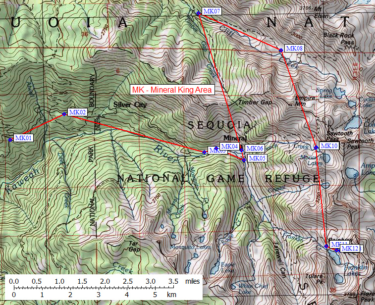
    9. Scroll down for a regional map of the entire Mineral King Area region.

    10. Use Google Maps or Google Earth to view this region overlaid with roads and trails on satellite images or maps.
      (Click on any icon to get details in a popup, double-left-click to zoom in, double-right-click to zoom out.)


    Map exported from TOPO! software, used with permission.