Bear Box at Mineral King Ranger Station (MK03)
Generated on 2 Aug 2022 - see revision history - please send updates to the webmaster
Detail Map of waypoint MK03
in Mineral King Area:
(scroll down for directions, waypoints, and area map)
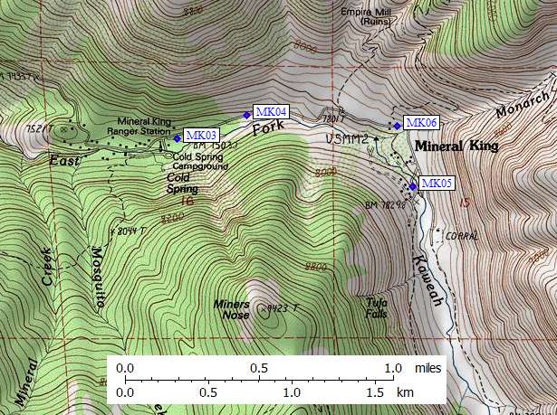
- MK03 is 3 large boxes, at about 7500 feet,
in the GPS route MINERAL KING.
- Directions from Steve Eckert, with GPS waypoint, June 2008:
Across the road (south) from the ranger station (just east of
the Cold Springs campground) is a small wooden storage building
in which you could formerly store trailhead food. There are now
steel bear boxes near this building. This ranger station,
and most trailhead parking lots in the area, have pay phones,
so you can call for repair after the marmots eat your car.
- MK03 coordinates: (see GPX waypoint download links above)
  (lat,lon) = (36.4523200, -118.6111300) in decimal degrees, NAD83.
  (zone,east,north) = (11S, 355701.0, 4035129.0) in decimal meters, NAD27.
- Scroll down for a regional map of the entire Mineral King Area region.
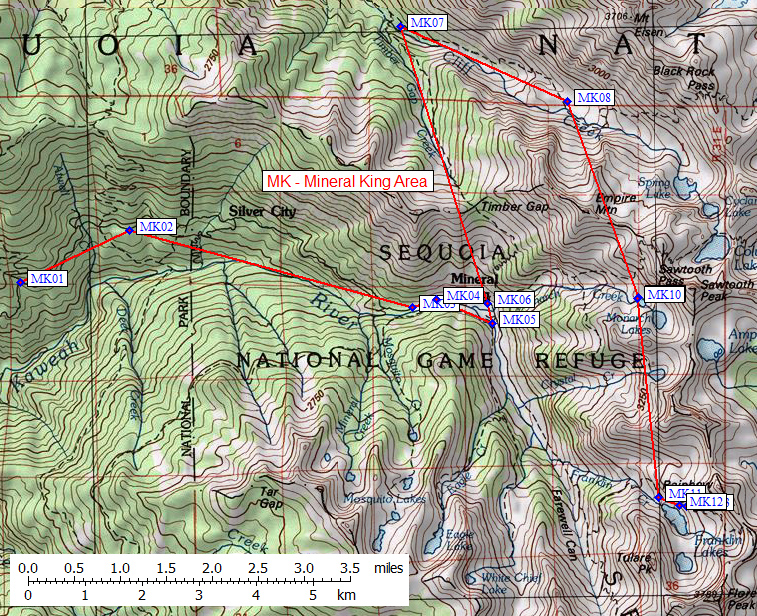
Map exported from TOPO! software, used with permission.
Useful Links: