Bear Boxes in Rock Creek North (RN)
Generated on 2 Aug 2022 - see revision history - please send updates to the webmaster
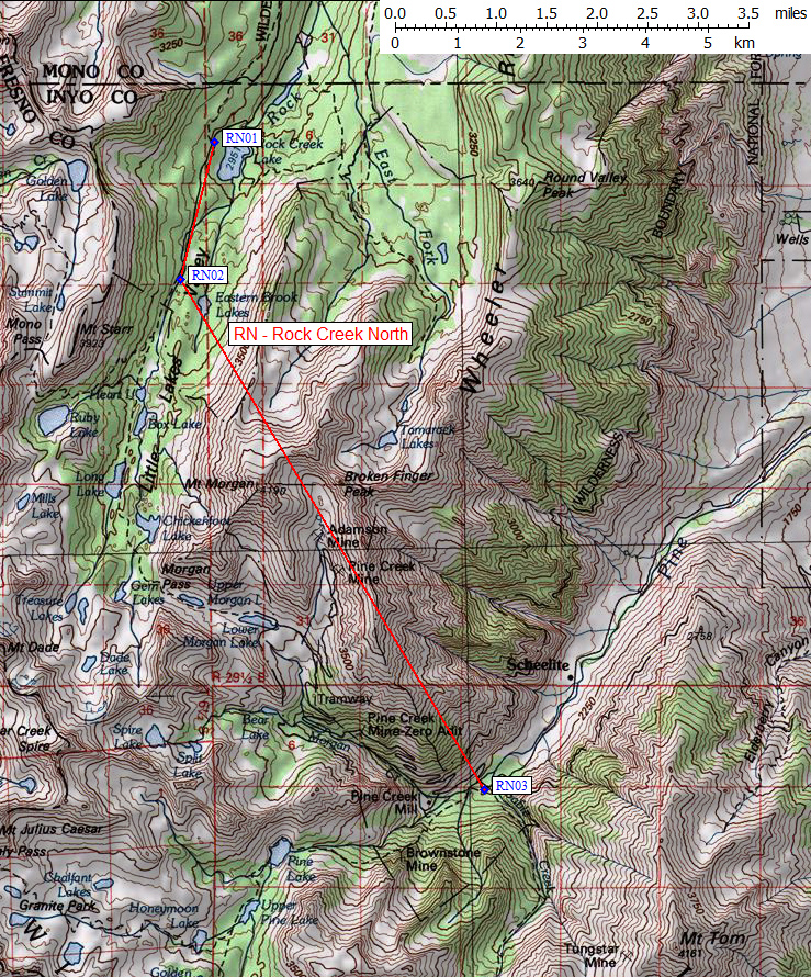
| 3 Bear Boxes in Rock Creek North - GPS route ROCK CREEK NORTH | |||
|---|---|---|---|
| click on name for details and directions | elevation | waypoint | food locker type |
| Hilton Lakes Trailhead | 9900 | RN01 | 2 standard boxes |
| Mosquito Flat Trailhead | 10200 | RN02 | 4 standard boxes |
| Pine Creek Trailhead | 7400 | RN03 | 3 boxes |
Useful Links: