Bear Boxes in Tyndall and Crabtree Area (TC)
Generated on 20 Oct 2025 - see revision history - please send updates to the webmaster
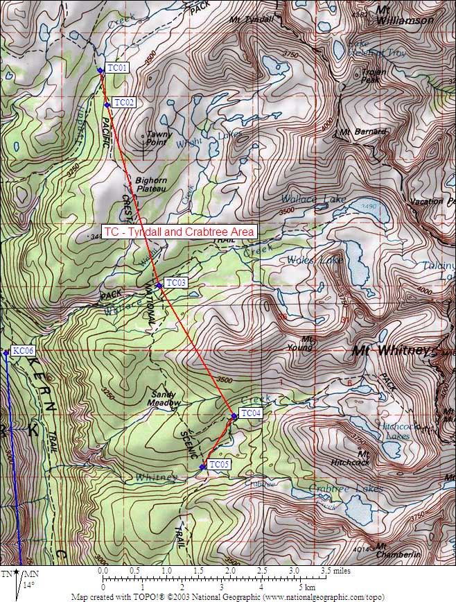
| 5 Bear Boxes in Tyndall and Crabtree Area - GPS route TYNDALL CRABTREE | |||
|---|---|---|---|
| click on name for details and directions | elevation | waypoint | food locker type |
| Tyndall Creek at John Muir Trail | 10900 | TC01 | a standard box |
| Tyndall Frog Ponds | 11000 | TC02 | a standard box |
| Wallace Creek / John Muir Trail | 10400 | TC03 | a standard box |
| Crabtree Ranger Station | 10700 | TC04 | a large box |
| Lower Crabtree Meadow | 10700 | TC05 | a standard box |
Useful Links: