Bear Box at Wallace Creek / John Muir Trail (TC03)
Generated on 20 Oct 2025 - see revision history - please send updates to the webmaster
Detail Map of waypoint TC03
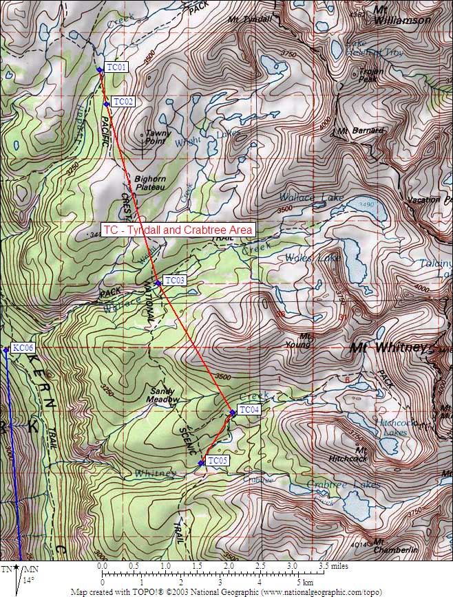
in Tyndall and Crabtree Area:
(scroll down for directions, waypoints, and area map)
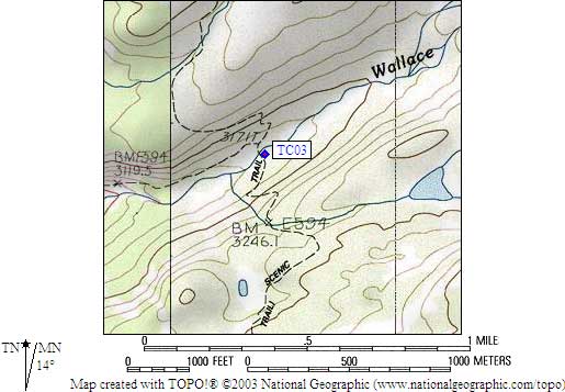
- TC03 is a standard box, at about 10400 feet,
in the GPS route TYNDALL CRABTREE.
- Note: (from Jeffrey Zimmerman) The box at the Wallace Creek JMT crossing
bears a disturbing note from the ranger, to the effect that if trash
continues to be left in the box it will be removed in 2008. Of course,
neither process is appropriate, either the trash (c'mon people, we can do
better!) or the box removal (what would be Interior's substitute? hiring
more rangers to enforce bear cans?). The Crabtree ranger seemed quite
confident the boxes were staying, but it is certainly easy to understand
the frustrations of a ranger whose training and experience gets reduced to
trash hauling.
- Directions from M F Miller, Sep 2020:
Large brown bear box directly on trail 15 yards past stream
crossing into camp area.
- Directions from Michael Golden, Sep 2000:
The box is right on the trail, near some established camp sites.
- Directions from Kit Groves, with GPS waypoint, July 2000:
One box west of the John Muir Trail and
about 100 feet south of Wallace Creek crossing.
- Directions from Mineral King ranger info sheet, dated 1991:
One box west of the John Muir Trail and
about 100 feet south of the creek.
- TC03 coordinates: (see GPX waypoint download links above)
  (lat,lon) = (36.5937700, -118.3707500) in decimal degrees, NAD83.
  (zone,east,north) = (11S, 377467.0, 4050487.0) in decimal meters, NAD27.
- Scroll down for a regional map of the entire Tyndall and Crabtree Area region.
Map exported from TOPO! software, used with permission.
Useful Links: