Bear Box at Lower Crabtree Meadow (TC05)
Generated on 20 Oct 2025 - see revision history - please send updates to the webmaster
Detail Map of waypoint TC05
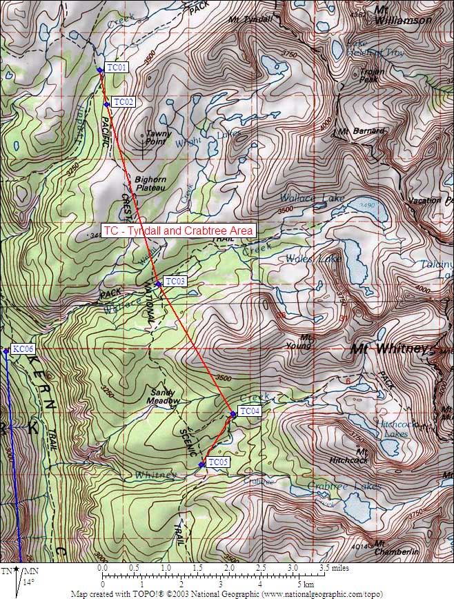
in Tyndall and Crabtree Area:
(scroll down for directions, waypoints, and area map)
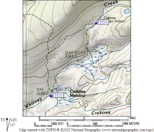
- TC05 is a standard box, at about 10700 feet,
in the GPS route TYNDALL CRABTREE.
- Note: Descriptions of this box vary, and TC04 is nearby!
This one is TC05, a mile south of the Crabtree Ranger Station,
at the trail junction in Crabtree Meadow, just west from
where Whitney Creek and Crabtree Creek join.
- Directions from Scott Sullivan, with GPS waypoint, Sep 2001:
One box on the west side of the trail and the south side of
the creek, perhaps 15 feet from the trail, in plain sight.
- Directions from Mineral King ranger info sheet, dated 1991:
One box about 100 yards southeast of the John Muir Trail.
- TC05 coordinates: (see GPX waypoint download links above)
  (lat,lon) = (36.5519719, -118.3584789) in decimal degrees, NAD83.
  (zone,east,north) = (11S, 378496.0, 4045837.0) in decimal meters, NAD27.
- Scroll down for a regional map of the entire Tyndall and Crabtree Area region.
Map exported from TOPO! software, used with permission.
Useful Links: