Bear Box at Curry Area Backpacker Parking (YV03)
Generated on 2 Aug 2022 - see revision history - please send updates to the webmaster
Detail Map of waypoint YV03
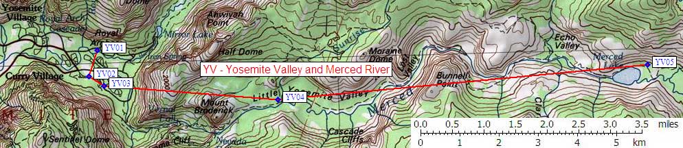
in Yosemite Valley and Merced River:
(scroll down for directions, waypoints, and area map)
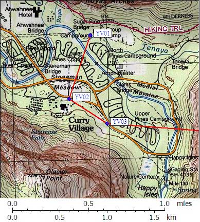
- YV03 is 20 large plus 5 standard boxes, at about 4000 feet,
in the GPS route YOSEMITE VALLEY.
- Directions from Steve Eckert, with GPS waypoint, March 2001:
Public car use boxes at the backpacker's overnight parking lot.
From Curry Village, go east and south past the tent cabins
toward Happy Isles. Where the road is closed, turn right into
a dirt parking area with 20 large and 5 standard bear boxes
lined up on the north side of the parking lot.
- YV03 coordinates: (see GPX waypoint download links above)
  (lat,lon) = (37.7355400, -119.5658200) in decimal degrees, NAD83.
  (zone,east,north) = (11S, 273980.0, 4179374.0) in decimal meters, NAD27.
- Scroll down for a regional map of the entire Yosemite Valley and Merced River region.
Map exported from TOPO! software, used with permission.
Useful Links: