Bear Boxes in Yosemite Valley and Merced River (YV)
Generated on 2 Aug 2022 - see revision history - please send updates to the webmaster
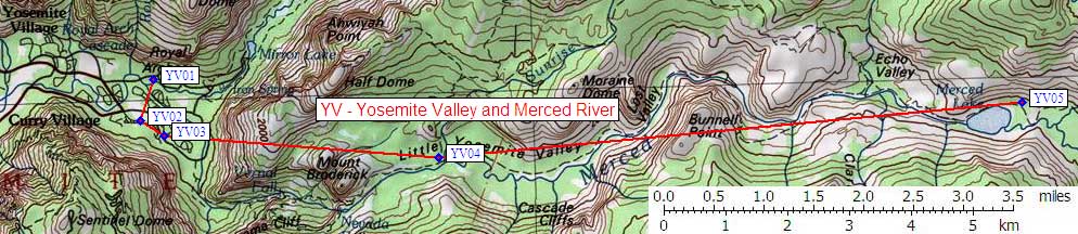
| 5 Bear Boxes in Yosemite Valley and Merced River - GPS route YOSEMITE VALLEY | |||
|---|---|---|---|
| click on name for details and directions | elevation | waypoint | food locker type |
| Curry Area Backpacker Campground | 4000 | YV01 | 23 large boxes |
| Curry Village | 4000 | YV02 | 120 standard boxes |
| Curry Area Backpacker Parking | 4000 | YV03 | 20 large plus 5 standard boxes |
| Little Yosemite Valley | 6100 | YV04 | 6+ standard boxes |
| Merced Lake | 7200 | YV05 | 4 standard plus 4 large boxes |
Useful Links: