Bear Boxes in Big Arroyo (BA)
Generated on 2 Aug 2022 - see revision history - please send updates to the webmaster
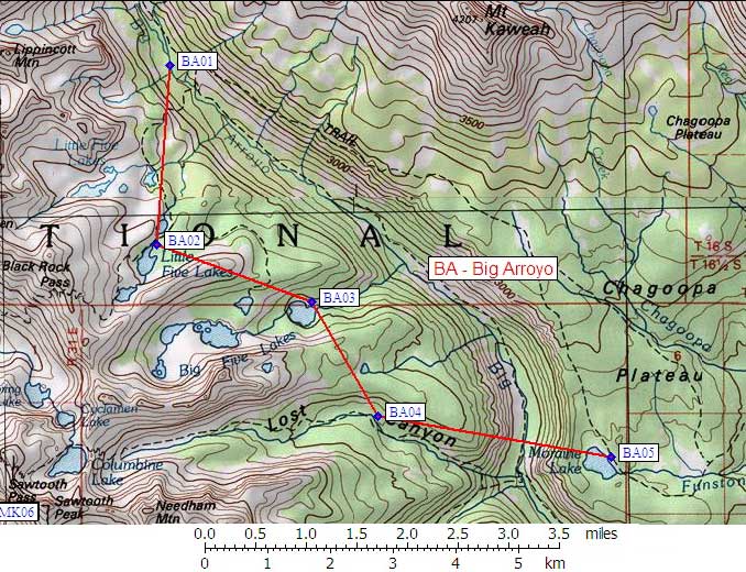
| 5 Bear Boxes in Big Arroyo - GPS route BIG ARROYO | |||
|---|---|---|---|
| click on name for details and directions | elevation | waypoint | food locker type |
| Big Arroyo Patrol Cabin | 9500 | BA01 | a large box |
| Little Five Lakes | 10500 | BA02 | a large gray box |
| Lower Big Five Lake | 9900 | BA03 | a standard box |
| Lower Lost Canyon | 9600 | BA04 | a standard box |
| Moraine Lake | 9300 | BA05 | a large box |
Useful Links: