Bear Box at Lower Big Five Lake (BA03)
Generated on 20 Oct 2025 - see revision history - please send updates to the webmaster
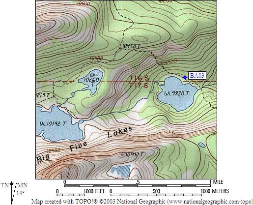
Detail Map of waypoint BA03
in Big Arroyo:
(scroll down for directions, waypoints, and area map)
- BA03 is a standard box, at about 9900 feet,
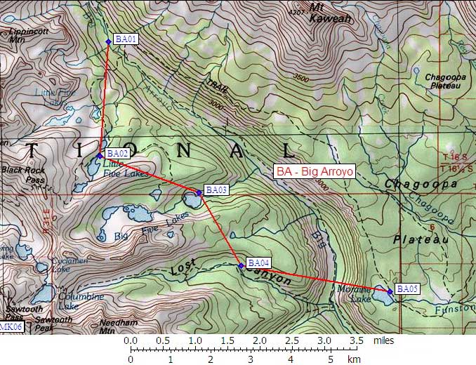
in the GPS route BIG ARROYO.
- Note: This box is northwest of the outlet of the lowest and most eastern of the Big Five Lakes, Lake 9830.
The rangers are apparently handing out a printed list that shows two boxes at Big Five Lakes.
Since only the one has been reported, there may well be a second one further up the drainage.
- Directions from Arturo Crespo, with GPS waypoint, Oct 2001:
The box is located at the middle of the northern shore of
the lowest lake of the Big Five Lakes chain (Lake 9830).
The box is a standard one and it is in plain view
from the trail that comes down from Little Five Lakes.
The box was about 10 feet NE of the trail and I'd say
150 feet from the lake.
- Directions from Anne Hartman, Sep 2001:
One standard box at a camping area on the main trail as it goes past
the easternmost of the Big 5 lakes. The box is just north of where
the trail crosses the outlet stream of lake WL9830.
- BA03 coordinates: (see GPX waypoint download links above)
  (lat,lon) = (36.4847000, -118.5083200) in decimal degrees, NAD83.
  (zone,east,north) = (11S, 364968.0, 4038573.0) in decimal meters, NAD27.
- Scroll down for a regional map of the entire Big Arroyo region.
Map exported from TOPO! software, used with permission.
Useful Links: