Bear Box at Little Five Lakes (BA02)
Generated on 2 Aug 2022 - see revision history - please send updates to the webmaster
Detail Map of waypoint BA02
in Big Arroyo:
(scroll down for directions, waypoints, and area map)
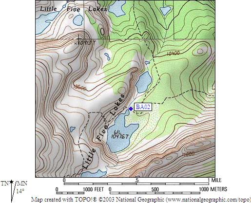
- BA02 is a large gray box, at about 10500 feet,
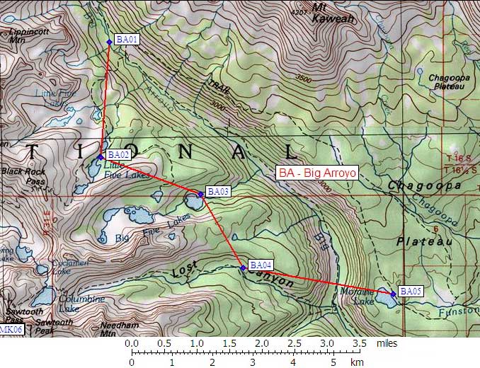
in the GPS route BIG ARROYO.
- Directions from Steve Eckert, with GPS waypoint, June 2008:
Just east of where the trail crosses the outlet of Lake 10476.
The box was moved closer to the stream when the old standard box was
replaced with the newer style gray box. It is about 10 yards from the
stream, and about 5 yards from the metal trail intersection sign,
east of the trail intersection. I listened to a bear tossing the old
box around all night in 1998, when it was chained to a tree.
Don't camp too near the box!
- Directions from Mineral King ranger info sheet, dated 1991:
Approximately 100 feet south of the Black Rock Pass / Big Arroyo / Big
Five Lakes trail junction in an established campsite (east of the junction)
behind a log parallel to the Big Five Lakes trail.
- BA02 coordinates: (see GPX waypoint download links above)
  (lat,lon) = (36.4928800, -118.5361300) in decimal degrees, NAD83.
  (zone,east,north) = (11S, 362494.0, 4039518.0) in decimal meters, NAD27.
- Scroll down for a regional map of the entire Big Arroyo region.
Map exported from TOPO! software, used with permission.
Useful Links: