Mammoth Lakes Trailheads
(Lake Mary, Lake George, Horseshoe Lake)
Revised 26 Jun 2014 - please send updates to the webmaster
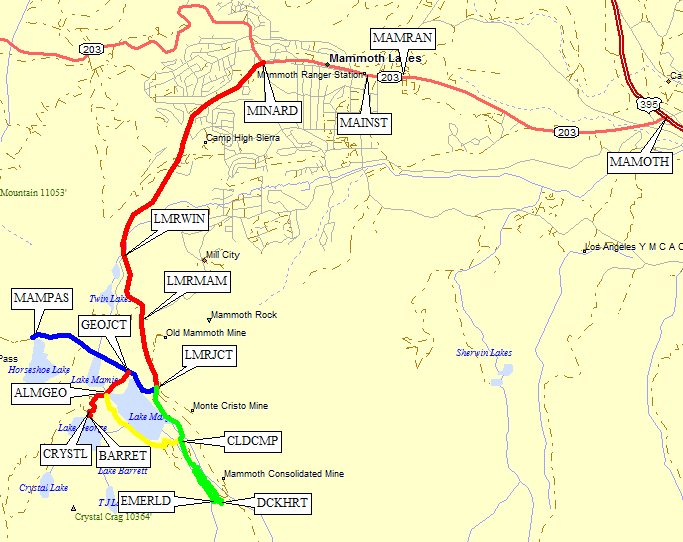
From Highway 395 outside of Mammoth Lakes (waypoint MAMOTH), take Highway 203 into the town of Mammoth Lakes. 2.5 miles from Hwy 395 is the Visitor Center (waypoint MAMRAN) where you can get wilderness permits at a Ranger Station from 8am-5pm. Continue up Hwy 203, now called Main Street, past the eastern end of Old Mammoth Road (waypoint MAINST). Consider that Schat's Bakery is open before 6am but does not serve dinner, and go straight when Hwy 203 turns right and becomes Minaret Summit Road (waypoint MINARD). Going straight through the stoplight, you are now on Lake Mary Road.
The paved road climbs to the southwest, crossing a bridge near the outlet of the three lakes that are called Twin Lakes. Go figure. The parking lot below this bridge is the winter parking lot (waypoint LMRWIN) for Lake Mary Road, below Tamarack Lake Campground and about 6 miles from Hwy 395. In the summer, drive on up the road past the western end of Old Mammoth Road (waypoint LMRMAM) until you reach the junction where the road splits (waypoint LMRJCT) to make a loop around Lake Mary.
The signs at this junction can be confusing. Both directions are signed 'Lake Mary', because 'Lake Mary Road' and 'Around Lake Mary Road' form a loop completely around the lake. All of the trailhead descriptions below start from this junction (waypoint LMRJCT), which is 7.3 miles from Hwy 395.

As mentioned above, Lake Mary Road climbs from the intersection with Minaret Summit Road (waypoint MINARD) to the southwest, crossing a bridge near the outlet of the three lakes that are called Twin Lakes. Go figure. The parking lot below this bridge is the winter parking lot (waypoint LMRWIN) for Lake Mary Road, below Tamarack Lake Campground and about 6 miles from Hwy 395.
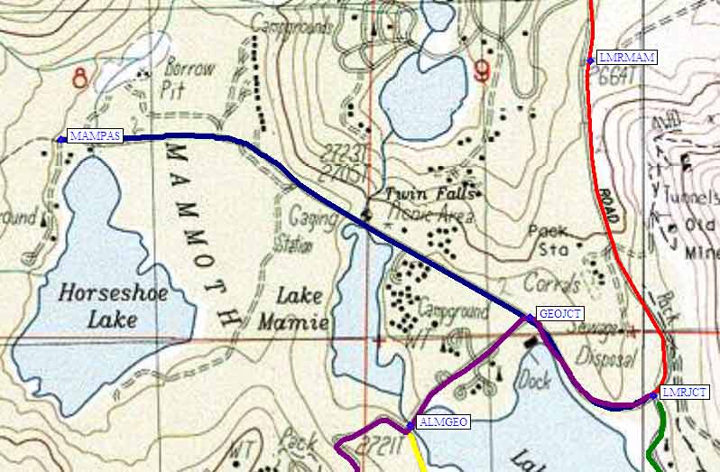
From the Lake Mary Junction (waypoint LMRJCT) drive one and a quarter miles west-northwest to the northern tip of Horseshoe Lake. You'll recognize the trailhead for Mammoth Pass (waypoint MAMPAS) by all the dead trees around it! This area has CO2 (carbon dioxide) leaching up through the soil, and there are warnings that you shouldn't camp in the area.
The trailhead sign says this trail leads to the Ansel Adams Wilderness. It's main claim to fame for peak baggers is that Mammoth Pass is one of the lowest passes into the central Sierra. It's an alternate way to get to Reds Meadow when the Minaret Summit road is closed.

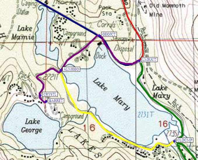
From the Lake Mary Junction (waypoint LMRJCT) drive a third of a mile northwest to the intersection where George Lake is a left turn (waypoint GEOJCT). Another third of a mile brings you to a 'T' intersection where George Lake is a right turn (waypoint ALMGEO), and Around Lake Mary Road is a left turn (which takes you around the west/south shore of Lake Mary to Cold Water Campground).
Yet another third of a mile brings you to parking for the Crystal Lake Trailhead (waypoint CRYSTL), and a separate sign in the same area for T J Lake or Lake Barrett Trailhead (waypoint BARRET).

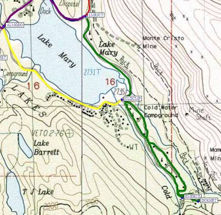
From the Lake Mary Junction (waypoint LMRJCT) drive 0.6 miles around the east side of Lake Mary, to the signed left turn into Cold Water Campground (waypoint CLDCMP). Drive through the campground, three quarters of a mile more, until you come to several non-campsite parking loops up-canyon from the campsites.
The western parking loop is the trailhead for Emerald Lake (waypoint EMERLD), the eastern parkign loop has separate trailheads for Duck Pass and Heart Lake (waypoint DCKHRT) and a tourist walk to an old mine.

Useful Links: