Green Creek Trailhead
Revised 11 Jun 2012 - please send updates to the webmaster
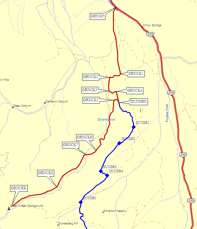
Leave Hwy 395 about 4 miles south of Bridgeport on Green Creek Road (waypoint GRN395). Follow this good dirt road past a few minor junctions (GPS Route GREEN CREEK, the red line on the map, waypoints GRNCK1 through GRNCK4) until you come to a hairpin at 7600' elevation (waypoint DUNGRN). If you go straight here, you'll take the (much rougher) Dunderberg Meadow Road south to the Virginia Lakes Road.
Make the hairpin turn at DUNGRN and continue in the Green Creek drainage (waypoints GRNCK5-GRNCK8), which gets both wetter and dustier as you go uphill. There are lots of apparently free camping spots in small pullouts on side roads, and since you're now in Toiyabe National Forest camping should be free.
The Green Creek Trailhead (waypoint GRNCRK) is a right turn just before the road ends in a campground. There's an outhouse and lots of dust here, along with a sign that says no overnight camping at the trailhead.
Even if you want to go between the Green Creek and Virginia Lakes trailheads, the Dunderberg Meadow dirt connector is a bad choice because it's faster and not much longer to go around on the paved roads - but see GPS Route DUNDERBERG (the blue line on the map) if you're curious.
Useful Links: