Climber.Org logo

Clickable Map of Sierra Nevada Peaks

Updated 25 May 2008, see revision history for details.
CORRECTIONS WOULD BE APPRECIATED! contact Steve Eckert.
Search and Navigate  |   Trip Reports  |   Trip Announcements  |   Roster
Driving Directions  |   Reference Data  |   Gear  |   Common Sense Rules!
For more peak data you can:
  • jump to the main Sierra Peaks List page or a clickable Sierra Peaks Map
  • for text only, click on a complete sorted list of all 328 SPS peaks or a short list of 24 SPS peak regions
  • jump to statewide peaks database for CA, CO, NV, OR, and WA (2000 peaks per state)

    Position cursor over the map, and check status bar for which SPS region you are in, then click on a region for details of that region's peaks (including GPS waypoints, elevations, climbing difficulty, etc).

    Click on the black-outlined areas or scroll down for a list of SPS regions.

    Sierra Nevada Peaks Bitmap - click in a black-outlined region!
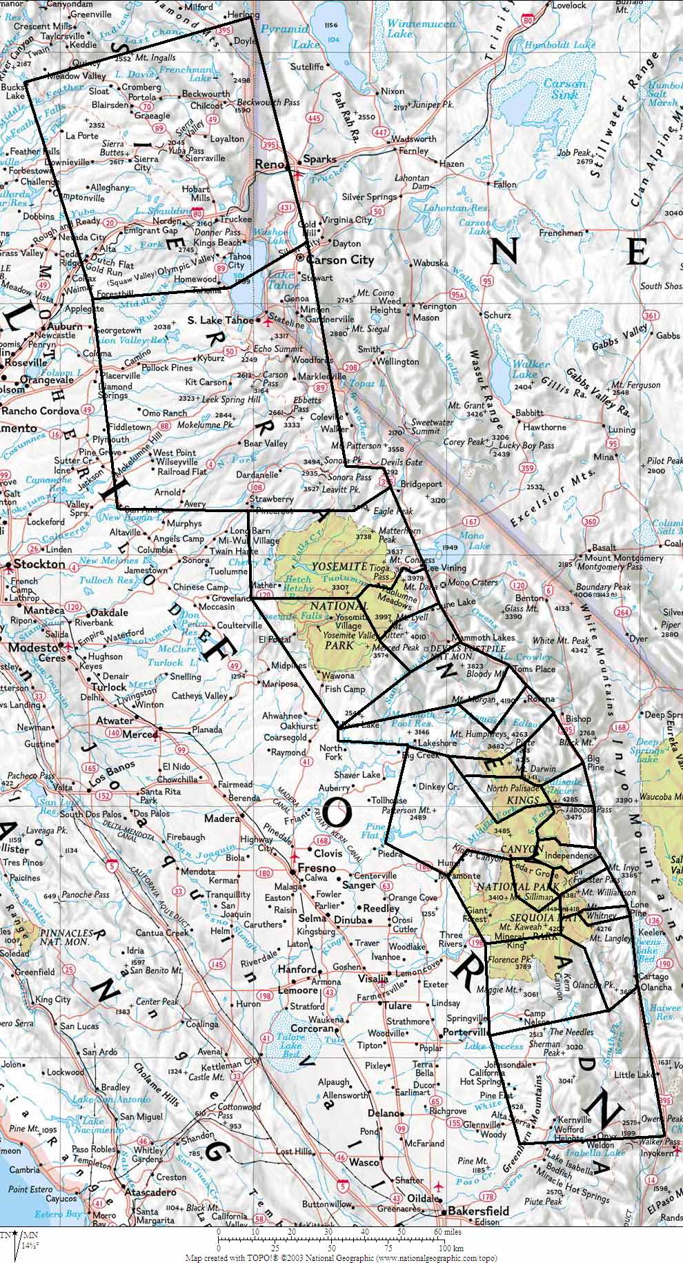
    Map exported from TOPO! software, used with permission.

    01 - Southern Sierra 02 - Mineral King And Kern River 03 - Olancha To Langley And West 04 - Corcoran To Whitney 05 - Whitney To Williamson 06 - Kaweahs And West 07 - Great Western Divide 08 - Kings Kern Divide 09 - Kearsarge Pass Vicinity 10 - Baxter Pass To Taboose Pass 11 - Western Mid-Sierra 12 - South Palisades 13 - Mt Goddard Vicinity 14 - North Palisades 15 - Evolution Area 16 - Humphreys Basin And West 17 - Bear Creek Spire Area 18 - Mono Creek To Mammoth 19 - Ritter Range And Vicinity 20 - Clark Range And Vicinity 21 - Mt Lyell And North 22 - Tioga Pass To Bond Pass 23 - Bond Pass To Lake Tahoe 24 - Northern Sierra

    Click on the map above, or the list of regions below.

    Regional links below will show peak details and GPS data, plus topo and Google maps.

    click for full detailsclick for map view
    Region 01 Southern Sierra 10 peaks Google Maps or Google Earth
    Region 02 Mineral King And Kern River 10 peaks Google Maps or Google Earth
    Region 03 Olancha To Langley And West 11 peaks Google Maps or Google Earth
    Region 04 Corcoran To Whitney 10 peaks Google Maps or Google Earth
    Region 05 Whitney To Williamson 10 peaks Google Maps or Google Earth
    Region 06 Kaweahs And West 15 peaks Google Maps or Google Earth
    Region 07 Great Western Divide 11 peaks Google Maps or Google Earth
    Region 08 Kings Kern Divide 12 peaks Google Maps or Google Earth
    Region 09 Kearsarge Pass Vicinity 18 peaks Google Maps or Google Earth
    Region 10 Baxter Pass To Taboose Pass 12 peaks Google Maps or Google Earth
    Region 11 Western Mid-Sierra 13 peaks Google Maps or Google Earth
    Region 12 South Palisades 11 peaks Google Maps or Google Earth
    Region 13 Mt Goddard Vicinity 19 peaks Google Maps or Google Earth
    Region 14 North Palisades 16 peaks Google Maps or Google Earth
    Region 15 Evolution Area 20 peaks Google Maps or Google Earth
    Region 16 Humphreys Basin And West 14 peaks Google Maps or Google Earth
    Region 17 Bear Creek Spire Area 16 peaks Google Maps or Google Earth
    Region 18 Mono Creek To Mammoth 13 peaks Google Maps or Google Earth
    Region 19 Ritter Range And Vicinity 10 peaks Google Maps or Google Earth
    Region 20 Clark Range And Vicinity 8 peaks Google Maps or Google Earth
    Region 21 Mt Lyell And North 16 peaks Google Maps or Google Earth
    Region 22 Tioga Pass To Bond Pass 19 peaks Google Maps or Google Earth
    Region 23 Bond Pass To Lake Tahoe 25 peaks Google Maps or Google Earth
    Region 24 Northern Sierra 9 peaks Google Maps or Google Earth