Bear Box at Lower Soldier Lake (RS03)
Generated on 2 Aug 2022 - see revision history - please send updates to the webmaster
Detail Map of waypoint RS03
in Rock Creek South:
(scroll down for directions, waypoints, and area map)
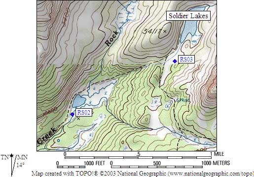
- RS03 is a standard box, at about 10800 feet,
in the GPS route ROCK CREEK SOUTH.
- Notes:
This is 'Rock Creek South', by New Army Pass. See also
'Rock Creek North', by Hilton Lakes and Little Lakes Valley.
Guide books call Lakes 10800 and 11200 'Soldier Lakes' because
of their proximity to The Major General. They are NOT named on the
USGS maps. Upper Soldier Lake is half a mile due south of The Major
General. This is NOT the Soldier Lake between Whorl and Excelsior!
- Directions from Rick Booth, with GPS waypoint, August 2001:
One standard box approximately the south end of Lower Soldier Lake
but back from the actual end of it by about one or two tenths
of a mile. It is on the east side of the outlet stream up on a
rocky bluff/cliff that is 25 feet in elevation above the stream
and maybe 250 feet from it.
- Directions from Mineral King ranger info sheet, dated 1991:
One box on the rocky peninsula on the south side of Lower Soldier Lake.
- RS03 coordinates: (see GPX waypoint download links above)
  (lat,lon) = (36.5002600, -118.2711000) in decimal degrees, NAD83.
  (zone,east,north) = (11S, 386244.0, 4039992.0) in decimal meters, NAD27.
- Scroll down for a regional map of the entire Rock Creek South region.
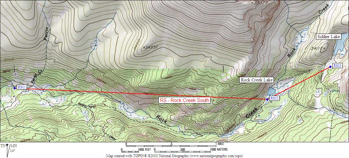
Map exported from TOPO! software, used with permission.
Useful Links: