Climber.Org logo

Sierra Nevada Bear Boxes
Details for RS02

Updated 21 Jun 2008, see revision history for details.
CORRECTIONS WOULD BE APPRECIATED! contact Steve Eckert.
Search and Navigate  |   Trip Reports  |   Trip Announcements  |   Roster
Driving Directions  |   Reference Data  |   Gear  |   Common Sense Rules!
For bear box data, including maps and location instructions, you can jump to:
  • the main Bear Box Page or a clickable Bear Boxes Map
  • click on a sorted list of 141 bear boxes or short list of 25 box regions

    Bear box 'RS02'
    (Rock Creek Lake)

    Detail Map: (scroll down for directions, waypoints, and area map)

    1. RS02 is a standard box, at about 10400 feet, in the Rock Creek South region.

    2. Note: This is 'Rock Creek South', by New Army Pass. See also 'Rock Creek North', by Hilton Lakes and Little Lakes Valley.

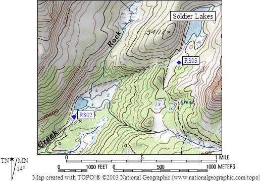
      Guide books call Lake 10400 'Upper Rock Creek Lake' because Rock Creek flows through it. It is not named on the USGS maps, and there do not appear to be any references to 'Lower Rock Creek Lake' despite the wording from the Rangers. It is southeast of Joe Devel Peak and southwest of The Major General.

    3. Directions from Arturo Crespo, with GPS waypoint, Jul 2003:
      One standard box in plain view from the trail. Nice place to camp.

    4. Directions from Mineral King ranger info sheet, dated 1991:
      One box about 50 feet north of the Rock Creek Trail near the west end of Lower Rock Creek Lake.

    5. Find waypoint RS02 in region waypoints or all waypoints file.
      (NAD83 decimal degrees or NAD27 UTM data suitable for TOPO! software or Waypoint+ software)
        (lat,lon) = (36.4949300, -118.2837100) in decimal degrees, NAD83.
        (zone,east,north) = (11S, 385107.0, 4039416.0) in decimal meters, NAD27.
    6. Previous box is RS01: Lower Rock Ck / Pacific Crest Tr.

    7. Next box is RS03: Lower Soldier Lake.

    8. Scroll down for a regional map of the entire Rock Creek South region.

    9. Use Google Maps or Google Earth to view this region overlaid with roads and trails on satellite images or maps.
      (Click on any icon to get details in a popup, double-left-click to zoom in, double-right-click to zoom out.)


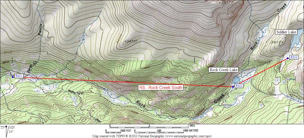
    Map exported from TOPO! software, used with permission.