Bear Box at Mehrten Creek (HS02)
Generated on 20 Oct 2025 - see revision history - please send updates to the webmaster
Detail Map of waypoint HS02
in High Sierra Trail:
(scroll down for directions, waypoints, and area map)
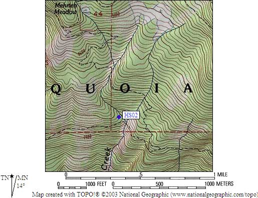
- HS02 is a standard box, at about 7600 feet,
in the GPS route HIGH SIERRA TR.
- Note: Mehrten Creek crosses two trails close together. This box is near
the southern trail (the High Sierra Trail from Crescent Meadow),
where the creek flows over slabs in a broad treeless bowl, not the
northern trail (to Mehrten Meadow and Wolverton). There was a sign
loosely tied to a tree when approaching from the west, which may or
may not stay put, but no sign was visible approaching from the east.
- Directions from Steve Eckert, with GPS waypoint, Oct 2002:
A standard box, 80' elevation above the trail and 40 yards west
of the creek. As noted by Gary, the box is entirely invisible from
the trail. Furthermore, a 15' face above the trail makes it seem
unlikely there is actually a box up there... but there is one!
Look for the creek and the bowl (described above), then go to
the clump of trees on the west shore of the creek. Follow the
west bank for 50 yards or so up the creek (on slabs) to get
around a 10-15' rock face, then cut west to the only 4' diameter
pine tree for miles, and the bear box is 20 yards to the southwest
(behind the roots of a fallen tree). Campsites are limited, but
have a view of the Central Valley. FYI, there is a really good
cell phone signal here also!
- Directions from Gary Craig, August 2002:
Didn't actually see this box, but there is a map attached
to a tree right next to the trail directing you above
(north of) the trail, just west of the creek crossing.
The posted map is obvious if coming from the west
but somewhat obscure if hiking from the east.
- Directions from Mineral King ranger info sheet, dated 1991:
One box 40 feet above the [High Sierra] Trail
on the west side of Mehrten Creek.
- HS02 coordinates: (see GPX waypoint download links above)
  (lat,lon) = (36.5727800, -118.6844400) in decimal degrees, NAD83.
  (zone,east,north) = (11S, 349362.0, 4048606.0) in decimal meters, NAD27.
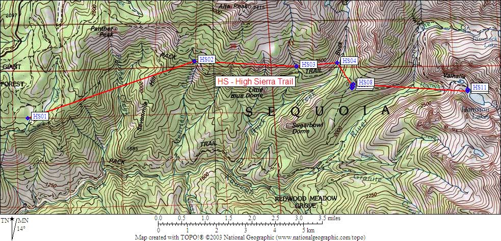
- Scroll down for a regional map of the entire High Sierra Trail region.
Map exported from TOPO! software, used with permission.
Useful Links: