Bear Boxes in High Sierra Trail (HS)
Generated on 2 Aug 2022 - see revision history - please send updates to the webmaster
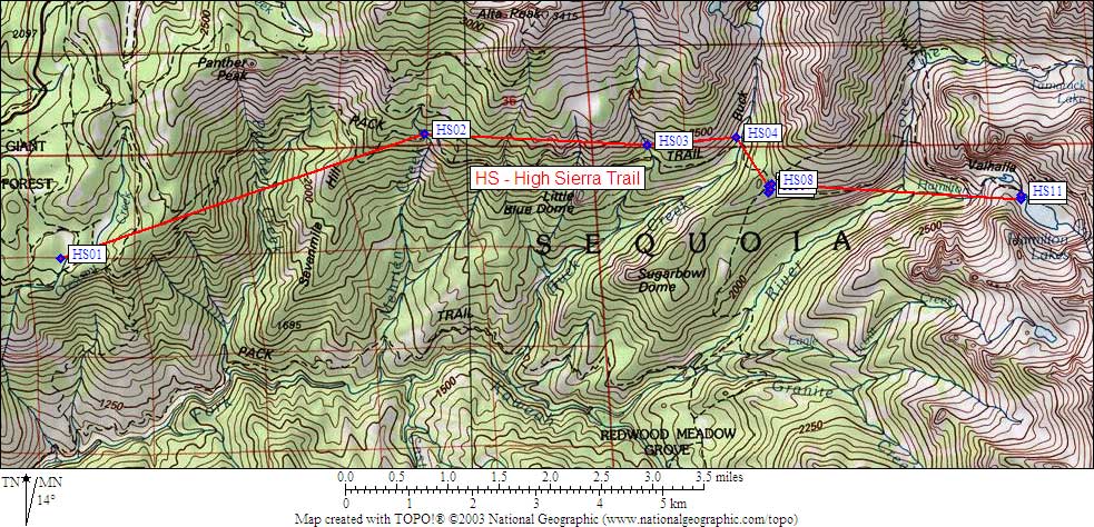
| 11 Bear Boxes in High Sierra Trail - GPS route HIGH SIERRA TR | |||
|---|---|---|---|
| click on name for details and directions | elevation | waypoint | food locker type |
| Crescent Meadow | 6700 | HS01 | 3 standard boxes |
| Mehrten Creek | 7600 | HS02 | a standard box |
| Ninemile Creek | 7500 | HS03 | a standard box |
| Buck Creek | 7300 | HS04 | a standard box |
| Bearpaw Meadow West | 7700 | HS05 | a standard box |
| Bearpaw Meadow South | 7600 | HS06 | a standard box |
| Bearpaw Meadow East | 7700 | HS07 | a standard box |
| Bearpaw Meadow North | 7700 | HS08 | a standard box |
| Upper Hamilton Lake #1 | 8300 | HS09 | a standard box |
| Upper Hamilton Lake #2 | 8200 | HS10 | a standard box |
| Upper Hamilton Lake #3 | 8200 | HS11 | a large box |
Useful Links: