Climber.Org Driving Directions
Revised 27 Mar 2012 - please send updates to the webmaster
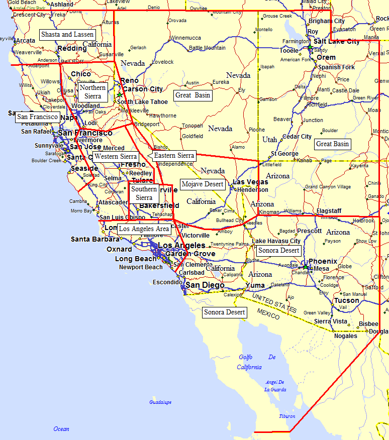
Highways and Passes around the Sierra Nevada: 395 Waypoints Hwy 395 turnoffs, not trailheads, on the east side artery Southern Sierra passes Tehachapi Pass (Hwy 58) and Walker Pass (Hwy 178) Central Valley overview, with a map and links to these routes: Fresno or Madera to Prather southern or northern approach Prather to Shaver Lake to reach the main west-side reservoirs Shaver Lake to Edison and Florence via Kaiser Pass Shaver Lake to Wishon and Courtright via Dinkey Creek Fresno to The Wye northern entry to Sequoia/Kings Canyon Sequoia and Kings Canyon trailheads between The Wye and Three Rivers Visalia to Three Rivers southern entry to Sequoia/Kings Canyon Bakersfield western approaches to Bakersfield, from I-5 and Hwy 99 Pacheco Pass from Gilroy to I-5 or Hwy 99 on Hwy 152 Sherman Pass access to Blackrock, Kennedy (S), Big Meadow Tahoe area passes Echo Summit (Hwy 50) and Carson Pass (Hwy 88) Tioga Pass through Yosemite Hwy 120 over Tioga Pass and the Yosemite Park high country Sonora Pass Hwy 108 over Sonora Pass Yosemite from the Bay Area how to bypass Oakdale and Tracy to avoid bad traffic Useful Links: Return to index of trailhead Driving Directions. Go to the Climber.Org Navigation and Search Page Return to the Climber.Org home page Send feedback to the webmaster
Highways and Passes around the Sierra Nevada:
Useful Links: