To celebrate Labor Day I decided to go to College... My brother and I had planned on climbing Dogtooth and Brown Peaks today but at 8 a.m. he was still asleep and didn't look as though he was going anywhere anytime soon, so I decided to look for something else to climb near home. For some stupid reason I decided to climb Kaiser Peak. An hour after starting was the most difficult route- finding of the day...and I was still in the car! I'll admit it; I got lost. I've always accessed the Kaiser Wilderness from the Home Camp Creek trail head. After 15 minutes of searching, I finally stumbled across the correct road, signed for the pack station. I parked at the hikers' lot just before the creek crossing near the pack station. I finally hit the trail at 10:45.
The trail leaves the north end of the pack station and quickly meets the Potter Creek Trail and shortly thereafter enters the Kaiser Wilderness. Moments after entering the wilderness the trail became brutally steep. Fifteen minutes later I reached the other trail to Potter Pass and took a short water break. On the map the next leg of the trail heads north for a quarter of a mile and then switches back east, gaining 600 feet in the process!!!! The word hell doesn't even come close to describing what it is like to hike this trail. The map shows one straight shot to the big switchback but there were some mini-switchbacks in between. Unfortunately, the trail dropped frequently and ultimately, the gross elevation gain is probably closer to 800 feet in one quarter of a mile. After 80 minutes of misery, I finally arrived at College Rock, my first and most technically challenging goal of the day.
College Rock is a southeast facing dome rising from the slopes of Kaiser Ridge. Kaiser Ridge is so steep that the south side of the dome is 300 feet high, while the north face is less than 50. The summit formation is shaped like an L, with one leg pointing north and the other west. The easiest route appeared to ascend a talus-filled gully on the southwest side, but after that hike up the trail I would have rather skipped College that day than hike down 100 feet to scout a route I couldn't even see well. The inside corner of the L was accessible by climbing over some downed logs and then climbing through some large talus. The west-facing face had some very easy class 5 cracks with no exposure, but I would have had to leave my lunch behind. I could have tried tossing my pack up on top, but not knowing how wide the summit was, I risked throwing my pack over and down the east face, so I instead turned to the north facing (not pointing) leg. Here were some longer cracks and...an easy class 4 chimney.
The magic 4th class chute on College Rock's north side.
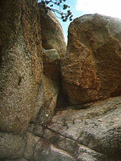
Exiting left from the chimney was a small crack that was home to a tiny pine tree. Exiting diagonally up and right about one-third up was a larger crack that exited onto the summit. The rock at the top of the chimney was overhanging so my only choice was to take a crack. The tree crack was certainly possible, but it would have been more physically than technically challenging: grab the tree, do a pull up and hope there's something to grab higher up. The other crack looked much more fun, although getting into it was quite awkward. I ended up stemming (well, I wouldn't actually call it stemming as it was only for 5 feet...) up underneath the tree. From here I used a tree root for a hold and stepped across to grab the flake that made up one side of the crack. The holds in the crack were plentiful and with little effort I reached the summit and crawled out on top. It wasn't graceful by any standards, but at least I had my lunch...
The view from the top can only be described as breathtaking. Only a mile away, but over two thousand feet below was beautiful Huntington Lake. The panorama of peaks was impressive. Mt. Givens, Mt. Goddard, Black Peak, Dogtooth Peak, Three Sisters, Red Mountain and Chinese Peak presented the whole spectrum of Sierra peaks, from granitic spires to cinder cones to metamorphic giants. The summit was exposed in all directions, especially the east side. A cool (or should I say cold) wind blew from the south, bringing with it some tropical clouds. After my snack I down-climbed the crack, bumping my elbow while exiting, and jumped down to the bottom of the chimney. From here I made my way back to the trail and headed north.
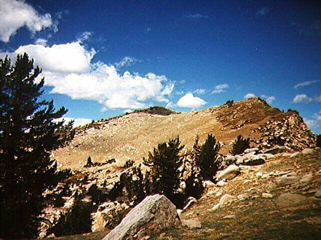
The Whitehills say "There's no getting around it - this is one tough hike" in their guidebook, referring to the Kaiser Peak trek. I would definitely say this is an understatement. Instantly the trail pitched upwards, sapping all of my energy. Half a mile later I reached a lovely meadow filled with blooming wildflowers and skunk cabbage. After passing through the meadow the trail makes the steepest climb of the Kaiser Loop. I almost turned back. I've been on the upper slopes of the Kaiser Ridge over 20 times, but have never actually been to the top because I always turned back before the punishment got unbearable. Over half an hour later, but with only a fraction of a mile behind me, I reached the saddle 4.3 miles from the trail head.
Only a mile left..
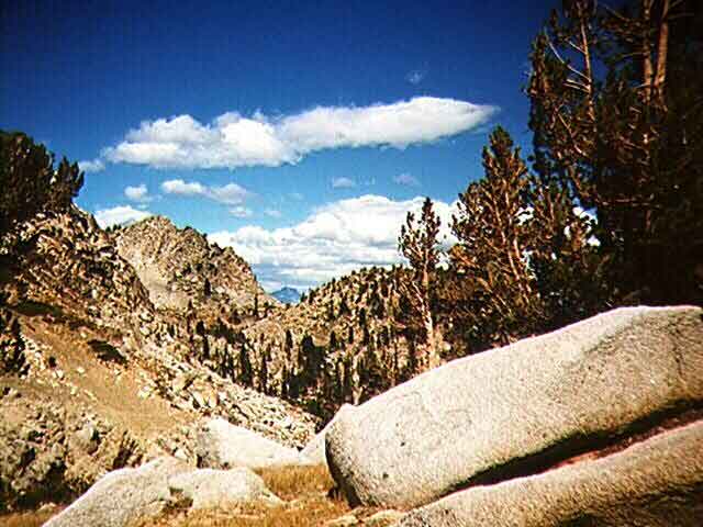
Kaiser Peak loomed on the horizon to the northwest but the most impressive views were those of the San Joaquin basin and the many peaks rimming it. My most important discovery of the day was that the pinnacles rising to the east of of Shuteye Peak on Chiquito Ridge aren't anywhere near Shuteye...they are the Minnarets!
Mt. Ritter viewed framed by unnamed peaks on Kaiser Ridge..
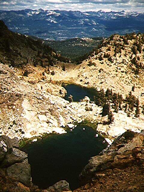
The trail followed the top of the ridge closely, sometimes getting a little too close to the edge for my comfort. Views down into the many cirques on the north side of the crest were gut wrenching; the worst was that of Jewel Lake, tucked directly underneath the vertical headwall that I was standing on top of.
Jewel Lake and the peaks north of Edison Lake..
The wonderful breeze that kept me cool during the hike up was now a howling wind that was uncomfortably cold, gusting at times to over 30 miles per hour. After one last section of steep trail and switchbacks, I gained the summit of Kaiser Peak and what a wonderful feeling it was.
I've been trying to reach this spot now for for three years, and finally I was here. The wind was still trying to blow me off the mountain, but I was enjoying the accomplishment so much that I hardly even noticed. I could litterally see everything from Merced Peak to Mt. Whitney, perhaps one of the finest views I've ever whitnessed anywhere. I had taken over twice as long to reach the summit as I had planned, almost 3 hours, so I turned back after shooting my last photos.
Unfortunately in my haste I had forgotten that there were 3 other "tenners" nearby that I wanted to summit, but I had so little energy remaining that they were better left for another day. Parts of the trail were so steep that I couldn't jog down, but for the most part it was easy going and I arrived at my car after only 1 hour, 15 minutes...not bad for 5.3 miles, although I was dead tired, more so than after hiking Whitney. In fact, I can't remember ever doing a hike harder than this one, and what better day to have done it on than labor day.