Bear Box at Comanche Meadow (SV01)
Generated on 2 Aug 2022 - see revision history - please send updates to the webmaster
Detail Map of waypoint SV01
in Sugarloaf Valley:
(scroll down for directions, waypoints, and area map)
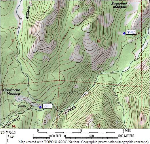
- SV01 is a standard box, at about 7800 feet,
in the GPS route SUGARLOAF VALLEY.
- Directions from Steve Eckert, with GPS waypoint, Aug 2003:
One box on the south side of the trail (a bearbox signpost
existed in 1999 but was missing in 2003) between the trail junction
that gives you two choices to Rowell Meadow and the stream crossing
just west of where the trail drops to the Sugarloaf River. The
campsite is in fairly tall trees, one of the few areas NOT primarily
pines, at the low end of a meadow. Water is nearby and this site
doesn't seem to be used by horse packers.
- SV01 coordinates: (see GPX waypoint download links above)
  (lat,lon) = (36.7108000, -118.6836800) in decimal degrees, NAD83.
  (zone,east,north) = (11S, 349701.0, 4063914.0) in decimal meters, NAD27.
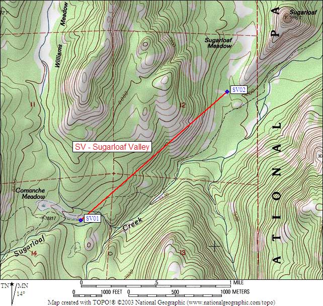
- Scroll down for a regional map of the entire Sugarloaf Valley region.
Map exported from TOPO! software, used with permission.
Useful Links: