Bear Box at Sugarloaf Meadow (SV02)
Generated on 2 Aug 2022 - see revision history - please send updates to the webmaster
Detail Map of waypoint SV02
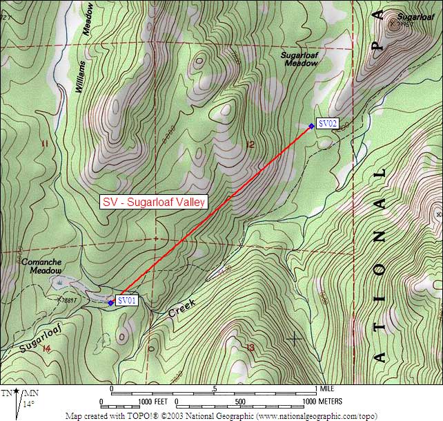
in Sugarloaf Valley:
(scroll down for directions, waypoints, and area map)
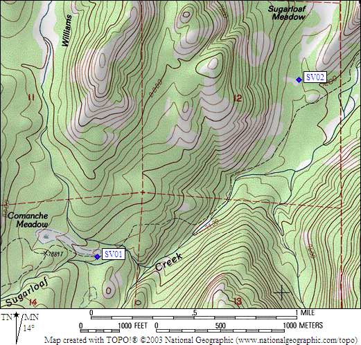
- SV02 is a standard box, at about 7200 feet,
in the GPS route SUGARLOAF VALLEY.
- Directions from Steve Eckert, verified GPS waypoint, Aug 2003:
One standard box 50 yards of use trail off the north side of the main trail
(a bearbox signpost existed in 2003) in a wooded horse camping area
next to a manure-soaked meadow. The nearest clean water is 0.2 miles
southeast in Sugarloaf Creek, but the dribble coming out of the horse
meadow does produce a wet spot on the trail. The meadow drainage crosses
the trail about 100 yards east of the use trail and just west of the
granite slabs that make up the south ridge of Sugarloaf Dome, and you
can follow the west side of that drainage north to the camping area.
- Directions from Joe Leal, with GPS waypoint, Sep 2000:
One standard box approx 50 yards north of the trail at the camping
area adjacent to a hitching rail.
- Directions from Mineral King ranger info sheet, dated 1991:
One box at the camp area at the south end of Sugarloaf Meadow near a hitch rack.
- SV02 coordinates: (see GPX waypoint download links above)
  (lat,lon) = (36.7233200, -118.6659700) in decimal degrees, NAD83.
  (zone,east,north) = (11S, 351307.0, 4065276.0) in decimal meters, NAD27.
- Scroll down for a regional map of the entire Sugarloaf Valley region.
Map exported from TOPO! software, used with permission.
Useful Links: