Bear Box at Upper Funston Meadow #2 (KC03)
Generated on 20 Oct 2025 - see revision history - please send updates to the webmaster
Detail Map of waypoint KC03
in Kern Canyon:
(scroll down for directions, waypoints, and area map)
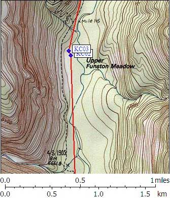
- KC03 is a standard box, at about 6700 feet,
in the GPS route KERN CANYON.
- Note: This box is near where Funston Creek joins the Kern River,
north of the Big Arroyo and Rattlesnake Creek trail junction,
and south of the Chagoopa Plateau trail junction.
The map does not show Lower Funston, but it does show
Upper Funston Meadow about 5 miles north of Funston Meadow.
- Directions from Mark Sapiro, with GPS waypoint, Sep 2006:
Follow a spur trail marked with a sign 'campsites' to the east (the
trail turns to the northwest). Continue north past the first campsite and box
(KLC02)to the second campsite with a standard box (KC03).
As you walk in on the above trail you see a 'toilet' sign pointing to your
right before reaching KC02. The toilet is perhaps 100 ft down this second trail.
- Directions from Mineral King ranger info sheet, dated 1991:
About 160 yards north of the meadow a smooth informal trail, worn
into the duff of the forest floor, leaves the Kern River Trail and
switngs south and east through the trees 250 yards to the camping
area. You'll pass a small campsite in the forest north of the meadow,
near the pit toilet. The first bear box is at the northeast corner
of the meadow, adjacent to the access path. The second is near a
campsite 60 yards further south. Coming from the north on the Kern
Canyon Trail, you'll encounter this access path ninety yards south
of the Upper Funston Drift Fence gate, which is 300 yards south of
the High Sierra Trail junction at the foot of the Chagoopa switchbacks.
- KC03 coordinates: (see GPX waypoint download links above)
  (lat,lon) = (36.4528400, -118.4135700) in decimal degrees, NAD83.
  (zone,east,north) = (11S, 373407.0, 4034909.0) in decimal meters, NAD27.
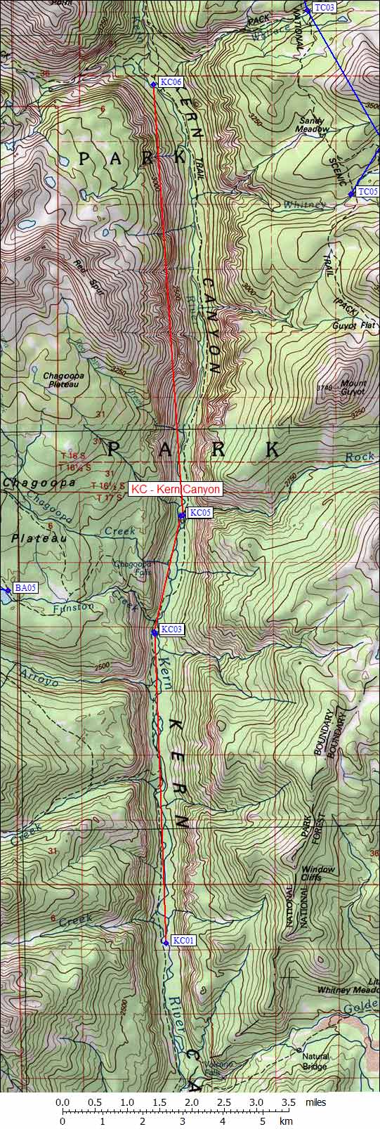
- Scroll down for a regional map of the entire Kern Canyon region.
Map exported from TOPO! software, used with permission.
Useful Links: