Pine Creek Trailhead
Revised 11 Jun 2012 - please send updates to the webmaster
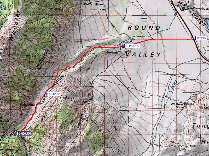
Leave Hwy 395 about 10 miles north of Bishop or 54 miles south of Lee Vining, at the sign for Rovana, on Pine Creek Road (waypoint 395PIN). There is no sign saying Pine Creek until after you are off Hwy 395.
Pine Creek Road goes past the mining village of Rovana, to the Pine Creek and Gable Lakes Trailhead (waypoint PINCRK). After parking under the trees, walk under the pack station sign to find the trail. Sleeping at the trailhead may not be as quiet and nice as pulling off on an abandoned (but still driveable) portion of the old Pine Creek Road, such as the one south of waypoint OLDPCR.
WARNING: The road that used to lead to the Morgan Pass Trailhead is gated as of 2005, and that trailhead may no longer be accessible! I was unable to drive beyond waypoint PINCRK. You can reach Morgan Pass from Rock Creek / Little Lakes Valley, using the Mosquito Flat trailhead.
Useful Links: