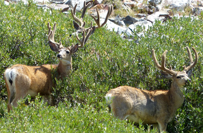
They were definitely National Park deer and ignored us for the most part.
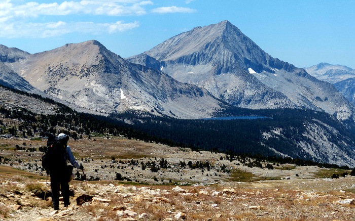
Bench Lake from just below Taboose Pass. Arrow Peak is behind the lake.
Ahead we could see the incomparable Bench Lake, perched high above the south fork of the Kings River. No one else was there. This was our second visit to Bench Lake, and we were the only campers the first time as well. I am surprised that this special lake is not visited more often. Looks like good fishing, great swimming and secluded campsites. But most folks are busy on the Pacific Crest Highway rushing either to Yosemite or Mount Whitney. We camped near the west shore. West of Bench Lake we hiked up the lovely valley and paused at a crystal-clear lake. Richard was trying to photograph a frog near the shore. I was looking across the lake when a strong wind came up and created a 5-foot high water spout behind Richard. "Oh my God!" I screamed. Then, instantly it was over. Richard missed it. We started up "Arrow Pass" a crosscountry approach to Pyramid Peak. With full packs the climb was difficult. We correctly aimed for the southern notch. We had ascended this route in snow 20 years before when we climbed Arrow Peak. Part way up it became obvious to me we should have been farther east. The notch looked too far. The lyrics to Kenny Roger's song, "The Gambler" kept cycling in my head, "Know when to fold 'em, Know when to walk away, Know when to run. . . ." It was almost 2 p.m. "OK," I said, "We'll go back to Bench Lake and tomorrow to Lake Marjorie and climb Mt. Wynne." We started down. We crossed the huge drainage in order to descend the easier ridge. I looked up. The pass didn't seem so far this time. "Let's do it!" (I recommend following the ridge which we didn't.) What was reasonable at first soon morphed into difficult. Very large blocks, then horrendous scree and sand which slid with every step. We topped out at 5:15 p.m.
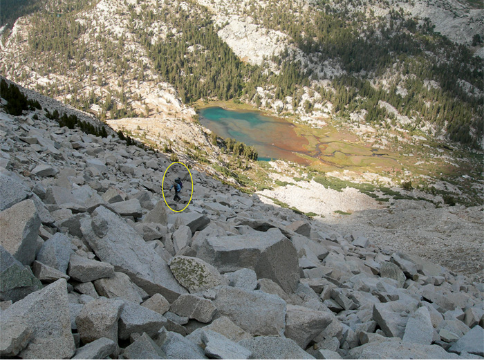
Richard climbing Arrow Pass. We could have avoided some of this talus if we had taken the ridge.
Getting down the other side took another two hours. We set up camp at the first lake below the pass just before dark, cooked supper and collapsed into a deep sleep. Luckily I had planned a layover day for the morrow. We bathed, moved camp a wee bit closer to the peak, and rested. And it rained. Fine except our tent zipper didn't work. Always prepared, we used clothespins to close the fly. We would climb Pyramid tomorrow. Up at 5:45 a.m. we started hiking at 6:30. We found a ramp leading to the long southwest ridge replete with secret deer bed sites. We scrambled along easy third class on the ridge.
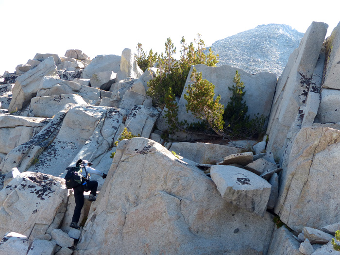
Debbie on the southwest ridge. The summit can be seen 1000 feet above on upper right.
About 1000 feet below the summit, Mother Nature had other plans for us. A storm was on the way. We looked for shelter, found an alcove with rock walls on three sides, and had just enough time to roof the cubby with our emergency space blankets, using rocks, a bit of line, and the useful clothespins. Just as we finished it started hailing. Soon the ground was white with small round bits of ice. We watched the show for three hours, made ourselves snow cones, ate some lunch and waited. Finally it stopped and we bailed.
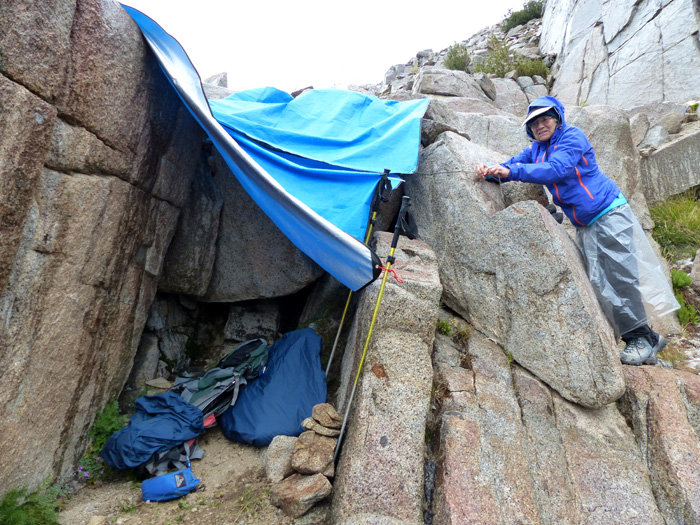
Taking down the bivy. Rain skirts are the latest fashion.
We descended the easy west face, which I decided to name the "bear route" since there was lots of bear sign (scat) there. I had inadvertently left my rain pants in the tent, so I constructed a "rain skirt" out of a plastic bag I carry for emergencies. The tiny Pacific Chorus Frogs loved the weather and were out in force. The next morning we left camp at 6:30 a.m. and climbed the bear route to the west ridge. This proved a much shorter route than the long southwest ridge, and we gained the summit by 11:15 a.m. It was a bit of a puzzle to find the easy way up the summit blocks. And what a view! Arrow Peak to the north, Clarence King to the South. There was no register book and only the top of the aluminum register cylinder. We left a small notebook in a plastic zip bag. In all we spent about an hour and a half on the summit. On the way down, just above our previous day's shelter site, it started to graupel (soft hail). This time we donned our rain suits and kept hiking. We reached our tent at 5:30, stowed our gear and got into our sleeping bags just before the rain picked up. Instead of cooking in the rain, we just went to bed without supper.
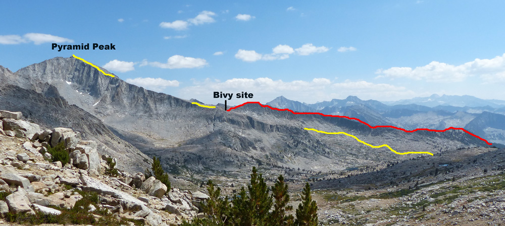
The red line is our first attempt. The yellow line is the next day's easier route. Our basecamp is out of sight behind the hill on the right.
The next morning it was clear. We thankfully dried out everything, brewed a full pot of tea and had a big breakfast. We even washed our socks and patched my sleeping bag which was leaking feathers. There was time to enjoy our valley, admire the Foxtail pines, Western azaleas, and interesting water grasses before we left to climb back over "Arrow Pass." This time we took the easier ridge to descend to the lake on the north side where we found mima mounds and other interesting landforms. We hadn't seen another human in five days. Our solitude was about the change. The next morning we encountered eight people resting at the junction of the Bench Lake Trail and the JMT. We first saw two women, possibly mother and daughter, from the San Francisco Bay area. The older one was wearing a full leg brace, sort of an exoskeleton. When I noticed it, I remarked, "You have a leg brace!" in surprise. She responded, "The doctor says I need a knee replacement, but I already had the permit." What moxie! As we approached Taboose Pass, a Golden Eagle buzzed us, to our delight. Then on the east side of the pass we saw another pika.
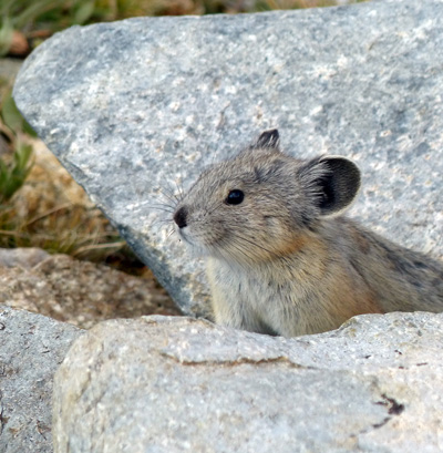
We stood silently for 10-15 minutes as the little cutie repeatedly poked its head up to see if the way was clear. That night we camped at our previous site on Taboose Creek. We could now see the Owens Valley, and it was smokey. We reached our truck at 5:15, it wouldn't start. Probably caused by the intense heat for 9 days. Perhaps I should have been worried, but I wasn't. I figured we could always sleep at the trailhead and deal with the problem in the morning. After all, it would be the weekend and new people would be arriving, perhaps one with a satellite phone. Our cell phones had no reception. Luckily, after about an hour Richard was able to start the truck, and we were home free.
p.s. After reporting our mulitple tent zipper failures to Big Agnes and mailing them the tent, they sent us a replacement for our much used 8-year old tent! What a great company.