At the pass, it was clear, about 40F, with a steady wind, about 20-30 mph so I camped under a pinion pine just over the east side of the pass/saddle. Surprisingly, I found no previous campsite on the windless side of the ridge so I slept on a bed of sloping sand under the stars, a 3/4 full moon, and the lights of Ridgecrest shining below. The constellations of Leo, Virgo, Corona Borealis, Bootes, and others were quite a different celestial landscape than what one sees on summer nights in the Sierra.
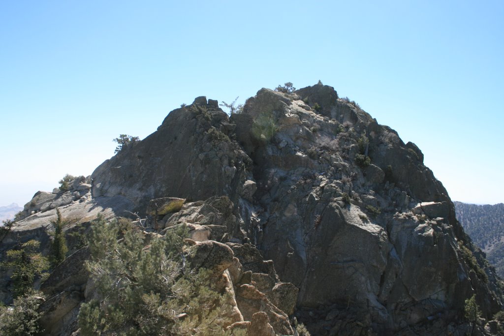
The next morning I set out at about 7am with the mindset that I'll just go as far as common sense will allow me, summit or no summit. I brought along a 70 ft. length of webbing and rock shoes, but used neither. Starting from the pass, there's a well ducked route that leads off roughly horizontally from the saddle, crosses 2-3 ribs and gullies and then becomes obsolete after about 1/3-1/2 mile or so. Near that point I mistakenly climbed up to a notch between 2 of the minor summits, still well short of the true summit- and back down again. Then traversed further on, and reached the correct, or last, chute that led up to the first false summit. At that point the true summit came into view. The notorious "slab with the lone tree" was unmistakable. It appeared much smaller than I what I had expected it to look like.
It was pretty brutal getting to this point. Alot of stout, stubby oaks to struggle through and route finding challenges were the norm from beginning to end.
From this point, it was still a few more up-down, brush choked struggles although the summit was only a stone's throw away. The notorious "slab traverse" was trivial compared to the effort involved reaching this point. Once on the slab, there was no lichen, and there was no ice at this time, thankfully. The footing was very solid.
Slab traverse on left, summit block on right.
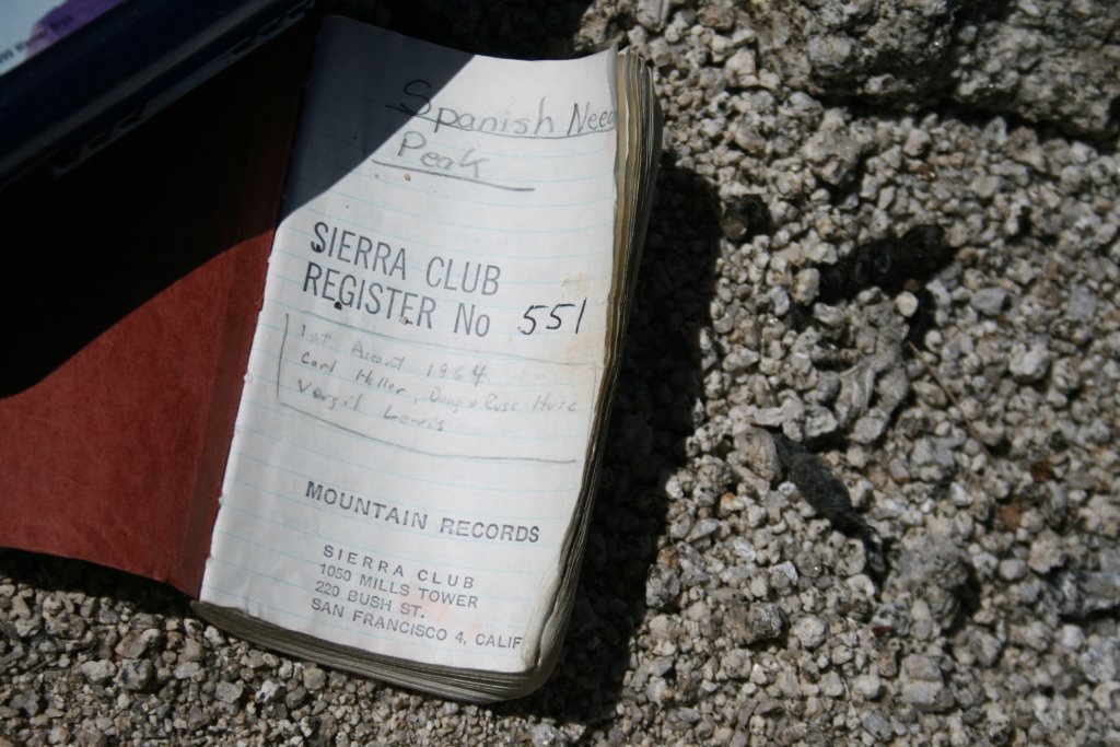
After the final 5 ft. jump across to the summit block, also fairly trivial, I reached the top at 1:00 PM. Whew! The view was impressive, the weather perfect, and I believe I saw Telescope Pk. to the east. To the north, there was no snow on the southern slope of 12,000 ft. Olancha Peak. I rested on top about 45 minutes, ate lunch, took pictures, signed the book, and then headed back to camp. I got back at about 5 pm., muscles cramping and scratched up, but happy. This little 2-3 mile outing had taken about 8-9 hours to complete.
The register-circa 1964
I returned to my car the next morning.
In hindsight, a first timer may want to consider not going solo, as I did. Going with an experienced partner, or group, may be a wiser choice. Less fatigue and less anxiety. Last notes- Summitpost.org lists this route as the "North Ridge" route which is misleading. More accurately, it skirts the eastern slope of the north ridge staying well beneath the ridgeline up to the final summit plateau.
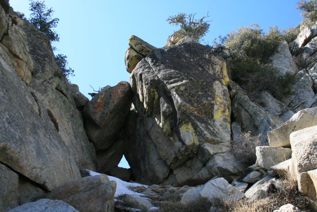
Also, in the upper summit area there's a small triangular keyhole beneath a chockstone at the head of a shallow ravine. It's just beyond the first false summit and it's pretty obvious. Going through this keyhole is easier than bypassing it, especially on the descent.
The keyhole.
Last item- I had dayhiked Sawtooth Pk. just 2 days prior from the same trailhead. An easy, mild walk up. These two peaks have extremely opposite personalities.