Gannett Peak
18-21 Aug 2010 - by Alex Winn
- Peaks: Gannett Peak
(sorted/filed as Gannett)
- Place: Wyoming
- Trailhead: Elkhart
- Participants: Brother, Sister, Cousin
- Difficulty: snow bridge, crevasse,, class 4, ice axe, crampons, glaciers, snow travel
Gannett Peak seemed out of reach for few un-experienced rug-rats, especially looking back at our trip, but thanks to amazing weather and some good luck we had an amazing experience with a gorgeous summit. Hopefully this post will help those looking to follow this most-commonly used route with the basic details.
Day 1 - We left from the Elkhart Trailhead on Aug 18, 2010 about noon. We followed the trail up past Photographer's Point (nice initial views of the area we were headed to ) and then on past Hobbs and Seneca Lakes. We camped at mile 10 on Little Seneca Lake.
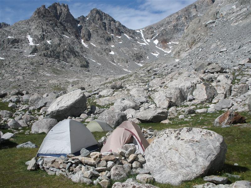
Day 2 - We got up and hiked past Island Lake and on through Titcomb Basin - up to Mistake Lake to try the fishing - but it was a bit chilly and we had no luck there - we were considering hiking to the top of Bonny Pass that afternoon - but decided not to take our full packs all the way so we found a nice spot about 1 mile north of Upper Titcomb Lake. It was a nice grassy spot with a little rock wall wall built to cut down wind. It was about 7 miles to that spot from our first night's camp. We set up tents as a base camp and decided to leave them set up and most of our gear there as we summited and returned on Day 3.
Base Camp for Nights 2 and 3
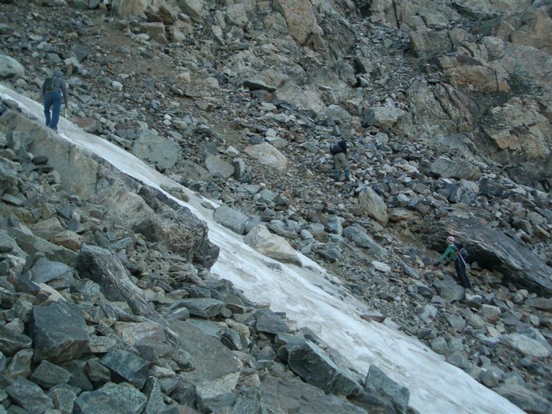
Day 3 - We got up at 4 am (packing day packs and necessary gear only - including crampons and ice axe). We crested Bonny Pass about 7am - which was a bit of a challenge - it being the frist steep ascent of the trip and was a mix of scrambling boulders and taking the snow fields by crampons - the snow was firm in the morning and probably the easiest choice for this section.
Bonny Pass Scramble
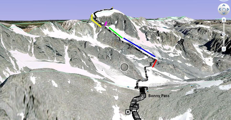
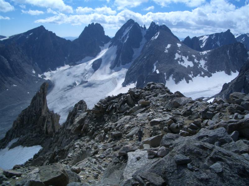
Once we arrived at the crest of Bonny Pass one can get a pretty good view of the rest of the trip - descending the pass on the back side, crossing Dinwoody Glacier, then hugging the ridge-line up to Gooseneck Pinnacle - skirting around the bottom edge, crossing the snow bridge, and then up the ridge the rest of the way. Here's a diagram showing our actual path we took via my Garmin (plotted in Google Earth - admittedly not the best picture - but it gives the general idea of the route to take.)
Rest of the Route
RED - Boulder Scramble up to ridge
BLUE - Follow ridge up - take snow when it's easier or scramble boulders if you prefer
GREEN - Skirt up around the bottom side of Gooseneck Pinnacle on the glacier till you come to the snow bridge (with crampons)
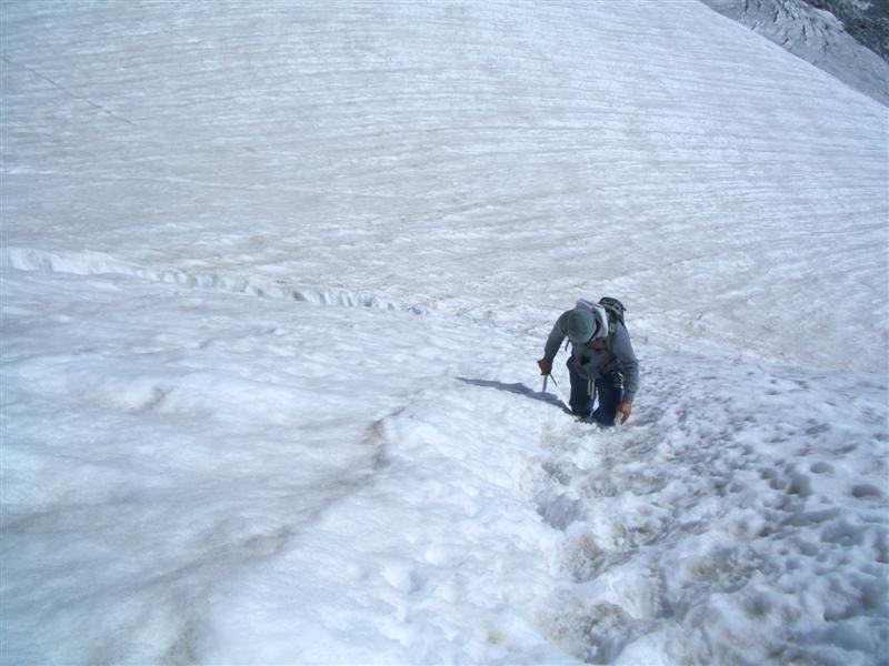
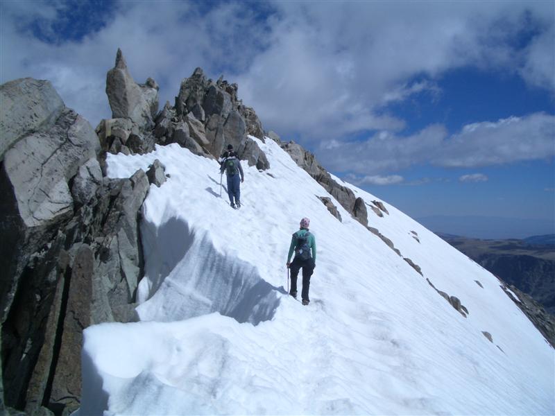
PURPLE - take the snowbridge followed by a very steep climp up to the top of the ridge again (this was the most nerve-racking part of the hike - quite steep - luckily some previous hikers had make nice set of steps in the snow for us)(This purple line is more of an arrow - i'm trying to show the point where the snow bridge is located)
YELLOW - Scramble up the rest of the ridge - when you get to the snow - put on crampons again and finish off the ridge to the summit - watch your footing - it's steep off both sides
Climbing Above the SnowBridge
Ridge Climb (in Yellow portion)
Last Section Over to the Summit
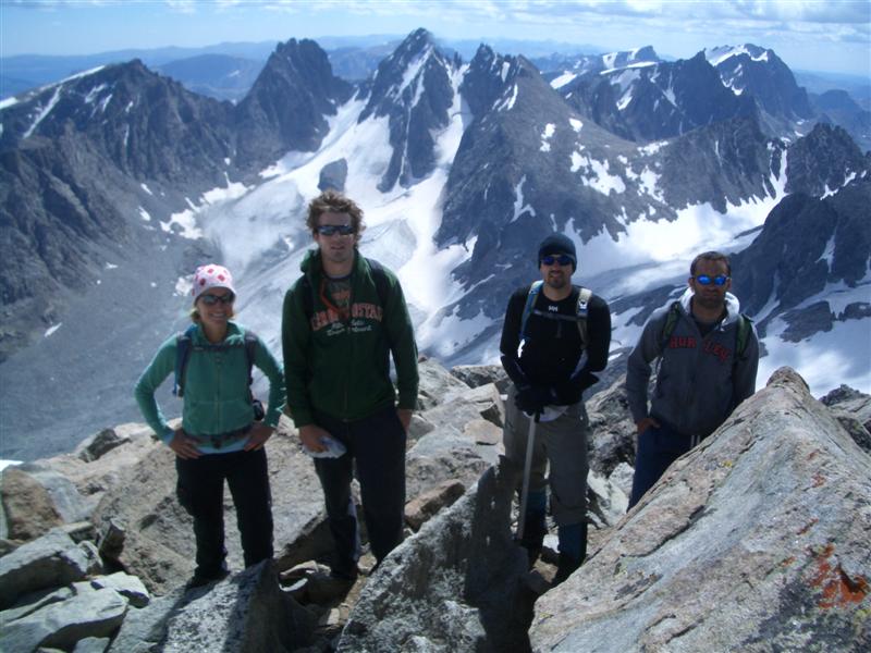
We summited right at noon on Day 3 - the weather was absolutely perfect. We couldn't have hit a better day - almost no wind - in high 40s by mid-day. My Garmin clocked 21 miles from the trailhead to the summit.
Our Rag-tag Crew and Amazing Views
The return trip was the same way back - getting up the back-side of Bonny was a killer - it was about 5pm at that point - very greuling. We got back to our base camp at about 6:30 to find everything in tact. Very tough day - but very rewarding.
Day 4 - We got up at 3 and hoofed it all the way back to the trailhead (17 miles with full-packs) OUCH! If I did it again - i'd make the return trip a 2-day hike-out - that was a sore set of feet on this kid.
Summary
This was an outstanding trip - very scenic - amazing views - very isolated - only one other pair summitting the day we chose.
I would make it a 5-day trip next time for a little more relaxed pace. Island lake looked amazing - but we didn't take the time to enjoy it enough.
Dinwoody Glacier did get a bit interesting when my brother slipped into a crevasse up to his thigh - we had been told not to worry about the crevasses, but if did it again I would rope-up for the glacier crossing.
Weather and distance can be the killers on this trip - we are amateurs and made the hike without ropes. Be careful and smart and you'll do fine! We loved it!
To file a trip report, please fill in the Report Entry form or contact the webmaster.