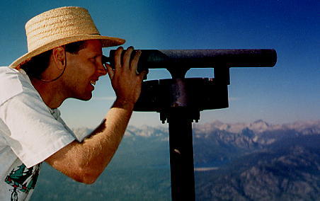
The ridgeline east of Kaiser pass provides moderate cross-country travel as well as unparalleled viewpoints of the Mono Divide high country. The view from Mt. Givens is so impressive that several years ago an observation scope was placed on its summit. It identifies summits from the Evolution Basin to the south to the Minarets and Mt Ritter to the north. A car shuttle at Florence Lake enabled us to make the one-way 12-mile hike with 2000 feet of altitude gain and 4000 feet of loss. Pat and Annie Phillips, Ted Jackson and I set out from Whitebark Vista following the Dusy Ersham 4WD trail east for two miles to a small meadow below Mt Givens. Less than a mile and 700 feet of climbing led us up the SW slope to the summit of Mt Givens 10,648 feet. After identifying as many peaks and routes as possible, we contoured SE, passing through a keyhole notch near the north end of the prominent rocky spine 0.8 miles SW of Mt Givens. We crossed the meadow on the other side and traversed rounded open slopes to the seldom visited summit of Mt Ian Campbell 10,616 feet, two miles further. Here we placed a summit register in a crack on the rocky summit outcrop. Next we descended east down steep wooded slopes, to Manse Meadow one mile and 1500 feet below. Walking through increasing thick forest, we were very happy to navigate straight to the edge of the meadow, which was not visible until 100 feet away. We followed Crater Creek for a few hundred yards where we intersected the trail to Dutch Lake, and made final 3-mile downhill walk to Florence Lake where a refreshing swim washed off all the trail dust before driving back to Kaiser Pass to retrieve our other car.
Mt Givens 10,648 feet
Mt Ian Campbell 10,616 feet
12 miles / 2000 feet gain / 4000 feet loss