The fog was thick and some of us started with wet gear just from sleeping at the trailhead. We left Lodgepole around 7:15am and followed the Twin Lakes trail across the ridge North of Lodgepole. As the ridge faces South, it was completely free of snow. At the top of the ridge, when the trail makes a 90 degree turn to enter the forest, we left the trail (at waypoint WILMDW) and headed cross country North East while keeping the main ridge on our right side.
To the contrary of our plan, the snow cover was very light and the 2 skiers Steve and I had to constantly take our skis on and off, while the snowshoers marched through the bare spots. We were not on top of the bushes and branches as planned, which forced us to make detours. In addition the thick fog persisted until early afternoon and required us to take frequent navigation breaks.
As we started paralleling Horse Creek (near waypoint HORSEO), the snow cover became more consistent but the terrain was very steep. At 4:30pm, we reached the little marshy area shown on the map 1.25 miles South East of Mt Silliman (waypoint HORSEC). It had taken us a sobering 9 hours tocover 4 miles and 3200' of gain.
Entering Silliman Bowl
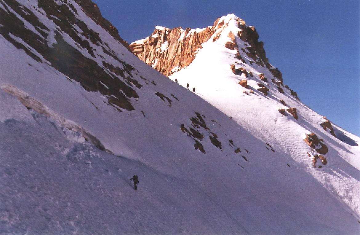
On Sunday morning, we headed for an obvious gap (waypoint SILIMP) in the ridge South of Mt Silliman and the permanent snowfield shown on the map. The Northside of the gap has a short steep section which discouraged members of our parties. However, the snow was soft enough and Steve and I found it was possible to get good footing by planting our crampons deep into the slope. We followed the contour lines around the cirque toward Silliman and reached the peak about 35 min after leaving the gap. This way seemed definitely easier than trying to hike to class 3 ridge as initially planned. Back at the gap we strapped our skis for a very fast and fun return to camp.
Sunrise from our Tableland campsite
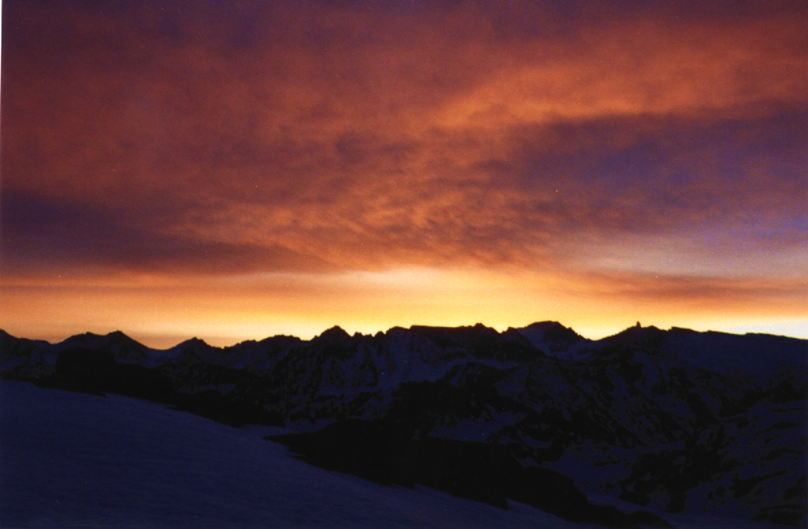
We left camp at noon toward the Tableland. It was bright sunshine but the snow was holding up well. We headed North East and followed the ridge toward the highest point of the Traverse: 11462', waypoint TRAV2. We rested up there, admired the unobstructed view and took turns trying to use up Steve's week-end minutes on his cell phone. On the other side of this high point, the snow was dramatically different and what was supposed to be the fun part of the trip turned out to be the most miserable. While skiers could manage to stay on top of the snow, snowshoers were punching through waist deep randomly and each time it took 3 people to extricate them and their packs. This exhausting exercise took its toll quickly and we set up camp (near waypoint TCAMP) to allow everyone to rest. Although we were considerably higher than anticipated (11,300'), we had a quiet and clear night.
Pear Lake overlook
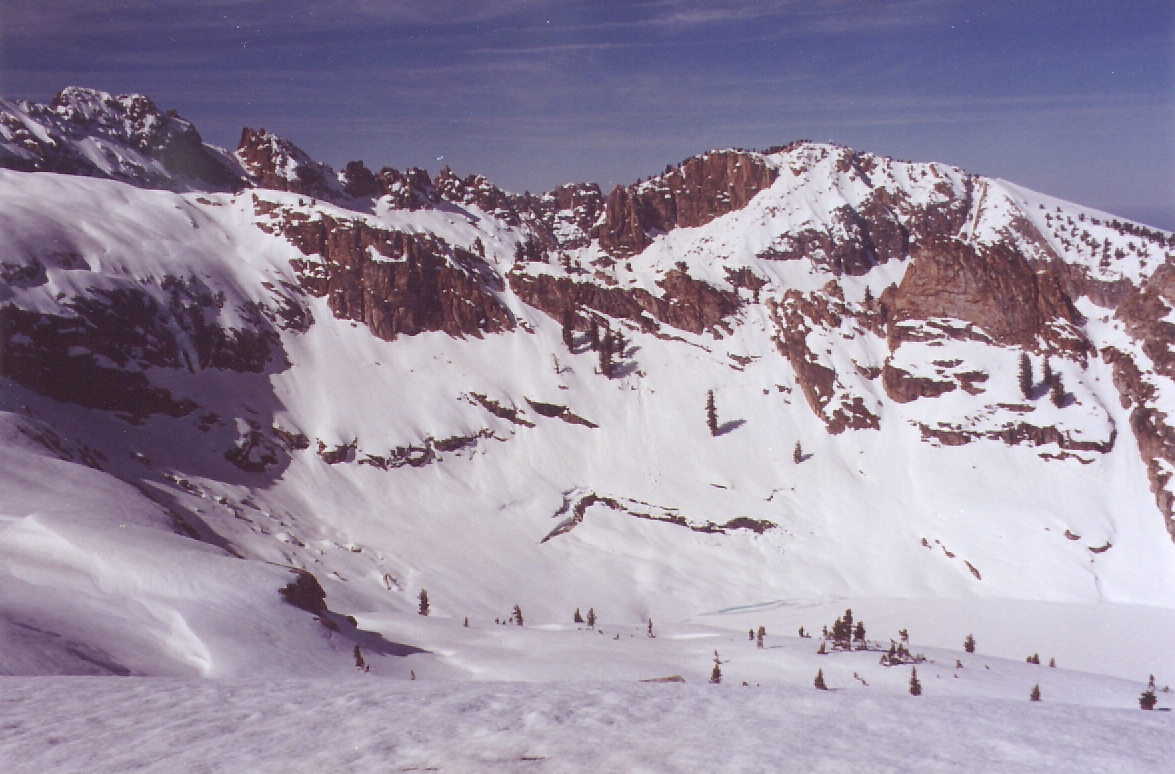
Monday morning, the snow was hard and we made good progress along the ridge. Did I mention the incredible sceneries on this trip? As we were running out of time we decided to leave Alta Peak for the next time. Coming to Pear Lake from the North East (near waypoint TRAV8), we found the slope to be very steep and the skiers in the group did a long S to cut the slope. In the future, snowshoers should probably go the same way to be more comfortable. From Pear Lake we followed the blazed tracks toward Wolverton and Lodgepole. The group stopped at Wolverton and I skied down to Lodgepole to pick up the car. Because I was completing the loop and arriving on the North facing slope, there was still plenty of snow and I was able to ski all the way down to the parking lot.
All in all this was a demanding but very enjoyable trip. As an alternative to our first day, people wishing to do the traverse may have an easier time taking the longer but easier route to Silliman via Silliman Creek and Silliman Lake, then going over the gap we used to rejoin the Tableland.
Thanks to Steve Eckert for this great trip idea.
Datum,North America 1983,GRS 80,0,-1.6E-7,0,0,0
RouteName,1 ,HORSE CREEK IN
RoutePoint,D,BRIDGE, 36.6048091650,-118.7230576277,04/17/2002,02:47:20,LODGEPOLE FOOTBR
RoutePoint,D,WILMDW, 36.6093099117,-118.7355620861,04/17/2002,02:47:14,7200 SW WILLOW M
RoutePoint,D,WILMDE, 36.6109889746,-118.7193078995,04/17/2002,02:47:14,7800 SE WILLOW M
RoutePoint,D,HORSEO, 36.6208800077,-118.7020599842,04/17/2002,02:47:15,OVERLOOKING PT 8530
RoutePoint,D,HORSEF, 36.6249899864,-118.6895799637,04/17/2002,02:47:15,8900 HORSE CK FORK
RoutePoint,D,HORSEC, 36.6310100555,-118.6812100410,04/17/2002,02:47:16,9900 HORSE CK CAMP
RouteName,2 ,SILLIMAN
RoutePoint,D,HORSEC, 36.6310100555,-118.6812100410,04/17/2002,02:47:16,9900 HORSE CK CAMP
RoutePoint,D,SILIMP, 36.6361900568,-118.6943600178,04/17/2002,02:47:15,10880 PASS S OF SILLIMAN
RoutePoint,D,SILIMN, 36.6434899569,-118.6970399618,04/17/2002,02:47:15,11188 MT SILLIMAN
RouteName,3 ,HIGH TRAVERSE
RoutePoint,D,HORSEC, 36.6310100555,-118.6812100410,04/17/2002,02:47:16,9900 HORSE CK CAMP
RoutePoint,D,TRAV1, 36.6374999285,-118.6574882269,04/17/2002,02:47:16,10800 SADDLE
RoutePoint,D,TRAV2, 36.6328099966,-118.6473300457,04/17/2002,02:47:16,PT 11462 - HIGH PT OF TRIP
RoutePoint,D,TCAMP, 36.6359399557,-118.6429500580,06/27/2002,16:06:25,SNOWSHOERS FALLING THRU
RoutePoint,D,TRAV3, 36.6329079866,-118.6306018829,04/17/2002,02:47:16,11000 BUMP
RoutePoint,D,TRAV4, 36.6268800497,-118.6205799580,04/17/2002,02:47:16,PT 11135 - CUT BELOW THIS
RoutePoint,D,TRAV5, 36.6224000454,-118.6115800142,04/17/2002,02:47:16,11240 SADDLE - CUT WEST OF THIS
RoutePoint,D,TRAV6, 36.6131600142,-118.6304800510,04/17/2002,02:47:17,PT 10860 - JUST BELOW THIS
RoutePoint,D,TRAV7, 36.6060299873,-118.6476099491,04/17/2002,02:47:17,PT 10824 - BTWN THESE BUMPS
RoutePoint,D,TRAV8, 36.6042200327,-118.6585799456,04/17/2002,02:47:18,10200 - BELOW THIS
RouteName,5 ,WOLVERTON OUT
RoutePoint,D,TRAV8, 36.6042200327,-118.6585799456,04/17/2002,02:47:18,10200 - BELOW THIS
RoutePoint,D,PEARLK, 36.6032212973,-118.6687482595,04/17/2002,02:47:18,9500 PEAR LAKE OUTLET
RoutePoint,D,PEARTJ, 36.6058820486,-118.6750514507,04/17/2002,02:47:19,9360 PEAR LK TRAIL JCT
RoutePoint,D,EMERLX, 36.5994501114,-118.6769611835,04/17/2002,02:47:19,9200 TRAIL X EMERALD
RoutePoint,D,HEATHL, 36.6019177437,-118.6880118847,04/17/2002,02:47:19,9260 HEATHER LK
RoutePoint,D,HEATHS, 36.6019392014,-118.6929417849,04/17/2002,02:47:19,9500 HEATHER SADDLE
RoutePoint,D,HEATHJ, 36.5967088938,-118.7092281580,04/17/2002,02:47:19,8300 HEATHER TRAIL JCT
RoutePoint,D,WOLVJ1, 36.5928518772,-118.7099577188,04/17/2002,02:47:19,8100 WOLVERTON TR JCT
RoutePoint,D,WOLVJ2, 36.5983289480,-118.7347306013,04/17/2002,02:47:19,7300 WOLVERTON TR JCT
RoutePoint,D,WOLVTH, 36.5966713428,-118.7340922356,04/17/2002,02:47:19,7250 WOLVERTON TRAILHEAD
RoutePoint,D,WOLVJ3, 36.5967625380,-118.7428416014,04/17/2002,02:47:19,7100 WOLVERTON TR JCT
RoutePoint,D,BRIDGE, 36.6048091650,-118.7230576277,04/17/2002,02:47:20,LODGEPOLE FOOTBRIDGE