Mt Goethe (13264') can be climbed by a mostly hands-in-pockets route from the south. The trouble is, this involves either a long trip over Lamarck Col, or a long detour from Alpine Col, neither of which being very attractive for a weekend trip. Instead, Peter Maxwell (scribe), Dee Booth and Scott Kreider tackled the peak via the "class 3/4 northeast ridge", leading up directly from Alpine Col. This alpine adventure took place on September 29/30, just in time for Scott to use his National Parks Pass which expired on September 30.
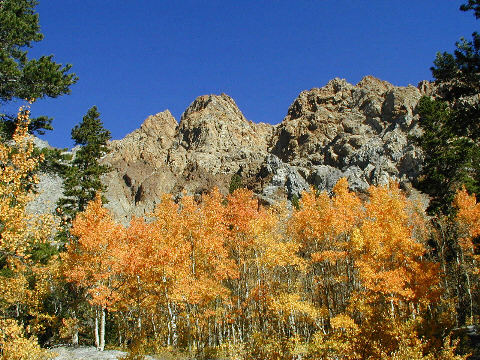
An added attraction were the vivid fall colors of the aspens in the North Lake region. The lower parts of the Piute Pass trail were through a wonderland of gold/yellow leaves. The contrast of the intense blue sky, the green of the pines, the multiple reds of Piute Crags and the yellow of the turned trees made a kaleidoscope of colors that was stunning in its beauty.
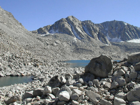
At the ranger station in Bishop I got the bear lecture and was told there was one in Humphrys Basin, surviving on YOUR food. I'll bet it didn't come up to Goethe Lake, which is totally treeless and surrounded for the most part by large boulders. We didn't even see any small critters up there and hung our food from a convenient boulder as a mere precaution, rather than thinking it was really necessary.
We got off to a leisurely start on Saturday morning at 9:30 in perfect fall weather. After a stop for lunch shortly after Piute Pass we arrived at Goethe Lake at 3:30 pm. There is a good trail from the pass to Muriel Lake, but from there it's cross country. The worst part was getting around the west side of Goethe Lake to the only flat area suitable for camping. From the lake just before Goethe to this camp site was boulder hopping and took us almost an hour. Bad as it was, the east side would have been even worse.
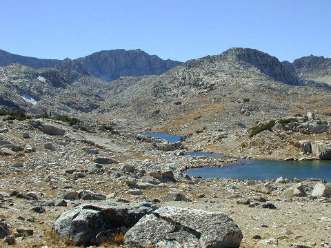
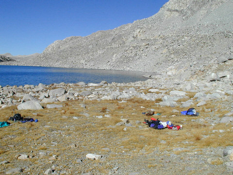
The camp site is right at the base of the wide gulley leading up to Alpine Col, so is very well placed for the climb. It's also quite large, and could accommodate a reasonable number of people without problems. The peak is hidden from the campsite and we were wondering just what the ridge leading to it was really like. It looked quite a long way on the map.
As soon as the sun went behind the higher peaks the temperature let us know that this was definitely no longer summer. The wind which gusted from time to time didn't help the situation either. Around 7 pm it was 46 degrees and nobody was keen on staying out of cosy sleping bags so we bid each other goodnight and settled down to a wonderfully long sleep.
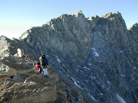
Sunday morning it was up in the dark at 5:40 am and we were walking an hour later. We were at Alpine Col by 7:30 to get our first decent look at the ridge. It rises up to a high spire which is unnecessary to climb so the best thing is to traverse left and up to pick up the ridge well beyond this spire. We ended rejoining it too soon and had to descend somewhat to bypass very difficult walls.
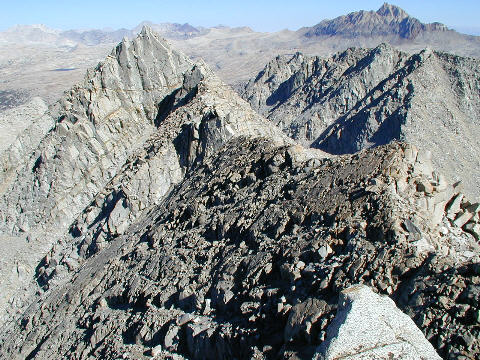
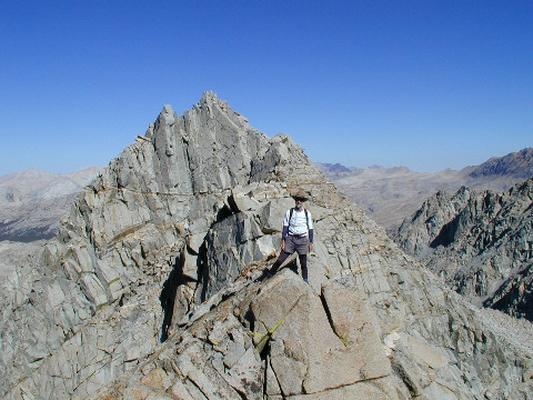
The next section of ridge is superb, being very narrow and with considerable exposure in places. It reminded Dee and I of the ridge encountered while climbing Palisade Crest. There were a few ups and downs but the best way was always right over the top. There comes a point however when continuing along the top would be a lot more difficult and we had to start traversing again on the left (south) side. The peak was in sight at this point so the traverse became the route to the summit, without getting back on the ridge top again.
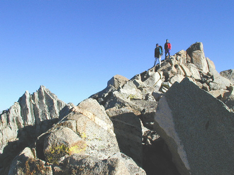
We were on the summit at 9:30, a total of 3 hours of climb. We decided that we wouldn't rate the ridge as class 4 in any way since the exposed parts were on easy terrain and the more difficult parts were regular class 3. This is about as good as it gets!
We hung around on the summit for half an hour, and were inspired by Aaron Schuman's quote from Faust in the register. On the return we learned from our mistake on the ascent and started angling down to Alpine Col from the last saddle before the ridge started its ascent to the aforementioned spire. The descent took longer than it should have because 10 minutes or so after our last break stop I realised I didn't have my camera with me. Shock, horror - I'd left it on the ground "back up there somewhere".
Dee was somewhat below us so Scott and I climbed back up, trying to retrace our path. We went up to a point that we knew was higher than our break stop and then searched carefully. Thanks to Scott recognising an oddly-colored rock, and a good deal of good luck, I walked straight to the camera and reclaimed it, much to my immense relief.
We arrived back at camp at 12:45, making a 2 3/4 hour descent, although without the camera misadventure this would have been nearer 2 1/4 to 2 1/2 hours. Eating lunch and packing up took us until 1:30, at which time we started the laborious task of the boulder hopping back around the lake. I had been dreading this, and as my tired legs took me and my pack up one boulder, down onto the next, up onto the next, I knew my dread was real.
However, all bad things come to an end, and it wasn't long before we were on much more pleasant terrain. The weather had become rather overcast by this time, which was actually an advantage as it gave us respite from the sun, which still had plenty of strength. We arrived back at the car at 6 pm and after gassing up in Bishop and getting fast food takeouts, were on the road home at 7:15 pm. The drive back was incredible - I have never seen the Tioga road so deserted and passed only 4 cars all the way to the Big Oak Flat entrance station. We made it back in slightly less than 5 hours, a record for me.
The final big unsolved mystery of the trip is why is there a sign by the North Lake campground pointing to "Piute Pass, Lamarck Lakes" and if you follow this sign you end up back on the road in 25 yards? The real trailhead is further up the road, at its end, where there is no sign at all.