Steve's Photos:
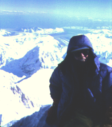
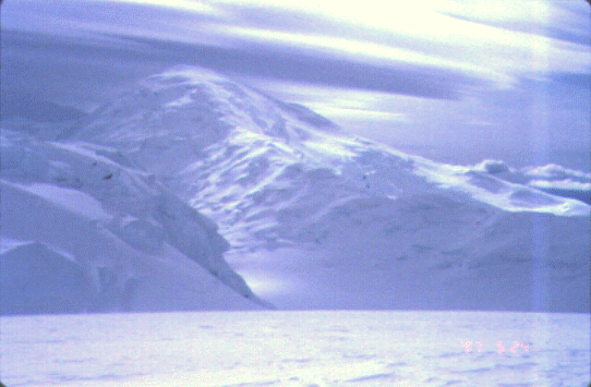
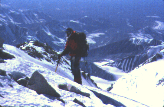
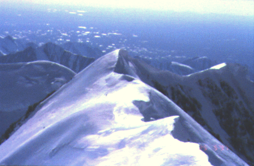
Tim's Photos:
(Skip to Day 15 if you just want the summit day story.)
Day 0 - Getting There
If you reserve far enough in advance, a round trip commercial flight from San Francisco to Anchorage is under $300. Then you'll need to contact a shuttle bus company like Denali Overland Transport, which will pick you up at the airport (or anywhere else in Anchorage) and drive you to Talkeetna for about $150 round trip (depends on how many are in your group). You can take the train, but few do anymore due to bad schedules. Once in Talkeetna, you check in at the ranger station (and pay a $150 fee for the permit you applied for at least 60 days in advance), then a ski plane takes you to the edge of the park round trip from 350' in Talkeetna to about 7000' on the Kahiltna glacier costs $250 each. We used Doug Geeting Aviation, who has a reputation for getting you off the mountain regardless of the weather, but they don't have a bunkhouse like K2 does (which could be a problem if you're stuck in Talkeetna due to bad weather). Fuel is $5/gallon on the glacier, so go with lots of empty bottles unless you think you can drag a thin metal can up and down the mountain without popping it. We used about a pint a day for two people, taking 10 liters for the whole trip. Guide services charge you about $2700 per person (plus transportation), and provide food, tent, rope, etc.
Day 1 - The Slog Begins
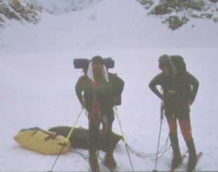
Tim Hult and I left Talkeetna about 11am after doing the frantic gear repacking thing and chatting with the nice rangers about our qualifications. Just a few days earlier there was a backlog of 100 climbers waiting on weather to get out of Talkeetna, but a day or two of reasonable weather had cleared that up. We buried a cache at Kahiltna Base (7200') with some spare food in case we got stuck on the way out, then roped up and headed down onto the main Kahiltna glacier. The landing strip is 400' up a spur this year (it varies) where there are no crevasses. Sometime around 11pm we made camp just below 8000', having dragged over 130 pounds of gear EACH down to the main glacier and back up about 1200'. We put some on our backs, and some in drag bags (other people used sleds, but the bags hold more and don't roll over).
Day 2 - Where Are We?
After about 5" of overnight snow, the morning was foggy but not too nasty. We hung around camp trying to decide if a real storm was coming in, and finally decided to push half our load up to 9500' with an afternoon carry. The rules are different when it stays light all night! There's no need to start early because it warms up about 10am and cools down somewhere around 9pm, with walkable light lasting 24 hours a day. We returned to camp at 8000' as it started to snow, just like the night before. This year most of the people who fell in crevasses did so between 8000' and 10000'. One team had four on a rope, and stepped off the trail to let a lone skier go by. The lone skier and the center two people fell in due to the weight concentration, even though no crevasse was visible!
Day 3 - This Is More Like It!
Light snow lasted until 2pm, and we hit the trail at 3pm. Moved camp up to 10000', bypassing our cache. This was a HOT day, where a single thin layer of polypro was plenty. The barometer was dropping in spite of the clear sky, and by 9pm it was only 15 degrees. After some vigorous debate, we decided to clear out an old tent hole and prepare for a storm even though the weather looked great. Tim's VE25 requires a platform over 10' in diameter, which is a lot of shoveling even if you can use some old snow walls.
Day 4 - Fresh Powder
Went back down to 9500' for the cache, moved it up to 10800', then went back to 10000' for the tent and established camp at 10800'. Skiing down between loads was pure heaven, with a firm base and several days of fresh powder on top. Those with snowshoes looked jealous. It stayed around 30 degrees all day, with an annoying but not nasty wind. We did not rope up here, both because the snowpack looked very uniform and because there were ski tracks all over the hillside. Tim's climbing skins were slipping badly on the final hill, so he wound up walking part of it.
Day 5 - Semi-Rest Day and Booty
In two carries, we moved everything from our perch at 10800 up to the main camp at 11400. This camp is where we left our skis, since it gets much steeper from here on. We suspect the altimeter was reading several hundred feet too high here, but the topography did not match the map and it was impossible to calibrate. The glacier changes considerably from year to year, so these camps move quite a bit. We were camped about 100' from an open crevasse, in which I spotted a full length RidgeRest foam pad. Setting a picket and a fluke as pro, I downclimbed a snow bridge (which went "whump" twice) with an ascender on the rope in case the whole thing gave way. Tim's combination of thin blue pad and thin Thermarest got a much needed boost from this extra insulation, and the snow bridge held up in spite of the visible cracks. (This pad makes up for a similar one I lost on Shasta a couple of years ago karma is preserved.) A rising barometer seemed to disagree with lenticular clouds and occasionally gusty winds slashing snow in our faces.
Day 6 - Real Climbing
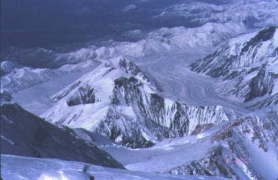
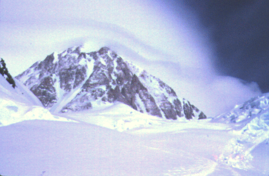
From 7k to 11k you're just skiing (or walking) up a big wide glacier. From 11k around Windy Corner to the Medical Camp at 14k (also known as Genet Basin) it gets a lot more serious. There was some blue ice, with white snow packed into foot-wide cracks. Those with no glacier experience seemed to like walking on the snow instead of the ice, and we saw many places where they had fallen through (probably up to the hip, not all the way in). Beyond Windy Corner (a rocky shoulder kept bare by consistent wind) the crevasses were an order of magnitude larger and the route wound drunkenly between them on snow bridges of varying quality. The route was poorly wanded, but easy to follow because of heavy traffic.
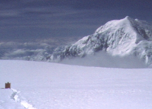
We dug our cache in at 14500' according to the altimeter (almost certainly reading 300' too high) and sat around watching the show: Some people had carried downhill skis up, and were doing yo-yo climbs and linking turns on the slopes around the camp. Others were practicing self arrests. One person did a 500' uncontrolled glissade that did not look intentional. A tent bounced around on the slope after blowing over the ridge 2000' above camp, winding up in a crevasse where no one was willing to rescue it. A solo climber was carrying his pack 100', setting it down, going back and dragging a sled, then carrying the pack again, etc. What a zoo! It appears that the 14k camp has become a destination for tourists, not just a place to stage a summit assault. Helicopter flights seemed common as frostbite victims were brought down (one from 16k to 7k dangling in a basket at the end of a rope for the entire ride). This was one of the first nice days after three weeks of unbroken bad weather up high.
We both felt great, with no altitude effects at all. Ascending slowly on the bottom part of a big mountain may be more important that I've thought in the past! Reluctantly, we returned to our camp at 11k.
Day 7 - Deja Vu All Over Again
Same as Day 6, except we moved camp instead of carrying a load. We finally met someone who had summitted! (In Talkeetna, the ranger indicated 300 were on the mountain, 45 had returned, and only 2 people had reached the summit so far this season.) A very safe climbing season as far as injuries go, but high wind and cold temperatures had prevented most people from even trying to summit. In the tent at 14k we were sweating it out until the sun slipped behind a ridge. Less than half an hour after "sunset" (about 930pm) we were freezing in single digit temperatures and fiddling with Tim's failed MSR ("Maximize Service Revenue") stove. We had a spare (my old Optimus 111B) which roared away while Tim got the frozen water drop out of the MSR.
Day 8 - Major Rest Day
Our first "do nothing" day of the trip! We lazed in the tent, alternately sweating in 90 degree greenhouse heat and frantically zipping up to keep spindrift out during the occasionally gusts of wind. The forecast was for a storm to come in, but we felt it was best to take a day off anyway.
Day 9 - Final Cache and Carry
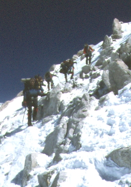
A falling barometer had pushed the altimeter elevation of camp up several hundred feet higher, but we carried 6 days supplies, climbing gear, and spare clothes 3000' up to high camp at 17200' anyway. The first 1500' of gain was on icy snowpack, but the next 500' was 45 degree blue ice with fixed ropes after an 8' vertical bergschrund! So much for this being a "long walk in the snow" sort of mountain. Once at 16k, the route follows a mixed rock-and-ice ridge along a knife edge to the saddle containing high camp. A fall on this ridge could easily be fatal, because it is over 45 degrees on the sides (and sometimes that steep along the ridge itself) with positively NO runout. You would start banging into rocks as soon as you fell, making any attempt to arrest unlikely to succeed. Some were roped into suicide pacts (not setting protection), but we climbed off rope because it was unlikely that one climber could stop another's fall. We both felt great at 17k, although Tim was developing a worrisome cough.
Day 10 - Hitting The Wall
With the weather definitely turning for the worse, we intended to move camp up to 17k and sit out the storm while acclimatizing before a summit push. Before the bottom of the fixed ropes, Tim's cough turned into a cold. He weakened and began to sweat heavily, so we turned around and parked the tent back at 14k. A trip to the resident doctor confirmed that the flu was going around (the rangers and doctors all had it), and that Tim was not suffering from edema. Most seemed to agree that the flu would not go away until we got off the mountain; your system is working hard to maintain itself at that altitude, and cannot muster the strength to fight off an infection. High camp was socked in with wind by 4pm, so being further down the mountain was not looking so bad after all!
Days 11, 12, 13, 14 - Boredom Sets In
The first three days were mostly stormy, with at least several nice hours per day. Some nights we had to get up every 2 or 3 hours to shovel out the tent due to blowing snow. Nights at 14k were always below zero, ranging from -5 to -20 degrees. One night it was -5F inside a fully zipped up double wall VE25, indicating outside temps of perhaps -30. The FM station in Talkeetna said 4 people had summitted so far, compared to 42 on the same day last year. A British soldier died after pushing to the summit in bad weather after some of his team (wisely) turned around. The body was recovered from the Orient Express (a direct chute off the summit plateau), several miles from their intended route. The altimeter showed 900' of altitude variation due to the low barometric pressure. We finished the books we were reading, and cursed ourselves for caching the other books at high camp.
Tim was running a temperature of 100.6, and the short walk to the latrine had him coughing badly: We talked at length about what to do, and he decided not to risk getting even more sick by moving up. A very tough call, especially since this was his second try at the peak. I spent part of Day 14 (which was perfect weather) trying to pick up a partner who had room in their tent at high camp. Since Tim could not move up, our tent was stuck at 14k. We also located some spare fuel, since we had carried more than half of our supply up to 17k and were running low. Finding no options available, we starting talking about the possibility of skipping high camp and striking out for the summit directly from 14k; that would be over a 6000' day at high altitude (from 14200' to 20320' with a couple of dips in between), but it appeared to be the only option. Staying at 14k, Tim was not recovering and I was at increasing risk of catching whatever made him sick. Either way we had to get our supplies back from the high cache since we were running out of food.
Day 15 - The Big Push
7am. 17 degrees below zero. No sun on the route. No one moving. This is the
one time I was truly alone on the mountain. From 14k to 17k I saw no one
moving anywhere on the route. Three and a half hours of total solitude, the
highest I had ever climbed solo. If I fell now, no one would even know
where to look. There was just the wind and my breath and the crunching of
the snow. Up the snowpack. Up the fixed ropes. Up the knife edge ridge.
Plant the axe, kick the crampons, shift the weight, repeat. Plenty of time
to think: Tim had repeated over and over "Listen to your body" as I was
preparing to leave. Good advice. Twice my toes became cold, twice I wiggled
and stomped them back to life (my warm overboots were foolishly cached at
17k in anticipation of moving camp mid-afternoon). At 16500' I climbed into
the sun and my feet were safe. By then I had already changed to thinner
gloves and could relax a bit.
1130am. Denali Pass. Over 18000', climbing well, and passing people who had
camped at 17k in spite of my long morning. I was on top of my game. Able to
pace myself without regard to other climbers, able to focus entirely on my
steps and my breathing. From 17k to 18k is a long traverse, with a very
narrow crampon trail that drifts over nightly. A fall sideways takes you
into seracs and bergschrunds, and I was not roped. I stopped for some food
and drink at the pass, introducing some Germans to Cheetos! They gave me
chocolate in return. I never saw them again, so I suppose they turned
around later. I spent very little time looking back.
The British Marines caught up with me, then fell into step saying they
liked my pace. I taught them the rest step and we chatted as we climbed.
Nice chaps, carrying Frederick the stuffed frog to symbolize amphibious
landings. I tried to contact Tim with their CB radio, but we were too far
away and the broad summit plateau blocked line-of-sight transmissions.
Almost no wands in the snow here, which is probably why the other British
team got off route. Not a problem in good weather, however.
Approaching the Archdeacon's Tower at 19500', the wind picked up a little.
I put on my last layer of fleece and my overboots while the Frogs pulled
away from me. Crossing the Football Field (a dip of several hundred feet on
the way up) I caught up with them resting at the base of the final push up
the summit ridge. We drank, ate, and dropped our packs. 700' to go. I put
on my down coat, stuffed a camera and some spare gloves in my pockets, and
headed up. That last 700' took us two hours! (The first 700' out of camp
had taken me about 30 minutes.)
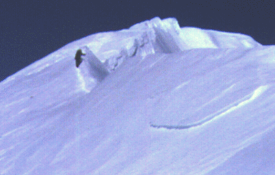
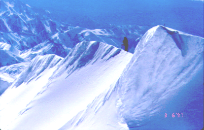
The summit ridge is incredibly sharp, at least this year. Sharper than the
ridge between 16k and 17k. Some places were heel-to-toe right on the crest,
others had a crampon track on one side and ice axe spike marks on the
other. No cornice to speak of, just an icy pointy ridgecrest close to a
mile long. The south face drops 9000' without obstructions. The wind
dropped somewhat near the top, perhaps 10mph, and the temperature was right
around zero; a clear and stunningly warm day for this particular summit!
Denali means "The Great One". White men renamed it Mt McKinley for a few
years, but the ancient name is the right name. 20320', the high point of
North America, 530pm, over 10 hours since camp. I was tired but not at all
sick. The Frogs and I took pictures, shook hands, moved around carefully,
and generally enjoyed the next half hour.
Returning to 17k, my concentration was on not tripping. I was healthy,
although tired, and had a lot of elevation left to drop. No need for an
accident now. While digging up the cache at 17k, a guy I had met on the way
up offered me some hot water and we chatted for a bit. Then I shouldered
the 60 pound cache load and headed down toward camp in the fading sun. The
day would have been a lot more fun if not for the need to remove our junk
from the mountain!
I hit the top of the fixed lines (16k) about 1130pm, and moved slowly down
the steep icy slope with an ascender on the rope. Again I was alone, this
time fighting fatigue instead of the cold. My legs started to buckle about
1000' above camp, and I dug a hole to ditch the pack; we could come back for
it the next day with a drag bag, since I was now below the technical part
of the route. At 1230am I banged on the tent and informed Tim that I was
back. Then I stood there. Just stood there. For 17 hours I had been telling
my feet to walk. Now they could stop, but I needed someone to tell me what
to do next. Tim heated some water for cocoa and I drifted into a fitfull
sleep without dinner. My altimeter registered 7000' of gain and loss for
the day, but I did not see that until the next morning.
Day 16 - Going Down
Tim retrieved the cache from 15k, and I drug myself out of the tent around
noon. We hit the trail around 3pm, dropping from 14k to 11k and retrieving
our skis. Our crampons were balling snow to the point of dangerous slips
between 12k and 11k. Then we skied from 11k down to 8k, finally stopping
around 10pm. The clouds were building, the temperature was falling, and we
wanted to be as low as possible if a storm hit. Skiing the crusty snow was
a real problem, especially since we were moving all of our gear at once and
the drag bags were very heavy. Worse yet, Tim's bindings kept popping off
and his skins started to come loose. We walked part of the way, wishing we
had been there earlier when the snow was soft corn and we could have
whizzed right down it.
Day 17 - Hamburgers And Showers
Up at 6am, skiing by 730am, the peak was gone in the clouds and we were
racing to get to the airstrip before the storm did. Light snow was falling
as we ground up Heartbreak Hill (400' of grunting at the end of a very long
trip). Fortunately, several planes had just unloaded passengers and we
caught them before they took off. Bags and people went onto separate
planes, with everyone rushing to make sure we got out before the visibility
dropped too far. By noon we were repacking gear in Talkeetna, then
showering and grabbing a bite on the way out of town. It was over, and we
had all of our fingers and toes.
Steve adds:
We landed at Kahiltna Base on 5/20 (day 1), I summitted on 6/3, and we
got back to Talkeetna on 6/5.
Note that historically May is a clear, dry, and cold month, with more
precipitation (read "storms") in June. Kahiltna Base "opens" around
mid-April (when the planes start landing regularly and a full-time staffer
is there with a radio). We met the people who helped establish Base, on
their way down after burning up all their food without a chance to try
for the summit.
The crevasses are much more of a problem in June, after the snowpack melts
and the bridges thin out. When Tim was there 8 years ago, there were no
open crevasses below Windy Corner even on his way out in June.
This year, 5 people had fallen in on the lower Kahiltna by the time
we started (mid May). Ugh. Remember that averages are useless unless
you know the standard deviation!
This year, late april and early may storms pinned people down at 14k and 17k,
apparently preventing some people from descending from 17k for over a week!
There were essentially NO good weather days for two or three weeks.
The only people who had summitted by mid-May were solo risk takers
(two of them). We had intended to start earlier, but are quite happy
that we were delayed.
Lots of wind, but apparently not that much snow (judging by the blue ice
on the fixed lines). There were lenticular clouds over every peak in sight
for the first week of our trip... indicating this was kind of a nasty year.
We heard numbers like daytime HIGHS of -20F with winds of 60mph on the summit.
Success rates range from 20% to 50% depending on the year, but this year
was running around 10% even after two good weather windows. YMMV.
Steve's Photos
Tim's Photos:
> It would be helpful if you could "ground" your story for me, i.e.,
> could you give the date of one of your climbing days (ideally,
> the range of dates of your trip and the summit date).