Meyers Approach to
Jobs Peak, Jobs Sister, and Freel Peak
(near Lake Tahoe)
Revised 9 Jul 2021 - please send updates to the webmaster
GENERAL NOTES:
Done properly, these peaks can be climbed in any season... but in winter you have to walk a lot further or park semi-illegally. Beware of plowed pullouts along Hwy 89 around Luther Pass. Some of them are explicitly signed No Parking (like the snowplow turnaround at Luther Pass, which is fine for summer parking but off limits in winter). Other pullouts are for short term emergency use only. There appears to be no explicitly legal place to park in winter except Hope Valley.
Please see the Hope Valley trailhead page for waypoints HORSEM, HORSMJ, WILLOW, and HOPVLY.
WARNING: In the winter, the green gate at the end of Oneidas may look like a good place to park, but before you get there you go past a sign that says No parking on public roadway right of way when snow removal conditions exist. I believe that means you'll get ticketed or towed if anyone notices you there when snow is on the ground. I and several others have gotten away with parking here, but I don't recommend it for anyone else (at least not in winter).
|
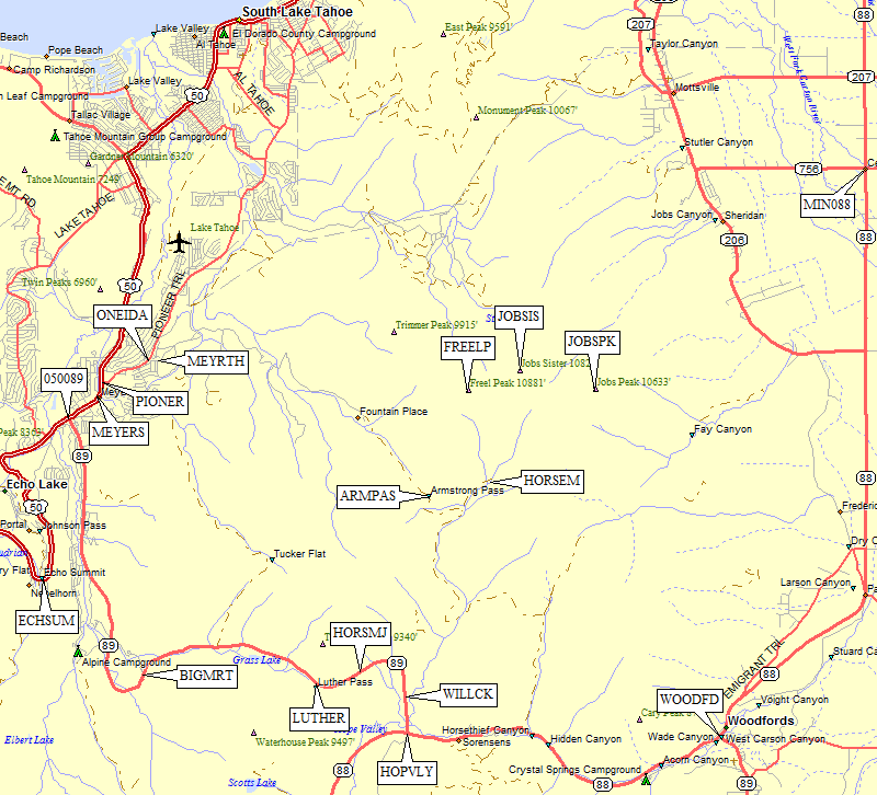
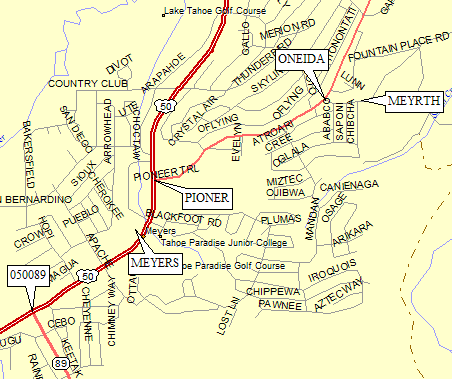
From the Chevron station in Meyers (waypoint MEYERS), go 0.3 miles
north on Hwy 50. Turn right (east) at the stop light on Pioneer Trail
(waypoint PIONTR). Follow Pioneer Trail 0.8 miles northeast, then
turn right on Oneidas (waypoint ONEIDA). Follow Oneidas 0.1 miles to
its end at a green gate and a National Forest boundary sign
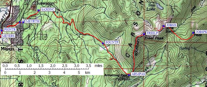
(waypoint MEYRTH). In the summer you can park here and follow the
directions in Schaffer's Tahoe Sierra across Saxon Creek
(waypoint SAXONC) and up Trout Creek to Armstrong Pass
(waypoint ARMPAS) and on to Freel Peak (waypoint FREELP).
Jobs Sister (waypoint JOBSIS) and Jobs Peak (waypoint JOBSPK)
are up-and-down travel from here, making this trailhead the
worst in terms of doing all three peaks.
See the GPS waypoint file for waypoints corresponding with all three maps. |
|
Useful Links: