Bear Box at Porcupine Flat (YW03)
Generated on 20 Oct 2025 - see revision history - please send updates to the webmaster
Detail Map of waypoint YW03
in Yosemite Park West:
(scroll down for directions, waypoints, and area map)
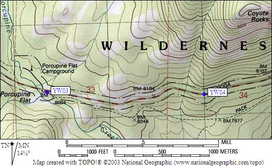
- YW03 is 4 large boxes, at about 8100 feet,
in the GPS route YOSEMITE WEST.
- Directions from Steve Eckert, with GPS waypoint, Sep 1999:
Four large boxes (new in 1999) around the trailhead parking at the Porcupine Flat trailhead
roughly 7 miles west of Tenaya Lake on Hwy 120. The trailhead is across the highway
from the Porcupine Flat Campground, and the boxes are on the south side of Hwy 120.
- YW03 coordinates: (see GPX waypoint download links above)
  (lat,lon) = (37.8067800, -119.5642000) in decimal degrees, NAD83.
  (zone,east,north) = (11S, 274340.0, 4187275.0) in decimal meters, NAD27.
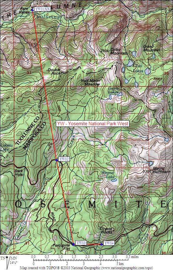
- Scroll down for a regional map of the entire Yosemite Park West region.
Map exported from TOPO! software, used with permission.
Useful Links: