Bear Box at Curry Village (YV02)
Generated on 20 Oct 2025 - see revision history - please send updates to the webmaster
Detail Map of waypoint YV02
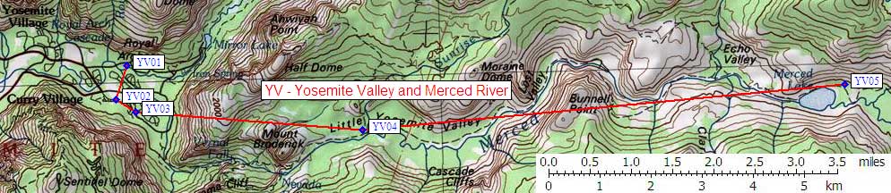
in Yosemite Valley and Merced River:
(scroll down for directions, waypoints, and area map)
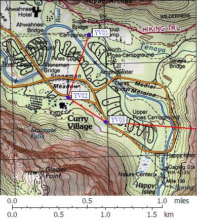
- YV02 is 120 standard boxes, at about 4000 feet,
in the GPS route YOSEMITE VALLEY.
- Directions from Steve Eckert, with GPS waypoint, Sep 2002:
Public car use boxes at the Curry Village day use parking
lot, and east all the way along the road by the tent cabins.
From Hwy 140, turn south at the sign for Curry Village,
then turn east at the last opportunity just before the buildings.
At least 30 groups of 4 standard bear boxes are here, but many
of them seem to have padlocks on them. You might have to hunt
for an empty one. The presence of padlocks implies your food
may be taken by other humans. There are no signs indicating
whether it is OK to put on a lock or whether the boxes are
reserved for certain users.
- YV02 coordinates: (see GPX waypoint download links above)
  (lat,lon) = (37.7378700, -119.5703700) in decimal degrees, NAD83.
  (zone,east,north) = (11S, 273587.0, 4179643.0) in decimal meters, NAD27.
- Scroll down for a regional map of the entire Yosemite Valley and Merced River region.
Map exported from TOPO! software, used with permission.
Useful Links: