Bear Box at Lower Kearsarge Lake (KA02XX)
Generated on 20 Oct 2025 - see revision history - please send updates to the webmaster
WARNING!
"XX" in this waypoint name means the coordinates and elevation are approximate!
Please contact the webmaster if you can help verify this box.
Detail Map of waypoint KA02XX
in Kearsarge Area Eastern Rae Lakes Loop:
(scroll down for directions, waypoints, and area map)
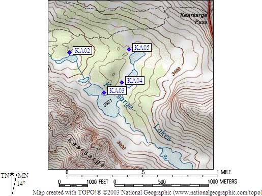
- KA02XX is a standard box, at about 10800 feet,
in the GPS route KEARSARGE AREA.
- Note: A small cliff/waterfall goes up
from Lower Kearsarge Lake to Main Kearsarge Lake, easily bypassed to the north.
- Directions from Gary Lewis, July 2022 (no coordinates provided, map not updated):
The box at the closest Kearsarge lake to the trail is installed again.
Rather than at the original location on the Climber.Org map, it
is on the south shore of the lake, right where a use trail from Bullfrog
Lakes intersects with the first Kearsarge lake from that direction.
The bear box is visible (in the distance) from the regular Bullfrog lakes trail,
partway down from Kearsarge. It's a small speck alongside the lake.
I walked right by the bear box when heading from Bullfrog Lakes to the 3rd Kearsarge lake.
- Directions from Alison Steiner, NPS Wilderness Coordinator, June 2012:
The park is closing the Kearsarge Lakes food-storage lockers for the 2012
season in response to a noted increase in food caching at Kearsarge Lakes.
Caching of materials in wilderness is problematic to park management and
disruptive to park visitors and, as such, is prohibited.
- Directions from Steve Eckert, with GPS waypoint, Aug 2000:
One regular box in the trees about 75 feet from the north shore
of the lowest Kearsarge Lake.
- Directions from Mineral King ranger info sheet, dated 1991:
One box southwest of the lower Kearsarge Lake.
- KA02XX coordinates: (see GPX waypoint download links above)
  APPROXIMATE  (lat,lon) = (36.7694600, -118.3931200) in decimal degrees, NAD83.
  APPROXIMATE  (zone,east,north) = (11S, 375749.0, 4070004.0) in decimal meters, NAD27.
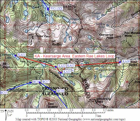
- Scroll down for a regional map of the entire Kearsarge Area Eastern Rae Lakes Loop region.
Map exported from TOPO! software, used with permission.
Useful Links: