Bear Box at Buck Creek (HS04)
Generated on 20 Oct 2025 - see revision history - please send updates to the webmaster
Detail Map of waypoint HS04
in High Sierra Trail:
(scroll down for directions, waypoints, and area map)
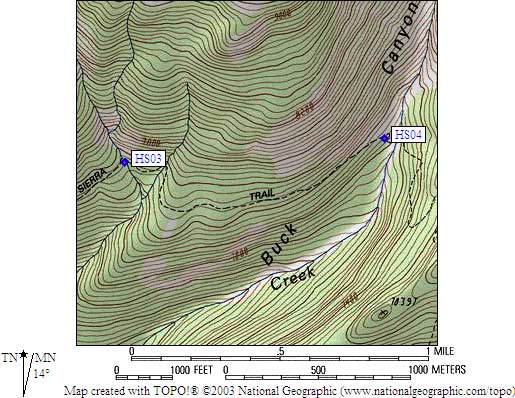
- HS04 is a standard box, at about 7300 feet,
in the GPS route HIGH SIERRA TR.
- Note: The trail has been re-routed several times due to washouts on
the east bank of Buck Creek, and rockfall as you climb out the
east side of the creek is still a serious risk. This box is on
the more stable WEST side, quite a ways from the water. It is
at the bottom of the switchbacks, on the uphill side of the
trail, at the base of some granite slabs.
- Directions from Gary Craig, with GPS waypoint, August 2002:
One standard box, on the southwest side of the trail, west of
the Buck Creek crossing. There is an official park service
'food storage locker' sign right on the trail directing you
to the box, which is about 50 feet off the trail.
- Directions from Mark Connell, June 2000:
It is located just off the south side of the trail, west of the creek.
The box is not mounted to anything which means the mounting holes on the bottom are open.
Mice are able to fit through these holes (except for the fat one that was
wedged in the hole and I had to pull out to set him free).
- Directions from Dan Braun, 1999:
One box west of Buck Creek, where the trail drops
steeply down into Buck Canyon.
- HS04 coordinates: (see GPX waypoint download links above)
  (lat,lon) = (36.5722800, -118.6292500) in decimal degrees, NAD83.
  (zone,east,north) = (11S, 354300.0, 4048465.0) in decimal meters, NAD27.
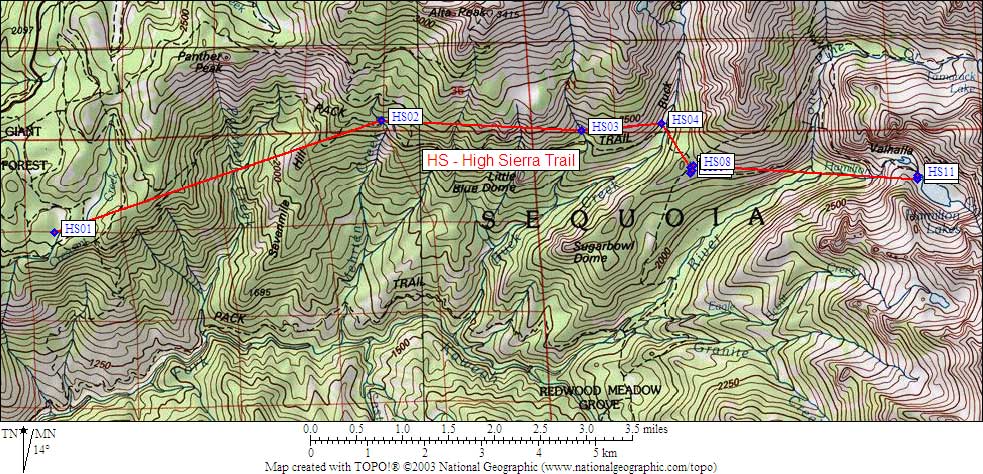
- Scroll down for a regional map of the entire High Sierra Trail region.
Map exported from TOPO! software, used with permission.
Useful Links: