Bear Box at Woods Crossing North (WC06)
Generated on 20 Oct 2025 - see revision history - please send updates to the webmaster
Detail Map of waypoint WC06
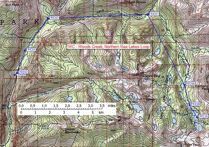
in Woods Creek Northern Rae Lakes Loop:
(scroll down for directions, waypoints, and area map)
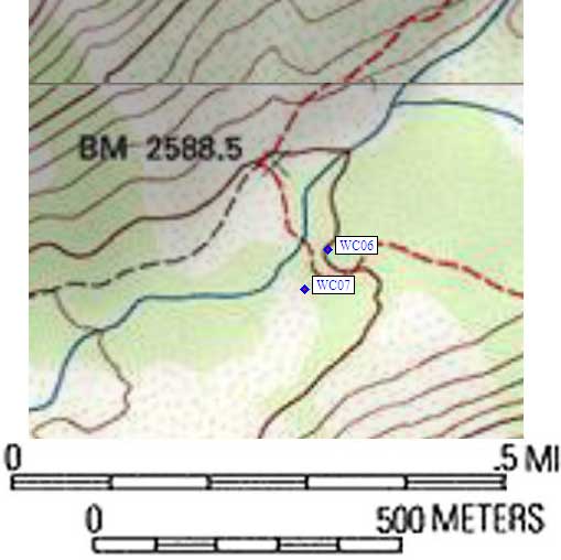
- WC06 is a standard box, at about 8500 feet,
in the GPS route WOODS CREEK.
- Directions from Peter Stephens (NPS), March 2006:
Use of these lockers is only available to through hikers on the PCT and
JMT. People who are starting or ending their trips in either Sequoia NP,
Kings Canyon NP,or Inyo NF and passing through this area are required to
carry portable food storage canisters and all food and scented items must
fit into the canisters. The public [should not] be misled into counting
on food storage locations that are not available to them. [Editor's Note:
Peter attached the document 'Special Public Use Limits and Closures for 2006'
which does not prohibit locker use by non-through-hikers, but does require
carrying a canister.]
- Directions from Steve Eckert, with GPS waypoint, July 2004:
One standard box about 30 yards from the east end of the
really cool suspension bridge at Woods Creek Crossing, on
the downhill (north, toward the river) side of the trail
in a well used camping area. There is a less used and
far more private camping area a bit further east and on the
south side of the trail. No pit toilet sign was seen, and
there was no campground info sign like in Paradise Valley.
- Directions from Laura Civiello, Aug 2000:
Two boxes on the south side of the river, one on each side of the
trail but not not next to each other, east of the suspension bridge.
The pit toilet is on the west side of the bridge.
- Directions from Mineral King ranger info sheet, dated 1991:
Two boxes on the south side of the foot bridge over Woods Creek.
- WC06 coordinates: (see GPX waypoint download links above)
  (lat,lon) = (36.8724700, -118.4378200) in decimal degrees, NAD83.
  (zone,east,north) = (11S, 371931.0, 4081493.0) in decimal meters, NAD27.
- Scroll down for a regional map of the entire Woods Creek Northern Rae Lakes Loop region.
Map exported from TOPO! software, used with permission.
Useful Links: