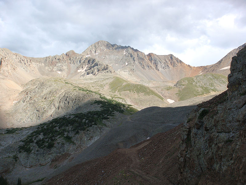
After years of controversy, the Silver Pick Basin access to Wilson was finally re-opened to the public in August of 2011. The new TH is one drainage over to the west from the old one, making for longer route, but it is still the shortest way to the top. We car camped not far below the TH the night before, and hit the trail just about sunrise. The trail is clear and well-maintained (as well as well-signed) all the way to the Rock of Ages Saddle(13,020 ft.). That's the easy part. After a short climbing traverse to a low point on the Gladstone Pk./Wilson Pk. ridge, the hard part begins. Numerous trail segment options and serious slide potential eventually resolve themselves into a clear trail leading up to a prominent low point on Wilson's SW ridge. From there, the trail drops back to climber's right off the ridge crest, before gaining it again just before the false summit (13,985 ft.). At the false summit, the trail slips over to the NW (climber's left) side of the ridge for the crux: a steep descent to a small level platform, and an equally steep, four-limb climb toward the true summit. Take heart: It's not as difficult as it looks at first glance. We took six-and-a-half hours to make this ascent, two-and-a-half hours of which were spent on the ridge climb above the Rock of Ages saddle. It was definitely worth it. The views from the summit are absolutely awesome. 14er #49 for me, #48 for Trisha. The TH is easy to find, following the directions on the Forest Service's recently revised website.
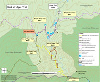
PDF map of the Rock Of Ages Trail: