Below are reports for dayhikes of Whipple Mtn, Chemeheuvi Pk, Stepladder Mtn.
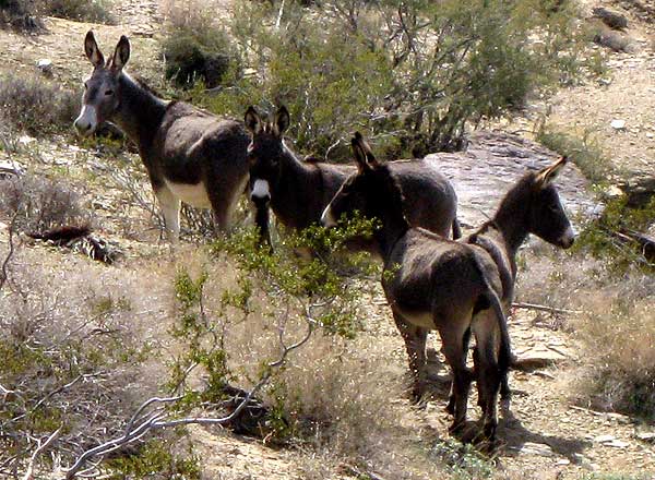 |
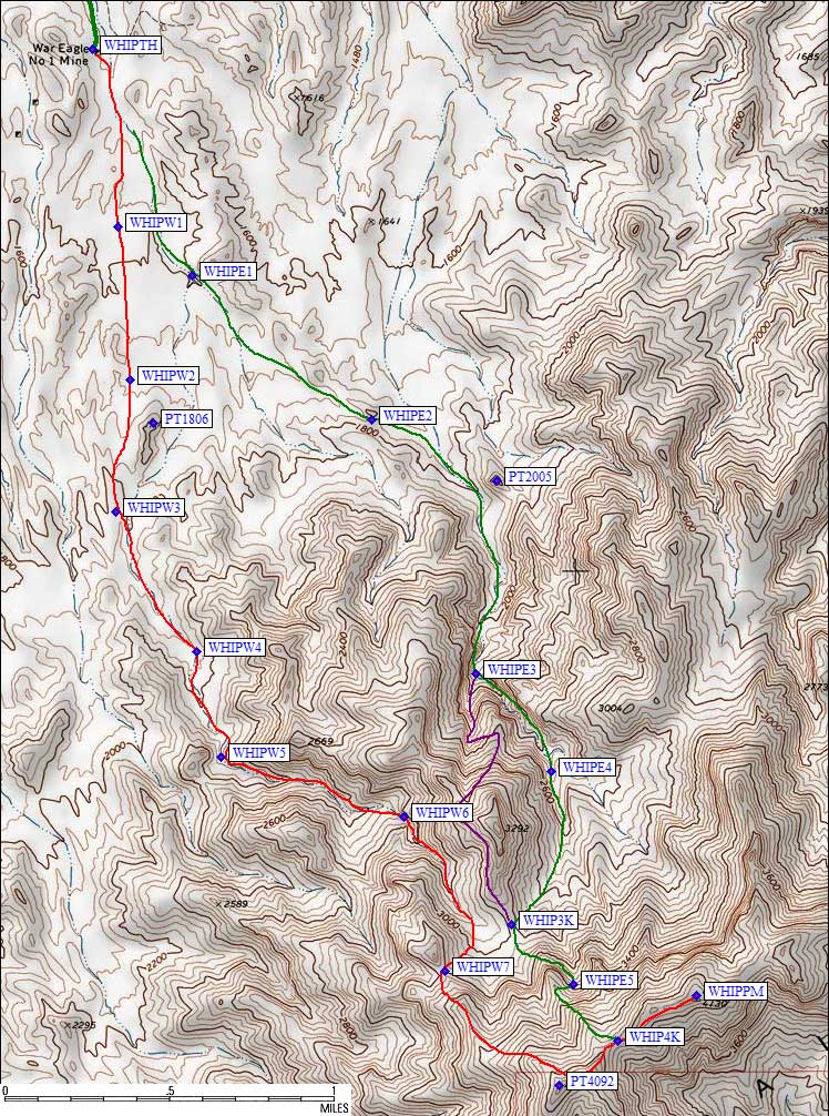
Whipple Mtn: (Burros on our route)
Click the map, or
|
My GPS was quite useful in finding some of the unmarked turns, so check the Whipple trailhead page for details of how to get to the War Eagle Mine. The powerline road is excellent, and the only alternate road we found was NOT passable. (We got about a mile west from waypoint EAGLE1 before deciding the chance of getting stuck was too high to continue with just one vehicle.) It's interesting that my Garmin GPS wanted to route us on that road instead of the one that works. Hmmm.
We spent a quiet night at the mine, thinking it would be a great party spot - no risk of making a mess compared to all the junk that's still there! We saw two sets of burros on the drive in, one set peering at us from a ridge and another set trotting along the wash as we drove the 4WD road. We heard them braying from camp, but unlike bears they don't seem to like human food. Or they haven't figured out how to break into a Jeep.
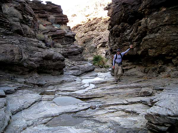
The DPS Guide has two routes from this trailhead, and we do NOT think they are equal. We went up the eastern-most one (green line below) and came down the western-most one (red line below, west of Point 1806). There's no question the western route is better! Better footing, better views, running water, and cool slick-rock features. The burro picture above was taken about a thousand feet below the summit, near waypoint WHIP3K.
From the mine we stayed just right of low bumps in a broad wash. So broad that we were never really sure if we were in the right place. It was often easier to walk above the edge of a channel than to be down in the brush-and-sand bottoms. Around the saddle at waypoint WHIPE2 we were sidhilling to avoid the narrow strip of brush that passed for a drainage. The route drops into another drainage here, passing west of Point 2005 and entering a deep canyon. WATCH OUT for branches. We missed the one at WHIPE3, going straight instead of turning left because our branch looked better. It was fun, but it ended at a chockstone. We climbed out to the left on class 2-3, ending up on the north ridge of Point 3292. Oops. From there it was an easy traverse back around to the 3000' saddle (waypoint WHIP3K) which was on the western route. Our little excursion is the purple line, but I wouldn't recommend it.
From the saddle at WHIP3K, we went up to the base of a cliff band, traversed left (east) around it, then headed up a steep brushy chute at waypoint WHIPE5. I wasn't looking forward to coming down this, and lobbied Daryn to consider going further west and then north on the summit ridge. The route checked out, and we went down that way - so I don't recommend this ascent to the summit ridge either!
We reached the summit at noon, 4 hours and 3000' of gain including mistakes, and spent an hour there. This is living! But all good things must end, and we headed down the summit ridge in a stiff breeze. The ridge is very easy, with about a 100' bump after the 4000' saddle (WHIP4K) where we first hit the summit ridge. Going almost over Point 4092 we strolled down much friendlier slopes, crossed fields of barrel cacti, leaving the ridge at 3200' (waypoint WHIPW7) and dropping into the bowl near the saddle at 3000' (WHIP3K). It would be easy to connect this ridge route with either of the DPS Guide routes, and we wanted to explore the western route on the way down.
|
This excursion I do recommend! It's a cool canyon. Way cooler than our uphill route. There are mini-waterfalls, considerable slick-rock to walk on, steep canyon walls, running water, and (unfortunately) plenty of burro dung. The picture to the right was taken somewhere between waypoints WHIPW6 and WHIPW5.
The burros helped us out by tramping a use trail into the rocky soil below the canyon exit. Walking their track was far better than walking in the wash, because they stayed up on the west bank and the soil was very stable with few bushes. Between waypoint WHIPW3 and the trailhead our route was apparently quite different from the published route. 8 hours total, including the hour at the top, 3200' of gain. |
|
|
Chemehuevi Pk: (viewed from the approach)
Click the map, or
|
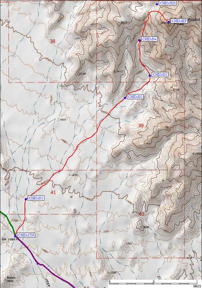
As mentioned on the Chemehuevi trailhead page, it's good to stop here on the way to or from Whipple. We crossed the Lake Havasu Road and stayed on the powerline road after Whipple, easily finding the trailhead in the dark because I had a pre-entered waypoint. We spent the night at the trailhead, with only occasional coyote howls and distant road noise to break the silence of a full moon on a calm night.
It doesn't matter too much exactly where you start, but being a bit too far east means you'll either wander or go up and down in some small bumps. We started from the car (waypoint CHEMTH) where the powerline crosses the road. The washes braid and separate without ever forming a main channel. It's easy to stop paying attention and end up following the wrong one. Walk sorta due north for almost half a mile, then sorta bend to the right a bit and get yourself to waypoint CHEM02. We almost drifted into the canyon west of the one we wanted, because the walking is easy and we were talking too much. OK, at least I was talking too much. Stay in the really wide/broad/flat wash here, and stay in the deepest cut once the gully forms.
The DPS Guide says to follow the gully to a saddle, which we faithfully did, but you don't need to. We came down much more directly to where the gully steepens, and found some interesting rocks along the way (Olivine crystals, I think Daryn said). We spent only 2.5 hrs getting to the summit, half that much time on top, and about 1.5 hrs getting back to the car. A 2000' yawn. But the view from the top was cool and the wind was positively cold.
|
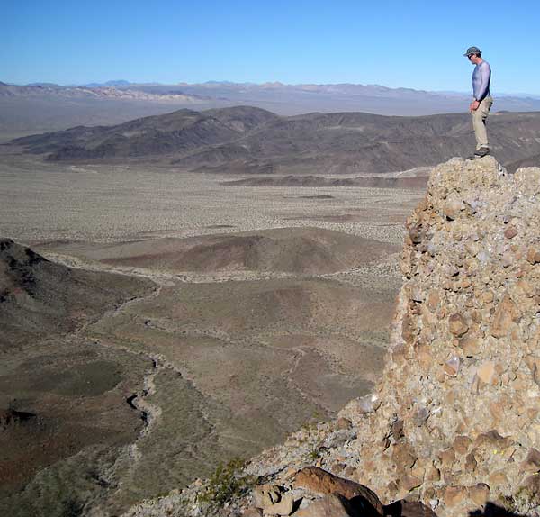
Stepladder Mtn: (Steve on the Summit)
Click the map, or
|
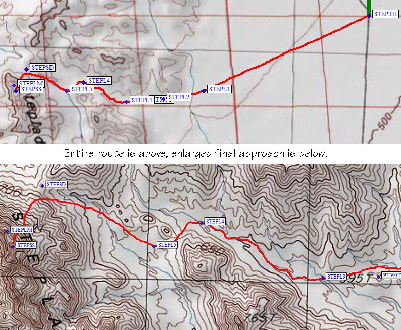
As mentioned on the Stepladder trailhead page, the pipeline road used in the DPS guide is a really bad road... and if you're doing Whipple or Chemehuevi you're already on a much better road! Follow the powerline road from US Hwy 95 (waypoint PWRJ95) to where it intersects the pipeline road (waypoint PIPPOW), then follow the pipeline road half a mile west to the 4WD track (PIP4WD). The trailhead page will give you the secret to finding this road.
The DPS Guide describes the wilderness boundary, and the road is staked as closed, but those places don't seem to match. We drove to the stakes and stopped there, even though we saw fresh vehicle tracks going around the stakes. The legal trailhead is now at waypoint STEPTH, and it's a slow drive getting there. (Daryn kept promising to wash and wax his Jeep so his wife wouldn't be upset by all the scratches from sideswiping brush.)
Instead of walking down the road on foot, we struck off at a GPS bearing. The terrain is open and easy to walk. There's no reason to walk the square cornered route they suggest if you have a GPS or if you're a good navigator - just head for the mouth of the canyon. (If you're worried about getting lost, walking straight east to the closed road and following it to your car is safer.) We adjusted our route a bit on the way out, and decided skirting relatively high on the alluvial fan was the best (waypoint STEPL1). Stay above (north of) Point 595 (meters) on great footing, and drop into the main wash around waypoint STEPL3 to avoid steep ravines coming in from the north.
We walked in nice sand for a while, then crossed a low ridge into the next drainage south. The best place to cross seems to be the saddle between STEPL4 and STEPL5. On your way back, look for the purple ground around STEPL5. On your way in, just look for the first low way over that ridge. We generally stayed out of the second drainage, preferring the footing elsewhere in the canyon.
The DPS Guide wants you to go to the saddle, but there's no real reason to. Angle left before you get there, and pass through a cliff band (better than contouring around the cliff band) to reach the talus fan above the cliffs. There are lots of interesting mineral deposits which formed in old rock cracks here, but you're still not to the unique part of this peak.
Follow the talus to the base of aggregate cliffs, then zig-zag your way to the top following a use trail and ducks. The ramps leading to summit are serious class 2, summit block is class 3 aggregate (see photo). There was one group here in 2002, no one in 2003, no one in 2007, and 3 groups in 2008 (Doug Mantle was the most recent).
The USGS names the north summit (waypoint STEPLM), the DPS climbs the south summit (waypoint STEPSS). We thought the south one was clearly higher and didn't bother to climb the north one. Only 2.5 hours from the car, we must have shaved off a LOT of mileage compared to the DPS guide. The 1250' of gain comes all at the end, some on steep unpredictable aggregate, and the long flat walk out would be really hot in the summer. There's 100' of gain on the way out, and we took almost as long returning to the car as we did climbing. Be sure to mark your car's location with a GPS or take along someone who can really follow a compass bearing. (Daryn lead this part on the way out, just checking a compass occasionally, while I followed behind with a GPS - he never wavered more than 100' from a straight line!) The brush is thin but fairly tall, and you won't see your vehicle until you're pretty close to it.
Next stop: Old Woman