We had made a first valiant attempt a year earlier, taking seven hours to hike from Onion Valley over Kearsarge and Glen passes, over Rae Col and into Sixty Lakes Basin. There, threatening weather, slower than expected progress, exhaustion, and the foreshadowing of an epic in the making combined to halt our advance. At that time, Matthew was all for continuing, but I called for a retreat. We had some consolation in climbing Fin Dome on our way back, but the failure to reach Clarence King would simmer over the next year.
Our second attempt took place Sept 25 of this year, and we'd come back fitter and more practiced in our art (though not necessarily more skilled). Surprisingly, we also came back with more people. Brothers Glenn and Curtis Gookin from Southern California joined us for this mad adventure, starting from Onion Valley at 2a - a rather serious alpine start for the Sierra. The other two were already there when Matthew and I pulled in to the lot shortly before starting time. After quick introductions via headlamp, we were all off. In the lead, Matthew tore up the trail to Kearsarge Pass, and none of us could keep up. He'd been out hiking marathons all summer and his greater fitness level was obvious. It took Matthew only an hour and a half to climb the 5mi to the pass, his tiny LED headlamp visible like a star on the horizon as I watched him reach the crest and turn to look for us. I was ten minutes behind him, and the brothers another ten minutes further behind. Matthew was getting cold by the time we were all together again. The moon had been up briefly when we started, but had set by the time we reached the pass. Not yet 4a, it was still very dark, but the outline of the many peaks surrounding us could be seen sharply against the starlit sky. It had been a bit windy when we'd started, but the wind had all but died by now and we were fortunate that the temperatures had only dipped to the upper 30s. It seemed both magical and comical to be standing at the Sierra crest at such an hour.
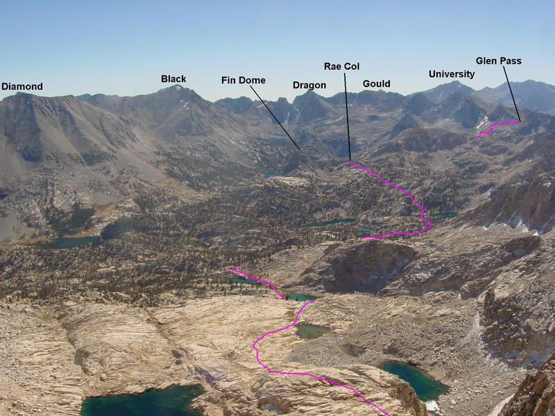
We repeated our chase of Matthew down towards Charlotte Lake and then up to Glen Pass. I was again in the middle of the hunt, but this time I didn't see headlamps before or behind me and I felt utterly alone in the dark, cool morning hours. Not until I was below the switchbacks on the south side of Glen Pass did I spot Matthew's faint beam high above me - I was relieved that at least he hadn't taken the wrong turn to Charlotte Lake where I had almost missed it earlier (actually, he did miss the turnoff, but fortunately there was a second one a bit further on and it only cost him an extra half mile). When I arrived at the pass shortly after 5:30a Matthew had already been there some 15 minutes and was starting to feel cold again. Having just arrived I was feeling great in just a t-shirt, though that slowly changed as I joined him to wait for the other two. The eastern sky was starting to herald in the new day, and we could identify the sillouettes of Dragon Peak and Black Mtn against the new day. Looking down towards Rae Lakes, I thought I could make out several faint lights in the blackness below, wondering who else could be out at such an hour. It took some time to realize they were the reflections of stars in the lakes far below. When Glenn and Curtis met up with us at the pass, we weren't a minute in starting down the north side - we were chilled and needed to get moving again.
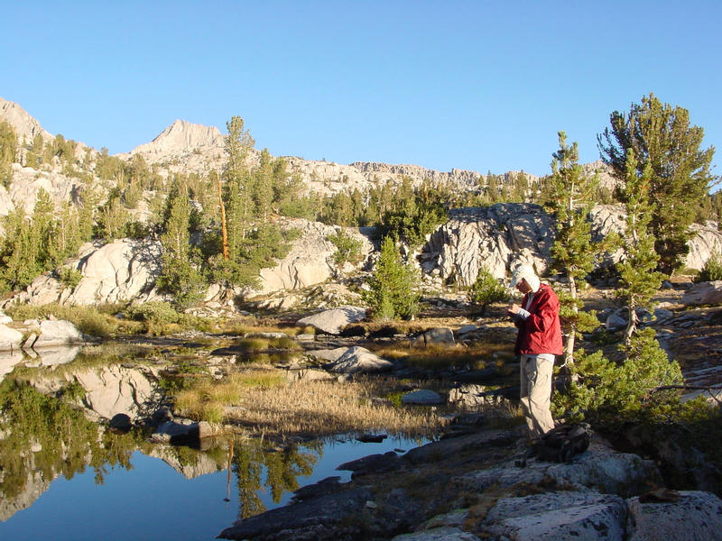
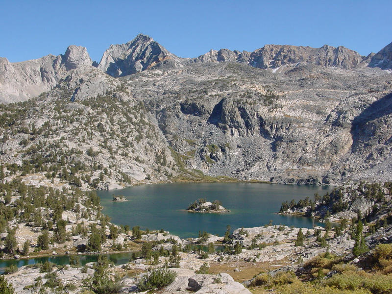
The new day came on as we made our way down to Rae Lakes, Matthew again pausing where the trail forks to Sixty Lakes Basin. When the brothers caught up I was able to get a good look at them for the first time. They were both young, particularly Curtis who was all of 16 years. His brother was in his early 20s. Matthew had met Glenn for the first time on their hike of the Nine Peaks in the San Gorgonio Wilderness a month earlier, but neither of us had met Curtis before. I was impressed that they had kept up as well as they did, as this is not the sort of hike that the younger guys excel at. Expecting that we might not see them for sometime afterwards, I gave Glenn some last minute beta on where to leave the trail, and how to approach the east side, which in retrospect turned out to be fairly accurate. Too bad for me I was unable to follow my own beta later.
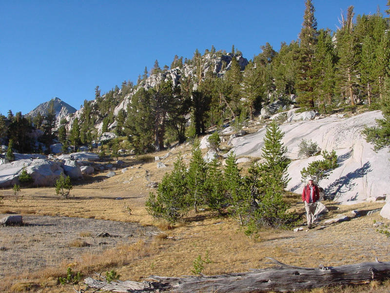
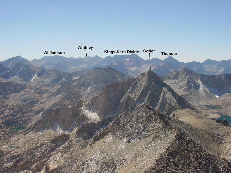
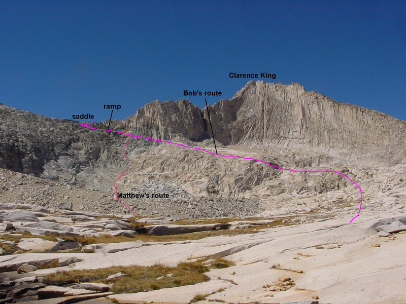
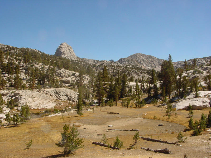
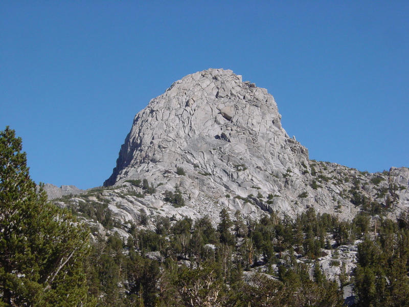
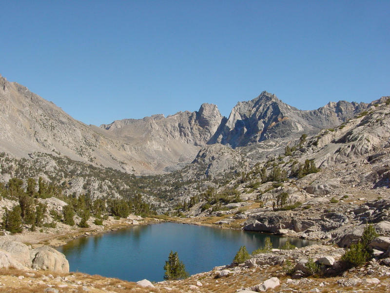
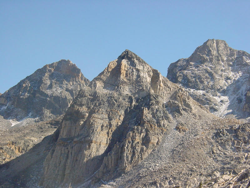
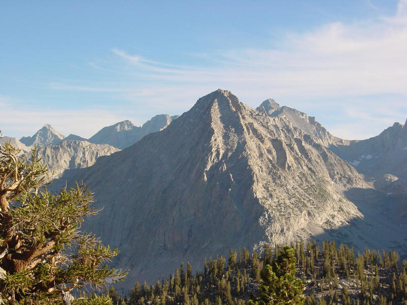
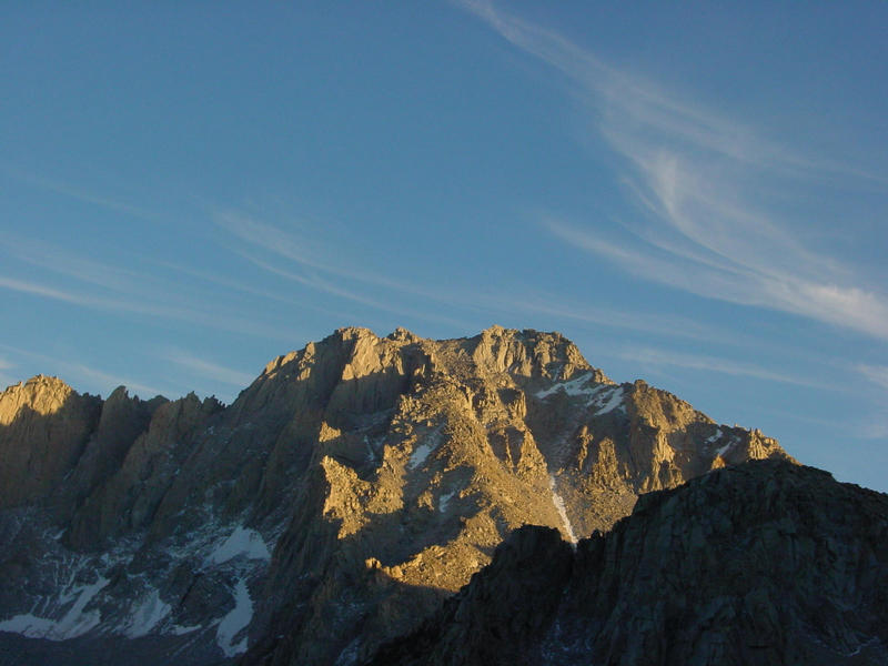
Leaving Rae Lakes, we marched up towards Rae Col just south of Fin Dome. Matthew had now slowed to mortal pace, and we hiked together up some 500ft over the next mile to the col. We were treated to sunny views of Mts. Cotter and Clarence King, the new day now fully upon us, not a cloud in the sky. We would not be able to blame weather if we failed again this time. The brothers were nowhere to be seen, and indeed that was the last we saw of them. We continued over the col, stopping at the outlet of one of the lakes a mile further in order to recharge our water supply. I ate some sort of protein bar while we were there and thought I was going to break my jaw on it. The cold had made it rock hard. A bit further on we came to an open meadow I dubbed "Quiters' Meadow" at the place we'd picked to leave the trail. This meadow marked the furthest point of our efforts the previous year. Interestingly, Glen and Curtis would reach this same spot an hour later before calling it quits themselves. And like us, they went off and climbed Fin Dome for consolation, so maybe this was some sort of right of passage that one needed to go through first. It was now 8a, having taken 6hrs to reach this point, a full hour faster than our first try. This time there was no talk of quitting (though I expressed doubts that we might be climbing Mt. Cotter as we'd hoped beforehand). Now for the final 2,000ft!
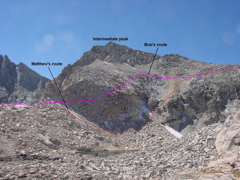
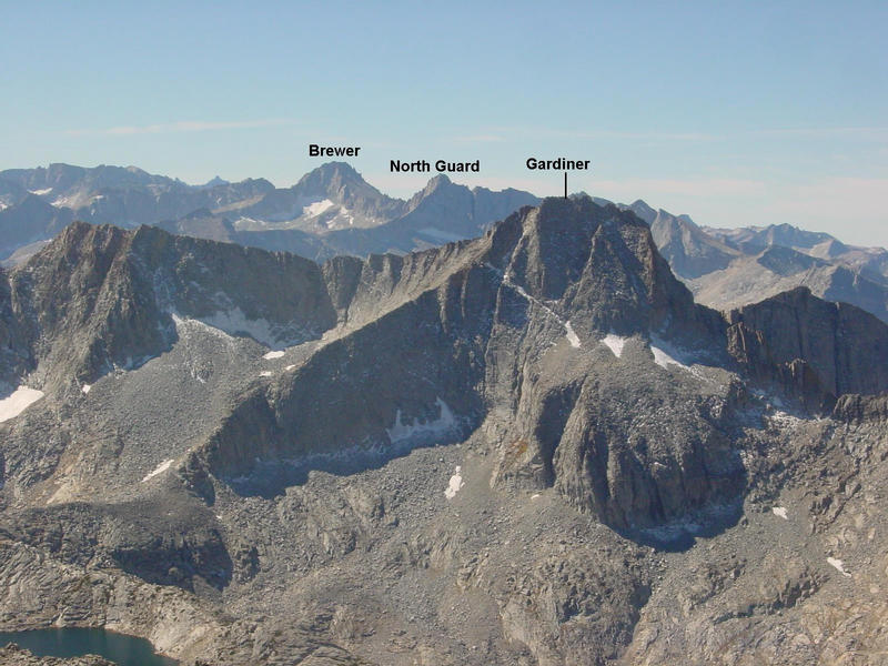
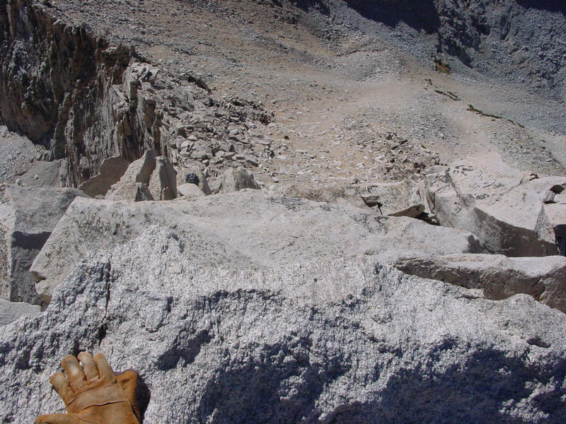
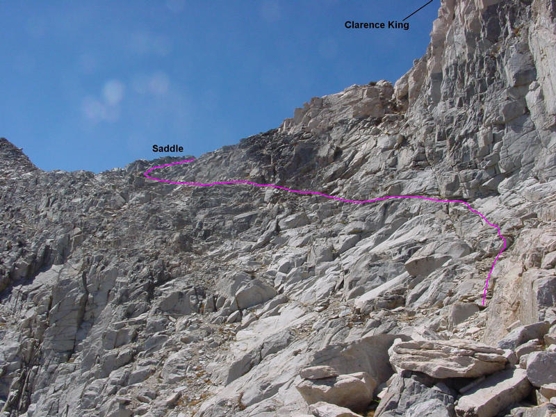
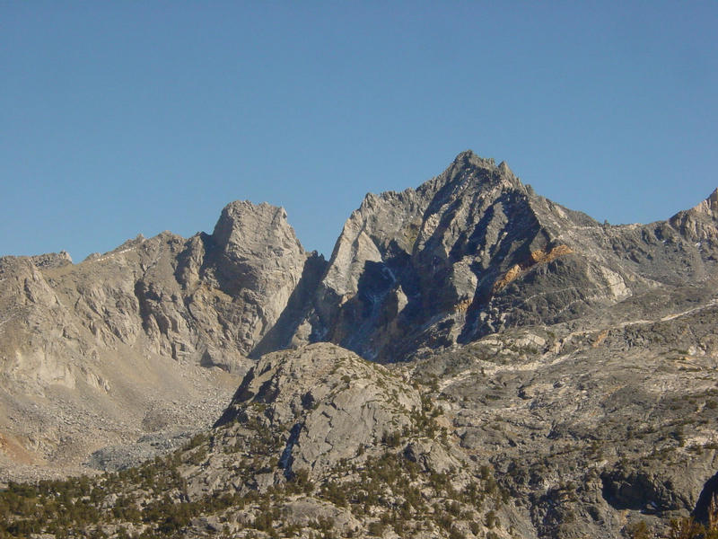
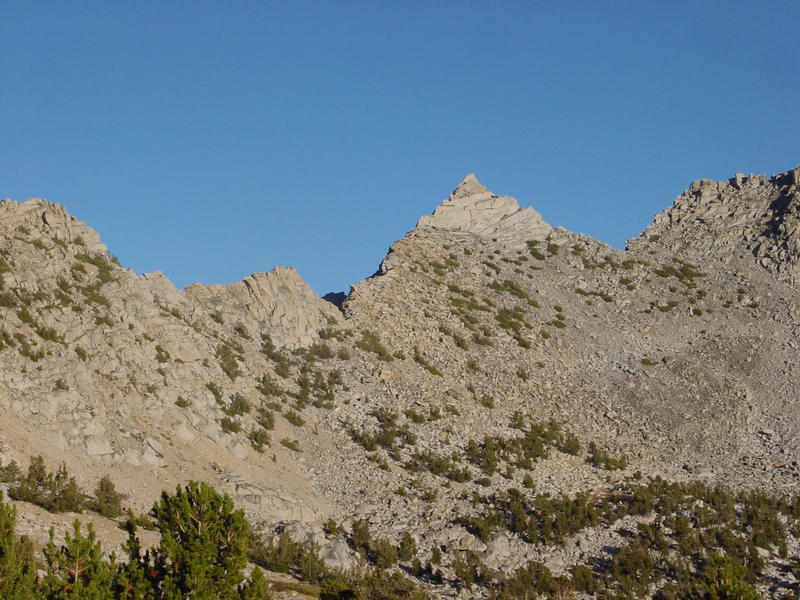
Climbing up the steep but easy slopes above the trail, we angled north as we climbed to bring us closer to Clarence King and the saddle on the South Ridge, our approach target from the east side. There is an unnamed intermediate peak between Cotter and Clarence King with a very prominent East Ridge of its own, and though we intended to land ourselves north of this ridge during the traverse, we undershot our target and ended up on the ridge itself. We had climbed some distance up and west along the ridge before we got to the top of it and realized our small error. A lake lay below us to the north in the cirque we should have been in, and the "correct" ridge just north of that. Some small distance ahead of Matthew, I decided to try and traverse the north side of the ridge we were on to gain the saddle without having to lose several hundred feet of elevation and regain them shortly thereafter. I progressed around increasing difficulties along a line of connected ledges with lots of exposure on my right side with fresh snow covering talus and hidden obstacles. It was the only snow of significance we found all day, most of the snowfall from the previous week having melted out already. Knowing Matthew would not appreciate such extracurricular spiciness, I turned to suggest it might not be to his liking. He had stopped some 50 yards back and had already decided not to follow me, choosing to take the more obvious route down and back up to the saddle. Our paths diverged. I spent a good deal of time negotiating the traverse, then climbing up some to avoid more cliffs that weren't obvious earlier, but eventually managed to find my way around the northeast side of the intermediate peak and on to the saddle south of Clarence King. Matthew was not far behind me as I approached the saddle, but neither of us realized it at the time. I had thought he'd gone all the way down to the lake and up the other side of the cirque, but instead he'd gone down only far enough to skirt the cliff band and then found a way back up to rejoin my route.
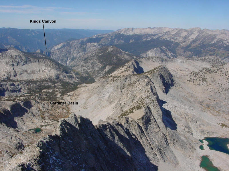
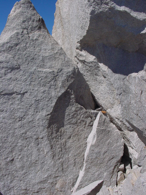
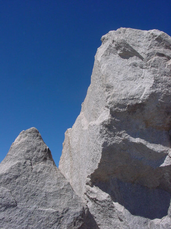
From the saddle the peak looks tantalizing close, but as I was to find out it was still a good distance off. Most of the route up the South Face can be negotiated at class 2, and it seems like one can reach the summit at the same difficultly level until you are about 100 feet below the summit. The easy routes suddenly dry up and you are left with a deeper respect for the climbing skills of Bolton Brown on his first ascent. It had been four years since I had first climbed Clarence King from Gardiner Basin with Mark Connell on a backpacking trip. At the time I was very new to roped climbing and this was one of the first roped leads I had done. In the passage of time I had come to believe that the route held no particular difficulties, but now that I was back facing them, I had to admit it was a bit more than I had remembered. Looking back down the slope, I could see none of my companions, so I knew I had at least a half hour lead. This gave me time to explore the various aspects of the face and see if I couldn't find an easier route up. I found the class 5 chimney/finger crack that Mark and I had used the first time. Looking left, I found an easier way up to the SW Ridge and so close to the summit block that I could make out the one good handhold for the last move. But I could not find an easy way around to the east side of the summit blocks. I had to downclimb across the South Face a short distance and make a few low class 5 moves to basically get myself back to the base of the finger crack. That hadn't been a fruitful excercise. I started up the finger crack with my boots but soon back off - seemed a prudent place to change into rock shoes. The added grip made the 12-foot finger crack easier to negotiate. Above that is a stiffer finger crack climbing only about 8 feet but nearly vertical. I found I could move left around an airy step and then up an easier, sloping flake to get myself over the crux of the South Face (probably low class 5). I found a rappel sling here, the only one I noted all day. From there I knew it was an easy matter to get to the summit blocks. But first I went over to the South Ridge to see if I could locate Secor's jam crack/squeeze chimney/guillotine flake combination. I could find nothing that matched that description looking both above and below me. Above the route seemed to run into cliffs. Below me the route looked more reasonable, so perhaps the very ridge was the way to get up to the rappel sling, and from there one goes to the summit. Hearing voices, I peered over the edge to the East Face, a precipitous drop of 300 feet. A climber had just reached the lower angled rock at the base of the upper cliff and shouted "Off Belay!" I watched him for a minute or so before turning back to the South Face unseen.
Without climbing the final distance to the summit, I found a comfortable ledge near the rappel sling from which to wait for Matthew. I strained my eyes to the slopes below, all the way down to the saddle, but I neither saw nor heard anything for half an hour. Then I heard my name shouted. Though I couldn't see him, Matthew had been waiting some 15-20 time at the saddle wondering where I was. He'd been scouring the the slopes to see if I'd fallen somewhere. Relieved to find I was near the summit, he headed up that way. It took him another half hour to reach the base of the difficulties. I directed him to the South Ridge which had looked to be the best way from above, but he found unclimbable blocks there, unseen to me. He next tried the route Mark and I had taken up, but he didn't make it past the first small chimney. I began to be concerned as there was a good deal of more difficult climbing ahead of him. Matthew was clearly tired by this point - we'd been at it nearly 9 hours now. Once tired, most climber's find their comfort zone drops on the difficultly scale, and Matthew's had dropped to class 3. This was going to be tough in order to get up a class 5.4 summit. As a third attempt he tried to his left, the route I had taken up earlier. This too, proved a match for him. Matthew then suggested he ought change into his rock shoes to which I readily agreed. It was going to take a bit of doing to get him up it seemed, and to do so from above would be difficult. Matthew had a 40-foot piece of rope in his pack (a piece we cut from the 8.5mm rope we battered on descending Lone Pine earlier in the year), though we had no harnesses or other gear aside from a few slings. The short piece of rope might be useful for a short belay and we had brought it for just this purpose, though it wasn't clear if it would be enough at this point. On our first dayhike attempt we had brought all the necessary rock gear, but the weight of it all in our packs had been one of the reasons I had cited for turning back at the time. Even as we'd sat there dejected at Quiters' Meadow, I had said I would come back the second time without it. That may not have been the best decision.
Not knowing if Matthew'd make it to the summit, I decided to first go up and tag the thing while he was changing his shoes to save some time later. My memory of the block had been pretty good, and was soon standing on the pointy flake, making the awkward mantle, then the delicate move onto the summit block. The last move, unbelayed, required an absolute faith in the power of sticky shoes. Once atop, I took a few quick photos (W - NW - N - NE - E - SE - S), looked for Matthew below (I couldn't see him), then descended.
In trying to reverse the delicate move I lost faith in the shoes and jumped down to the lower block - finesse could wait for another ascent. Reversing the awkward mantle proved far easier than going up, and not 3 minutes was spent from the base of the summit blocks on the roundtrip manuevering. I took a few pics of the summit blocks from the east side, then went down to help guide Matthew. I reversed all the other moves and joined matthew about 80 feet down the South Face. Though tired, he had no evidence of being gripped. Having come all this way he very much wanted to make the summit, but his previous efforts had mostly frustrated him. He showed excellent composure and even thanked me for my patience on this trying section. For my part, I was feeling guilty for having undersold the difficulty of the peak, and hoped there was a way to get Matthew up. Time wasn't an issue as it was still before noon.
Having changed into his rock shoes, he left his boots where they were - no need to have a few extra bulky items making things harder. We took the route up to the left and Matthew had little trouble on this second attempt. Rather than climb up to the Southwest Ridge where we'd get stuck, we traversed right towards the base of the finger crack section. There was a class 3-4 slab to cross just before the finger crack, about 10 feet across that held us up. By example I tried to show Matthew that it was fairly easy, with good holds in a crack above to wrap fingers around. The slope wasn't too severe and it was possible to stand on the slab without finger holds at all. Matthew started over, then retreated, started again, and again retreated to the left side. He was more concerned with the finger crack on the other side and how he was going to downclimb it, setting off little alarm bells inside his head. He'd had a scare on the Lone Pine retreat that had him more cautious of downclimbs, and Clarence King was beginning to look like a repeat performance. The summit block moves would be harder than the finger crack by my reckoning, so I couldn't say he was at the crux without lying. There wasn't much room on the right side to safely belay Matthew across it, so we didn't use the rope. After more deliberation, Matthew made the decision to forgo the summit. It was 12:15p now, and I'd been at or near the summit for the last two hours. I couldn't see how it was going to get any easier even if he did manage to get across the slab section, so I agreed. Taking a slightly different route back, I lead down the central chimney section that he'd balked on earlier, and we were soon back to his boots where we both changed footwear.
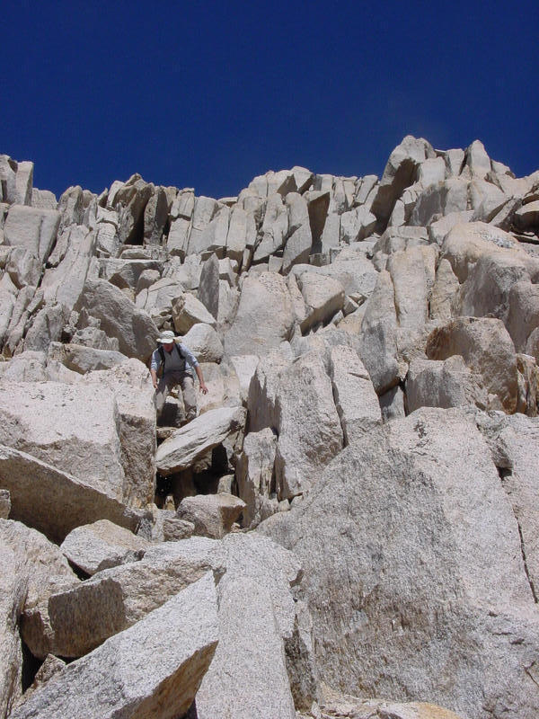
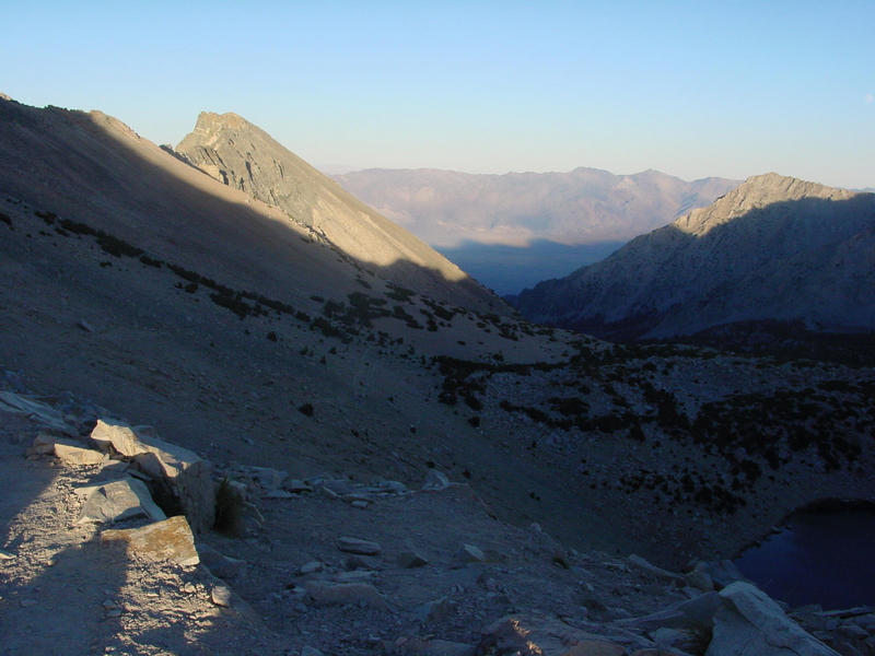
We climbed back down to the saddle, descending from there by slightly different routes. Though we didn't discuss it, neither of us felt inclined to take on Mt. Cotter and our thoughts turned to the return effort. I found an interesting ledge system that lead down and diagonally across the east side of the saddle, ending on the top of the ridge we'd originally been shooting for during the ascent. This ledge is the very one described in Secor I found later. Matthew followed the ledge for most of the way before taking a more direct line off the ridge. I opted to follow atop the ridge instead, finding the rock slabs to be excellent hiking and avoiding the loose talus & morraine that looked to line the cirque (Matthew was also able to avoid the loose crud he'd had to cross in the morning). I followed the descending ridgeline, traversing to the southeast to the outlet of an unnamed lake at the foot of the cirque. This point marked the return to the East Ridge of the intermediate summit, and I was cautious as I recalled the cliffs that were to be found just below me. Taking my time, I found an alternate way down through the cliff band keeping it to class 3. Once below this I knew all the technical difficulties were behind me and it was just a matter of grinding back out the way we came. I returned to Quiters' Meadow just after 1:30p, more than an hour ahead of Matthew. From past experience I knew I would be well ahead of him at this point, but he would make it up once he got back on the trail.
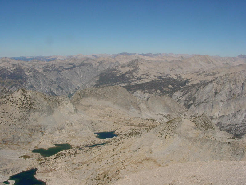
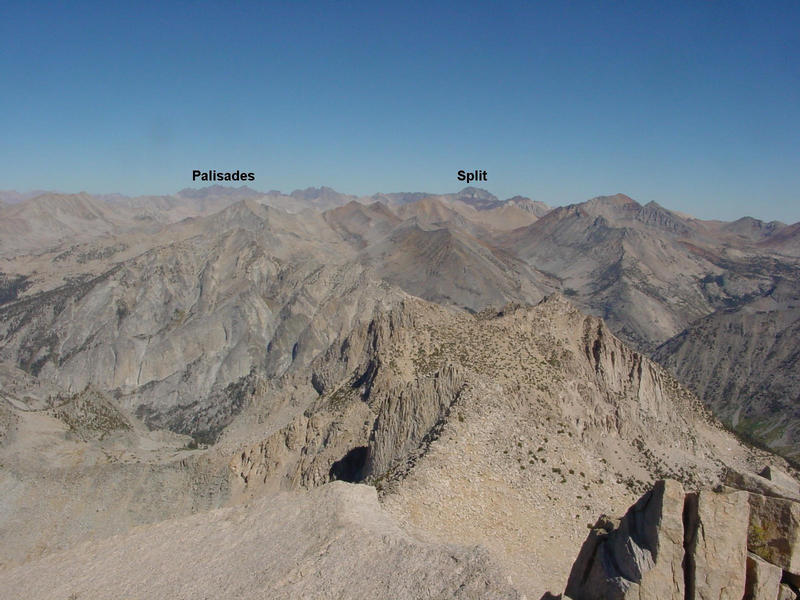
Passing by Mt. Cotter and Fin Dome for tne second time, I found the hike back up to Rae Col exceedingly difficult and I began to wonder how I might feel once I got to the two harder passes. There was going to be some suffering it would seem, though I was trying to maintain denial. I stopped at the same lake outlet we'd stopped at in the morning, refilling water a second time and having my second snack of the day. Another protein bar, this one went down much easier owing to it not being half-frozen. Reaching the col at 2:30p, I took a moment to enjoy the fine views of the Sierra crest afforded, including Diamond Peak, Black Mtn, Dragon Peak, Painted Lady, and Mt. Rixford. I was happy to be hiking downhill towards Rae Lakes though of course I would just have to regain all the lost elevation. There were a few backpackers in the vicinity of the lakes when I reached it, all looking for camping sites to set up at for the night. Above Rae Lakes there would be very little water along the trail until I was over Kearsarge Pass, so it was important to refill my bottles fully at the last opportune time. I looked forward to this last break about a third of the way up to Glen Pass, and I took off my pack and lay down on the rocks where the water ran across the trail just under the tops of the flat talus rocks. I had my third and last snack here, feeling like a puddle of tired bones wanting to melt away into the stream. It was now about 3:30p, and I was struck with the thought that if anybody had happened by while I was lying there, they might easily have mistaken me for a homeless guy. And without a tent or sleeping bag or any warmer clothes, I pretty much was a homeless guy - I had to get back to the trailhead as there was no option for a bivy.
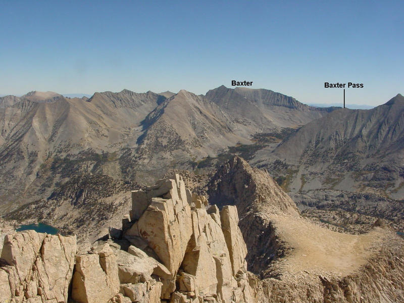
I picked my butt up and ground my way up the switchbacks to Glen Pass by 4:15p. It was a tough climb, but thankfully no worse than the climb to Rae Col. Maybe it wouldn't be so bad afterall. I took a few more photos looking south and north from the pass, had a last look at Clarence King, then headed down the south side. I was again glad to change momentum and exercise the downhill muscle groups. Some high clouds came in over the Great Western Divide to the southwest, portending of a weather change, but they would have no effect today. After a number of switchbacks, the trail makes its way down the steep canyon and around three sides of Peak 3732m just east of Charlotte Lake over the next several miles. The next trail junction marked the lowpoint between Glen and Kearsarge Passes, and I had before me the last climb, a 1,000-foot rise over three miles to Kearsarge Pass. The gradient was easier than the previous two climbs, but I still had to stop a number of times to catch my breath. It was tiring work now. I had some fine views of East Vidette, Kearsarge Pinnacles and other interesting peaks in the area. There are so many peaks that can be reached out of Onion Valley that Matthew and I had commented we'll be doing this routine over Kearsarge Pass for years to come. Good thing it was scenic!
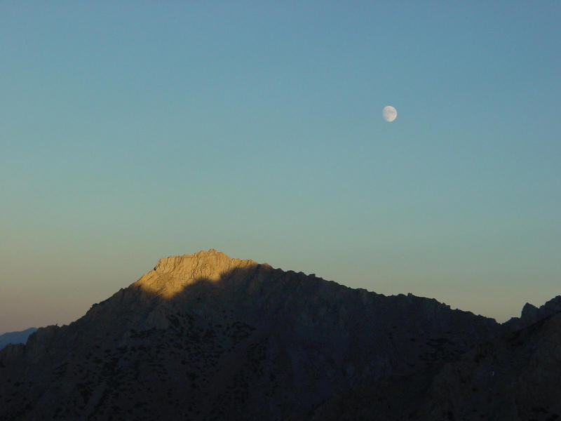
I reached Kearsarge Pass just after 6p, tired but not yet exhausted (a good thing, since I still had five miles to go!). The sun had set on the east side of the pass, now shrouded in the early evening shade. There was still another hour of sunlight left on the west side of the pass. I had looked back regularly for signs of Matthew, but to no luck. I had passed a few groups of backpackers on my way up to Glen Pass, but since then I had seen no one the rest of the afternoon. It looked like most of the folks had hunkered down in camp for the evening. It was breezy and growing cooler, and I couldn't stay long at the pass. I put on my jacket, gloves, and balaclava as I started down the east side. The moon rose during my descent. Though nearly full, it had not been helpful for navigation the previous evening and would not do much good tonight since I would be out to the trailhead before it grew too dark. I enjoyed the sunset on University Peak, some left over dusting of snow mixing with the alpenglow of the setting sun. It took only an hour and a half to cover the remaining distance, but I was unable to make it out without using my headlamp again, needing it for the last 20 minutes to avoid stumbling along the trail.
When I got back to the car at 7:30p it was notable that I felt better than after our first attempt when I was fairly nauseous the last several hours. I found a note on the car from Glenn and Curtis, finding they'd climbed Fin Dome and already headed home. I wasn't sure if Matthew would be back in 15 minutes or 2 hours, but I was fairly sure that I was tired and could sleep for a good long time. I set out my sleeping pad and bag and hunkered down in front of the car to wait for Matthew. I worried some that a ranger would come by and roust me out. I must have dozed off because I came to notice Matthew's presence several minutes after he'd already been back. He hadn't seen me and was wondering where I had gone to. Turned out he was only 45 minutes behind me, making up half the time he'd gotten behind on the cross-country portion. We packed up our gear and drove down to Independence.
When we got to town we found all the motels booked, so we headed north to Bishop. There too we were disappointed, finding every place we tried (over a dozen) with the No Vacancy signs out. We had no idea what Eastern Sierra event had caused such a run on the motels, but it was the first time all summer either of us had been shut out so. And we were so tired, just wanting a shower and a soft bed to lie down on - it was certainly frustrating. We might even have been angry and upset if we weren't so tired. Next in line was some sort of washing up, so we had a dirtbag towel bath in the Shell restroom, one of the vilest bathrooms I have encountered in Bishop. In a way it was humorous, with the foodmart attendant keeping a wary eye on us, changing all the garbage can liners while we were parked there. After a fresh change of clothes we felt better and drove to Denny's for a late dinner. During our meal we discussed plans for the following day. Matthew was pretty well sick of the Sierra by this point and would have preferred a drive to Utah over another hike up to Mills Lake (our original plan for Sunday). He suggested Boundary Peak in Nevada, but it quickly became apparent we had no beta, no driving instructions, and only the faint possibility that we might pick out the right peak against the skyline. Then Matthew suggested Mt. Tom, a peak that both of us had been putting off for some time now. That seemed a bold "warm down" peak, so I readily agreed. After dinner we drove out to the Buttermilks to camp near the Horton Lakes trailhead. We found a surprisingly nice spot sheltered in some trees by a running creek about a mile from the trailhead. It was after 1a before we got to sleep again - what you might call a pretty full day.
Pictures, maps, and other info at: http://www.snwburd.com/bob/trip_reports/clarence_king_2.html