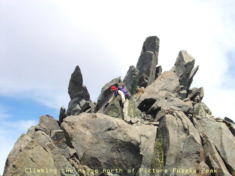
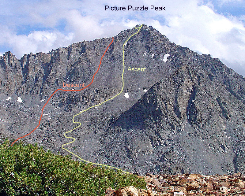
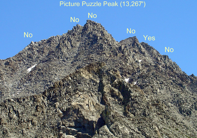
On short notice we drove on Sun, 8/22, from Southern CA and the Bay Area to Bishop, got a wilderness permit for the Bishop Pass trailhead and hiked from South Lake to Ruwau Lake. On Mon, 8am, we ascended from Ruwau Lke east along its inlet stream for about 1/2mi, then turned south to climb straight up the north face of Picture Puzzle Peak on loose talus. There were multiple high points on the ridge and the highest one appeared to be on the right (west) side of the ridge; thus we chose a prominent chute leading straight toward it. Since the upper part of the chute was filled with hard snow at >40 deg we proceeded on adjacent cl 3 rock to the top. There the puzzle started: there were multiple peaks along a N-S facing jagged ridge and the true summit appeared 1/4mi to the south. Running the top of the ridge looked like a cl 4 exercise. The west side was definitely cl 4 territory. Thus, we explored the east side of the ridge. It required traversing the ice-filled chute. We down climbed part of it, then squeezed into the gap between ice and rock and chimneyed up to the east side. Now one could clearly see the main summit of Picture Puzzle Pk (13,267'). There were at least three major chutes to traverse. One possibility was to down climb one of them for a few hundred feet into a large cirque above Seventh Lake and then to reclimb the east couloir to the summit. The better choice was to find a mentioned cl 3 route just below the ridge and above the chutes, which is exactly what we did. It was an exciting adventure to work around pillars and up and down over many big blocks some of which were precariously loose. Finally we crossed the last chute and started the cl 3 ascent to the summit area. The brown rock was covered by lichen, which would be no pleasure to climb when wet.
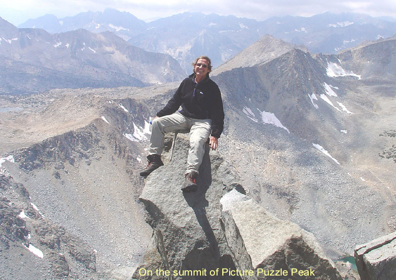
By 12noon we were on the summit and found a glass jar with the peak register (UTM 11 363 392E, 41 09 973N, NAD 27, elev. 13,276'). It had been placed in 1978 on an SPS trip, the only Sierra Club trip mentioned in 30 years. There were also transcriptions of the first recorded entries from 1967 and two others in 1973. The booklet was only half full. Our entry was the first one in 2004. We ate lunch, took pictures and enjoyed the fine views. To the south was the Palisade Range with North Pal, Thunderbolt, Winchell, Agassiz and a bit closer closer we spotted Aperture Peak, which we visited a year ago. To the east we could see the rugged ridge of Gendarme Pk above the Big Pine Lakes. To the northeast was Cloudripper, which we skied a few years ago. To the northwest one could see the Thompson Ridge, Humphreys, Emerson, Basin and Tom. To the southwest was Bishop Pass across which we skied four months earlier. Beyond Dusy Basin we saw Columbine, Isosceles, Gireaud, etc and the Black Divide in the distance. We could have enjoyed the views longer if it were not for thick, low clouds rolling in from the west.
Originally, I had planned to continue to nearby Gendarme Pk (13,252') and to return via Jigsaw Pass. However, there are no cl 3 routes down from Picture Puzzle to the south or west to reach the SW ridge of Gendarme. The only option is to descend the east couloir and to reclimb the moraine and snowfields NW of Gendarme. Luckily, the 40deg east couloir on Picture Puzzle was only partially filled with snow. We descended it carefully because of lots of loose rock. When we were ready to traverse toward Gendarme the clouds had moved in and covered the crest of the Palisade peaks. Although prepared with a GPS, I did not want to gamble climbing in this terrain in a whiteout. So we reclimbed the ridge between Picture Puzzle and Cloudripper and then dropped down into the cirque east of Ruwau Lke.
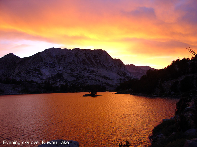
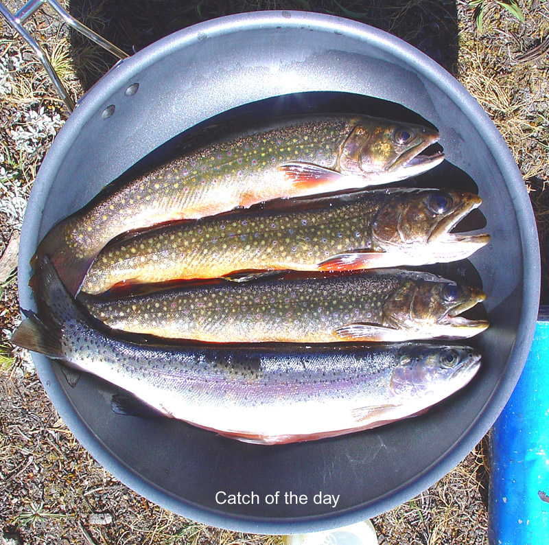
The weather held up and we felt only a few raindrops. Since there was time left, we headed for Chocolate Peak (11,682'), which is north of Ruwau Lke and encircled by Long Lke, Bull Lke and the Chocolate Lkes. This peak is not known for any climbing challenges but for its colorful rock, which exhibits all shades from white to green to red brown. It even has a peak register, filled with almost daily entries from local hikers. After having some pieces of chocolate on the summit we headed back to basecamp at Ruwau Lke. This is a very pretty area. At sunset time we had a spectacularly red evening sky. The fishing was great and we feasted on four big trout. Too bad, the next day we had to return to work.