| Thursday, 24 December 1998, Christmas Eve | |
| We left St. Louis and drove down I-44 to Springfield, and continued south to Russellville, AR. After attending a Christmas Eve service at the Russellville Presbyterian Church, we settled in for the proverbial "long winter's nap." |
| Friday, 25 December 1998, Christmas Day | |
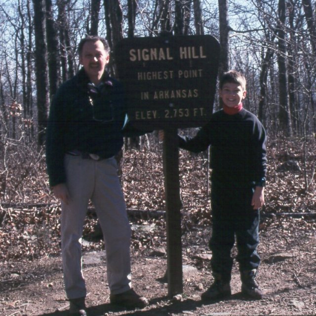
| For Christmas, we wandered along the state roads to Magazine Mountain, the highpoint of Arkansas. The summit is referred to in the state park as "Signal Hill", and a marked and well-travelled trail leads from the road to the summit. We met up with another highpointer near the summit, and we traded photo-taking duties to document the event. Somehow, I forgot to record a waypoint, but my estimated location of 35deg 10' north, 93 deg 38.71' west was, as I recall, within about 100 feet of the summit marker. |
 |
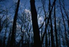 |
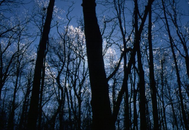
Along the short trail, we were treated to natural Christmas decorations, courtesy of an ice storm which had moved through the area a day or two before. |
| Saturday, 26 December - Wednesday, 30 December |
| We spent the next several days meandering our way through Texas, with San Antonio, Dallas, and Houston on the itinerary. Finally, we headed east into Louisiana, spending the night in Shreveport. |
| Thursday, 31 December, New Year's Eve | |
 |
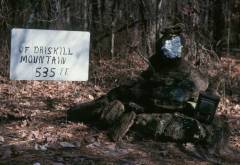
Leaving Shreveport, we drove to Arcadia, LA, and on down to Driskill
Mountain. At 535', Driskill Mountain is the third-lowest state
highpoint, after Florida and Delaware, and the lowest highpoint west
of the Mississippi River.
Finding the highpoint is a bit of a trick, as the area is being logged, and there are a couple of forks in the logging roads which are confusing. We tried following a GPS bearing, but the brush got a bit too thick, and we cut back to the road which parallels the ridge, but a bit lower, and soon found the correct trail up to the summit. |
|
The highpoint is marked with a cairn and summit log, stored in the ammo
box next to the cairn, as well as a sign of somewhat dubious lineage.
There is supposed to be a USGS benchmark nearby, but we failed
to find it, unless it is buried under leaves and undergrowth. (We did
find a benchmark at the corner of the section 100' or so away from
the highpoint, but this was not the one we sought.)
My GPS reported the location of the highpoint as 32deg 25.481' north, 92deg 53.776' west. |
 |
| Friday, 1 January 1999, New Year's Day |
|
After spending New Year's Eve in Jackson, MS, we had originally planned
to drive just as far as Memphis, and do some sightseeing around there.
However, the weather forecast was for a severe ice and snow storm all
along our route, so we opted, instead, to drive straight through to St.
Louis. Conditions were passable until we hit the Akansas/Missouri line,
and got progressively worse the closer we got to home. However, the Saab
managed to keep the right end pointed forward, and the shiny side up,
unlike many of the 4WD vehicles we saw wheels-up in the ditch. We were
very glad to reach home in one piece, and given the weather the
next day, had made the right choice, as it was even worse.
Two more highpoints checked off the list...fourteen down, thirty-six to go! |
Signal Hill, on Magazine Mountain, the Arkansas Highpoint
 |
|
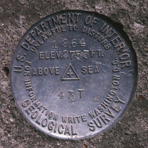 |
The Arkansas highpoint is well signed, and confirmed by a USGS benchmark near the sign. The trail is easily followed for the quarter-mile or so from the road up to the summit. Christmas morning was chilly but sunny, and the leftover ice on the trees was rapidly melting. |
 |
|
Driskill Mountain, the Louisiana Highpoint
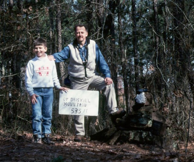 |
| About a mile from the road, Driskill Mountain was a pleasant walk, once we got past the logging trucks and their noise. It appears that the area all around the highpoint will soon be logged, but hopefully the summit will remain wooded. |
 |