Left St. Louis, drove to Corinth MS for the night.
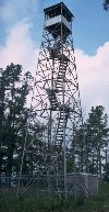
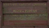
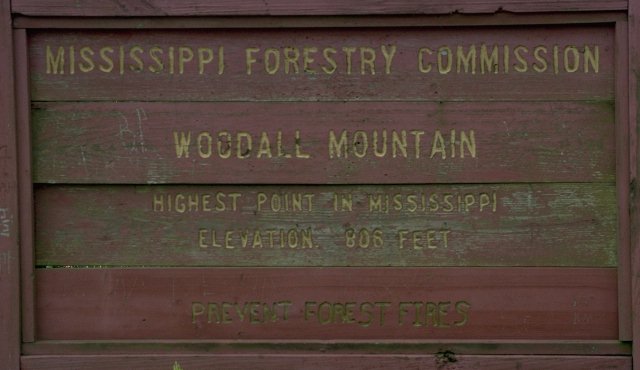
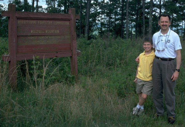
Drove from Corinth down to Woodall Mountain (806'), the Mississippi high point. From Corinth,
take US72 east to MS state highway 25 south, 1.3 miles then right on Tishomingo County
route 187 northeast 0.6 miles and left on county route 178 east. Follow 178 0.6 miles to a
gravel road on the right, through the open gates, and wind up a mile or so to the summit of
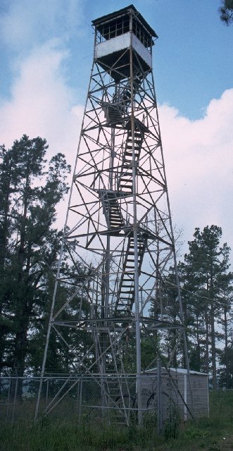
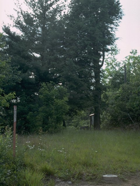
Woodall mountain. The high point is marked with a large sign, and the fire lookout tower is
still in place but is ill-maintained and looks dubiously safe to climb, although there is no gate
or barrier preventing access.
Drove on down to Anniston, AL for the night.
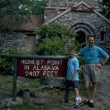
Left Anniston on US431, turning right on Alabama SR281 about 3.5 miles south of I-20.
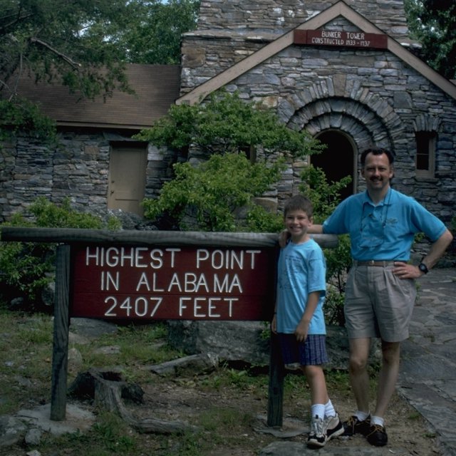
SR281 leads directly to Cheaha (rhymes with "yee-hah") State Park, which contains the
Alabama high point, Cheaha Mountain (2,407'). Park charges $1 per person entry fee on the honor
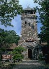
system if no-one is in the entry station (there wasn't...we did pay). There is a CCC building
at the summit of the mountain, built of what appears to be local stone with walls about 3'
thick. The climb up the stairs is made more interesting by the fact that the walls are a bit
porous and rainwater creeps in and drips on the metal stair treads. The view from the top is
worth the three-story climb.
Leaving Cheaha State Park, we continued south through Montgomery and on down to Florala,
on the Alabama/Florida line. We left US331 in Florala onto Alabama SR54, turning right onto
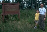
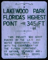
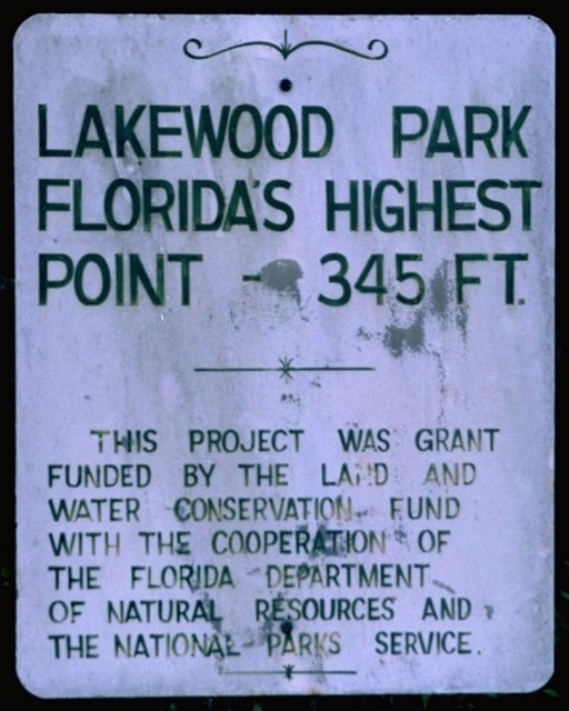
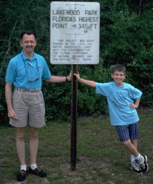
county road 1087. Britton Hill (345', pass the oxygen tank, please)
is now marked with a county park and the high-point marker.
As we continued down US331 toward Defuniak Springs, there were also signs pointing to the
high point up a Florida county road a couple of miles south of Florala.
Spent the night in Defuniak Springs before heading on to Mecca for this trip, Walt Disney
World.
(The narrative will thankfully remain silent while we tour Florida's tourist destinations...suffice
it to say we were "theme-parked" out!)
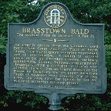
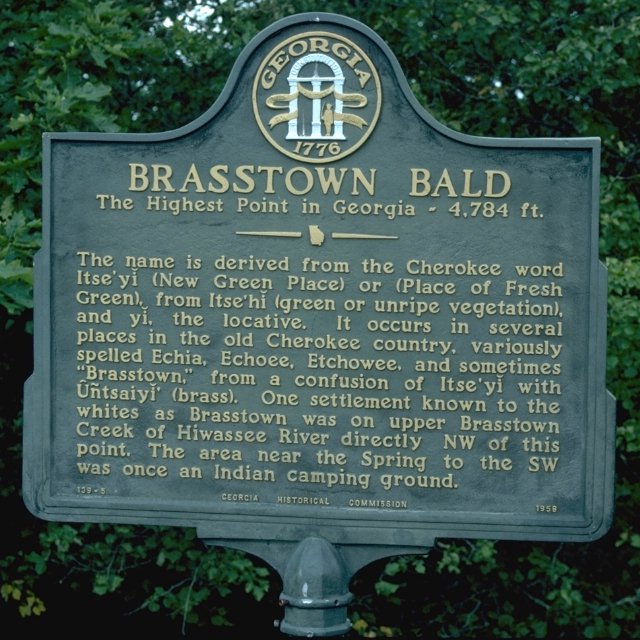
Left Athens, GA, heading north up US 441 to US 76 west toward Hiawassee, GA. Then 12 miles south on GA 17
to GA 180. 5.3 miles west on GA 180, then 2.5 miles north on "Spur 180" to the Brasstown Bald
parking lot. From the parking lot, you can either hike a 1/2-mile paved trail or take the van
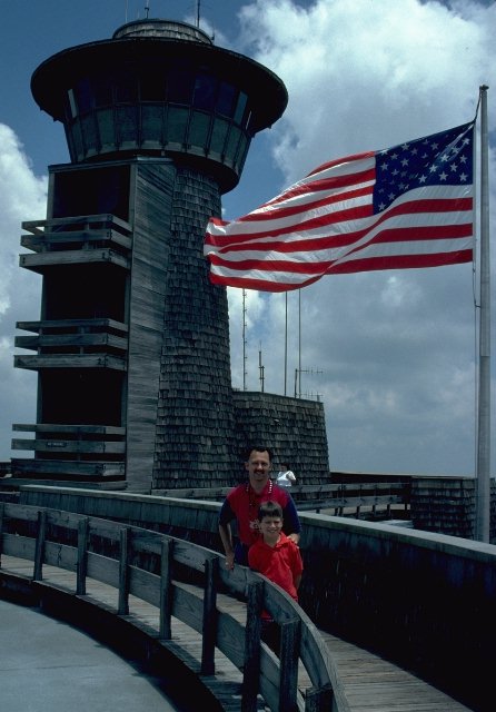
up to the summit (4,784') for the princely sum of $2.00 each. We rode up, walked down. There is a visitor center on
top with a museum and overlook, but you are not permitted to go up into the fire tower which
is yet another 20 or so feet above the overlook balcony.
From there, we headed east on US 76 toward Seneca, SC, picking up SC 183 between Richland and
Seneca and going north from there. In Pickens, SC, we turned north on US 178 and went 15.5
miles north to Rocky Bottom, turning right onto the "F. Van Clayton Memorial Highway", which
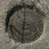
leads 4.7 miles NE to Sassafras Mountain, 3,560'. There is a parking lot and a short (100-yard)
walk up the gravel road to the high point. There is no sign posted at the high point, and it
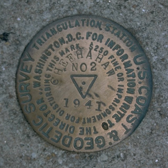
appears that the USGS benchmark is near, but not at, the highest point of land on the summit
of the "mountain".
By the time we had wound through the twisting mountain roads in Georgia and South Carolina,
we were out of time and did not try to make it up to the North Carolina highpoint that
day, stopping, instead, at our planned overnight spot in Sylva, NC.
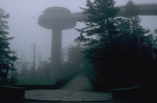
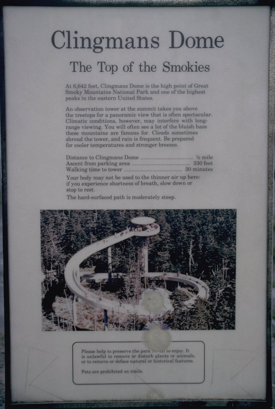
Left NC via US 441 which goes over the Smoky Mountains and into Tennessee via the Newfound
Gap. At the crest of the ridge, a well-marked road winds south about 7 miles south to Clingmans
Dome, 6,643', the Tennessee high point. As we approached in the morning, the clouds closed in
on us, and visibility was down to less than 100 yards as Nathan and I walked the half-mile
paved path to the highpoint. There is an observation tower with an impressive handicapped-
accessible ramp to the observation platform. Various plaques described the landmarks we
could not see in the clouds. Clingmans Dome is the second-highest state highpoint east of the
Mississippi River, with only North Carolina's Mount Mitchell (6,684') being higher.
We meandered our way back home through Tennessee, having completed our "Southern Six-Pack",
although missing the "Southern Lucky Seven" that was our original plan.
The Mississippi high point is marked with a Forest Service sign.
The mountaintop is reached by a good gravel road, and the abandoned
fire tower is accessible, but the stairs look of questionable
quality at this point.
Cheaha (rhymes with "yee-hah") Mountain is within Cheaha State Park
and is accessible by paved road. At the summit is an impressive
sandstone CCC-built observation tower which affords a view worth
the three-story climb. The walls are impressively thick, making
the tower's interior more like a cave than a building, complete with
stalactites growing where the rain water has seeped in through the
porous rock walls.
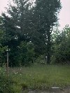
Britton Hill is named for the retired postmistress of the
Lakewood. It is located in a county park and
marked with a high point sign. Be sure your car is tuned
for these extreme altitudes before attempting to drive there!
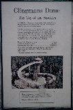
Certainly one of the fancier high-point structures...we are
standing on a balcony above a very nice museum showing Indian
(oops...Native American to be politically correct) artifacts
and a history of European settlement of the area.
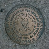
The highpoint itself is not marked as such, with the geologic survey
benchmark perhaps 100' from the apparent high point up in a cluster
of trees. There reportedly had been a fire lookout tower on the
summit at one point, but it has been dismantled.
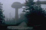
The high point of our trip (altitude-wise), Clingmans Dome was
thoroughly socked in when we arrived in mid-morning...not an
unusual condition in these parts, as I have driven through the
clouds several times in the Smokies. Thus, the view was non-existent
but the plaques insisted on telling us what we could not see.
The dead conifers were killed by an infestation of European aphids
which spread from Maine down the east coast.
Thursday, 12 June: Woodall Mountain, Mississippi
Friday, 13 June: Cheaha Mountain, Alabama; Britton Hill, Florida
Saturday, 14 June...Tuesday, 24 June
Wednesday, 25 June: Brasstown Bald, Georgia; Sassafras Mountain, South Carolina


Thursday, 26 June: Clingmans Dome, Tennessee

Friday, 27 June...Sunday, 29 June
Woodall Mountain (806'), the Mississippi High Point
back
Cheaha Mountain (2,407'), The Alabama High Point
back

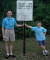
Britton Hill (345'), the Florida High Point
back
Brasstown Bald (4,784'), the Georgia High Point
back
Sassafras Mountain (3,560'), the South Carolina High Point
back


Clingmans Dome (6,643'), the Tennessee High Point
back