Emerald Bay Trailheads
(Eagle Creek, Inspiration Point, D L Bliss)
Revised Dec 2007 - please send updates to the webmaster
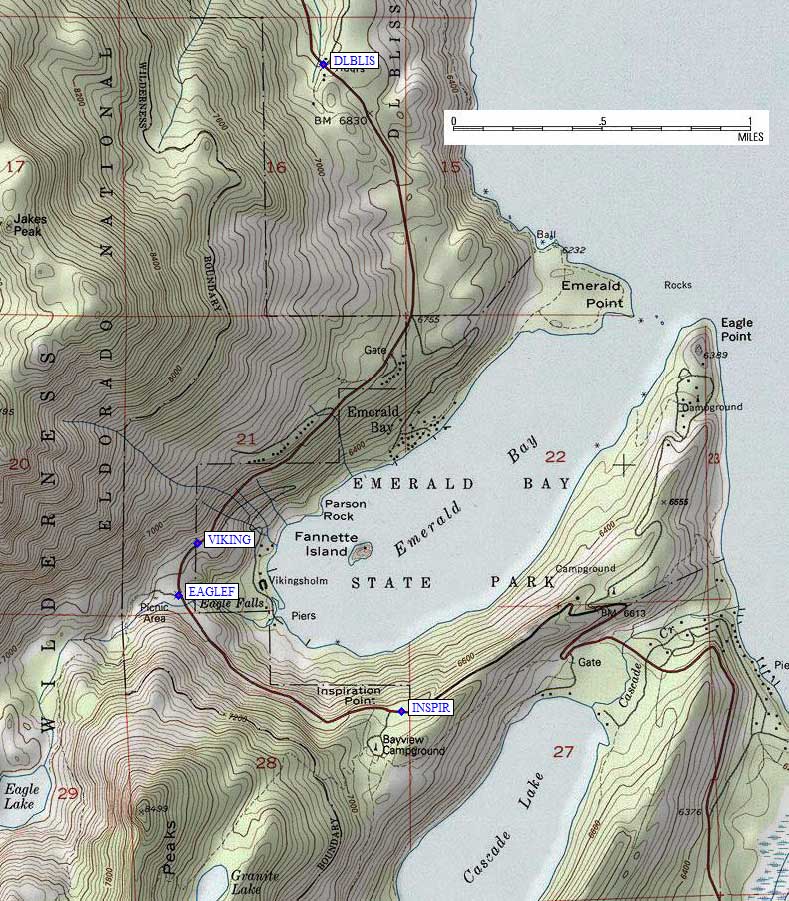
D L Bliss State Park, Inspiration Point, and Eagle Creek (or Eagle Falls) are on the southwest corner of Lake Tahoe, near Emerald Bay. These trailheads cab be used to reach Maggie, Dicks and Jacks Peaks, or the Desolation Wilderness. There is a Forest Service Visitor Center (waypoint VISCTR) for wilderness permits, but it's only open in the summer even though permits are technically required year round. The center is just over 3 miles northwest of where Hwy 89 and Hwy 50 split (50 goes up the east short of Lake Tahoe, 89 goes up the west shore). The strip of Hwy 89 just south of Inspiration Point is on an impressive knife-edge ridge that may be icy and treacherous when the rest of the road is reasonable.
The Inspiration Point viewpoint (waypoint INSPIR) is closed in winter, but there is some plowed parking near it on the uphill side of the road. These parking areas are mostly used by sightseers, but there is a trail that leads from the Bayview Campground up past Granite Lake and over the saddle between Maggie Peaks. Great views for a short winter hike!
The Eagle Creek / Eagle Falls trailhead (waypoint EAGLEF) is 9 miles northwest on Hwy 89 from the junction where it leaves Hwy 50 (waypoint 089050 in South Lake Tahoe). There are no obvious Sno-Park signs, but if the trailhead is full or restricted you may be able to go a quarter mile north to the Vikingsholm viewpoint and parking lot at waypoint VIKING (a tourist trailhead where you can walk down to lake level). There is a picnic area immediately south of the on-highway parking lot at Eagle Falls, but I think you have to pay to park in the picnic area and you probably can't park there overnight. Eagle Creek can be used to dayhike Jacks and Dicks peaks in summer.
D L Bliss State Park is closed in winter, but they plow parking areas near the (waypoint DLBLIS) headquarters and there seem to be no parking restrictions (Sno-Park or overnight) here. This is where I started to climb Rubicon and Jakes peaks in the winter.
Useful Links: