Bear Box at Yosemite Creek, Ten Lakes Parking (YW02)
Generated on 2 Aug 2022 - see revision history - please send updates to the webmaster
Detail Map of waypoint YW02
in Yosemite Park West:
(scroll down for directions, waypoints, and area map)
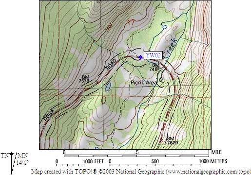
- YW02 is 10 large boxes south of 120, 4 large boxes north of 120, at about 7500 feet,
in the GPS route YOSEMITE WEST.
- Directions from Steve Eckert, with GPS waypoint, Sep 2000:
Two groups of large boxes around the parking lot near the Ten Lakes trailhead,
where Yosemite Creek crosses Hwy 120. Ten of the boxes are south of Hwy 120, four
more boxes are north of Hwy 120.
- YW02 coordinates: (see GPX waypoint download links above)
  (lat,lon) = (37.8520900, -119.5760000) in decimal degrees, NAD83.
  (zone,east,north) = (11S, 273440.0, 4192333.0) in decimal meters, NAD27.
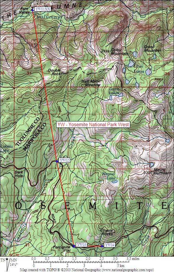
- Scroll down for a regional map of the entire Yosemite Park West region.
Map exported from TOPO! software, used with permission.
Useful Links: